
MyTopo
China Hill Georgia US Topo Map
Couldn't load pickup availability
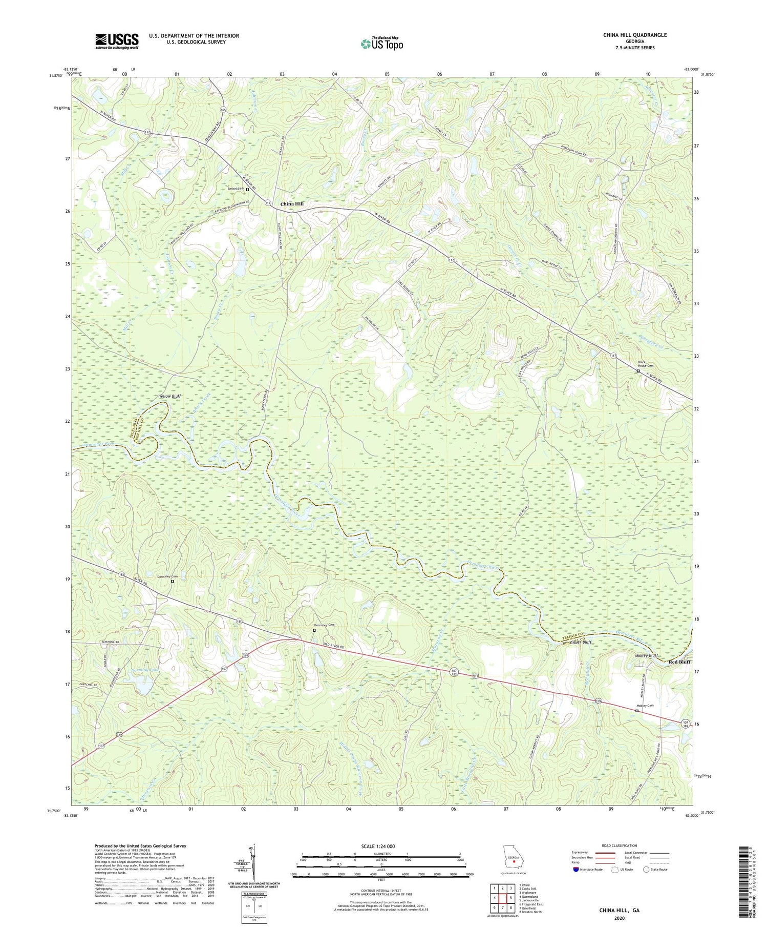
2024 topographic map quadrangle China Hill in the state of Georgia. Scale: 1:24000. Based on the newly updated USGS 7.5' US Topo map series, this map is in the following counties: Telfair, Ben Hill. The map contains contour data, water features, and other items you are used to seeing on USGS maps, but also has updated roads and other features. This is the next generation of topographic maps. Printed on high-quality waterproof paper with UV fade-resistant inks.
Quads adjacent to this one:
West: Queensland
Northwest: Rhine
North: Cooks Still
Northeast: Workmore
East: Jacksonville
Southeast: Broxton North
South: Osierfield
Southwest: Fitzgerald East
This map covers the same area as the classic USGS quad with code o31083g1.
Contains the following named places: Ben Hill County Park, Bethel Church, Bethel Church Cemetery, Blockhouse Church, Blockhouse Church Cemetery, Boney Creek, China Hill, Cowan Dam, Dorminey Cemetery, Dorminy Lake, Dorminy Lake Dam, Dorminy School, Fussel Store, Gilder Bluff, James Dormin Dam, Johnson Creek, Lampkins Old Field Ferry, Little Sturgeon Creek, Middle Prong Sturgeon Creek, Mill Creek, Mobley Bluff, Mobley Cemetery, Red Bluff, Red Bluff Creek, Sturgeon Creek, Temple Chapel, Union Church, Wesley Chapel, Yellow Bluff


