MyTopo
Cooks Still Georgia US Topo Map
Couldn't load pickup availability
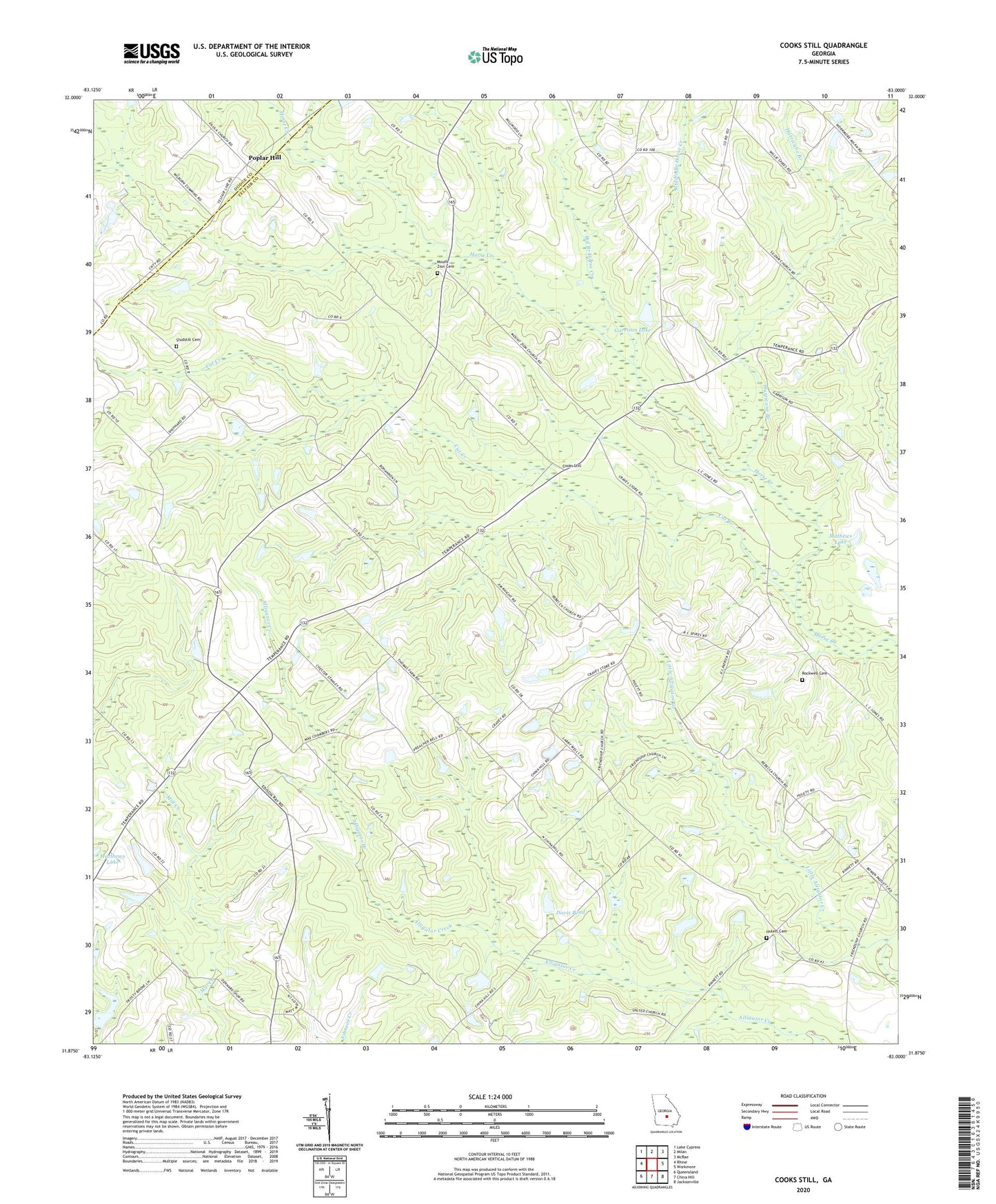
2024 topographic map quadrangle Cooks Still in the state of Georgia. Scale: 1:24000. Based on the newly updated USGS 7.5' US Topo map series, this map is in the following counties: Telfair, Dodge. The map contains contour data, water features, and other items you are used to seeing on USGS maps, but also has updated roads and other features. This is the next generation of topographic maps. Printed on high-quality waterproof paper with UV fade-resistant inks.
Quads adjacent to this one:
West: Rhine
Northwest: Lake Cypress
North: Milan
Northeast: McRae
East: Workmore
Southeast: Jacksonville
South: China Hill
Southwest: Queensland
This map covers the same area as the classic USGS quad with code o31083h1.
Contains the following named places: Big Branch Horse Creek, Cat Creek, Cook Chapel, Cooks Still, Davis Pond, Davis Pond Dam, Friendship Church, Garrison Lake, Garrison Lake Dam, Hulett Cemetery, Hurricane Branch, Mathews Lake, Mathews Lake Dam, Middle Branch Horse Creek, Milan Division, Mount Zion Church, Mount Zion Church Cemetery, Poplar Hill, Rebecca Church, Rockwell Cemetery, Rockwell Church, Siloam Church, Studstill Cemetery, United Church, West Telfair Academy, WMCG-FM (Milan), ZIP Code: 31060