
MyTopo
Workmore Georgia US Topo Map
Couldn't load pickup availability
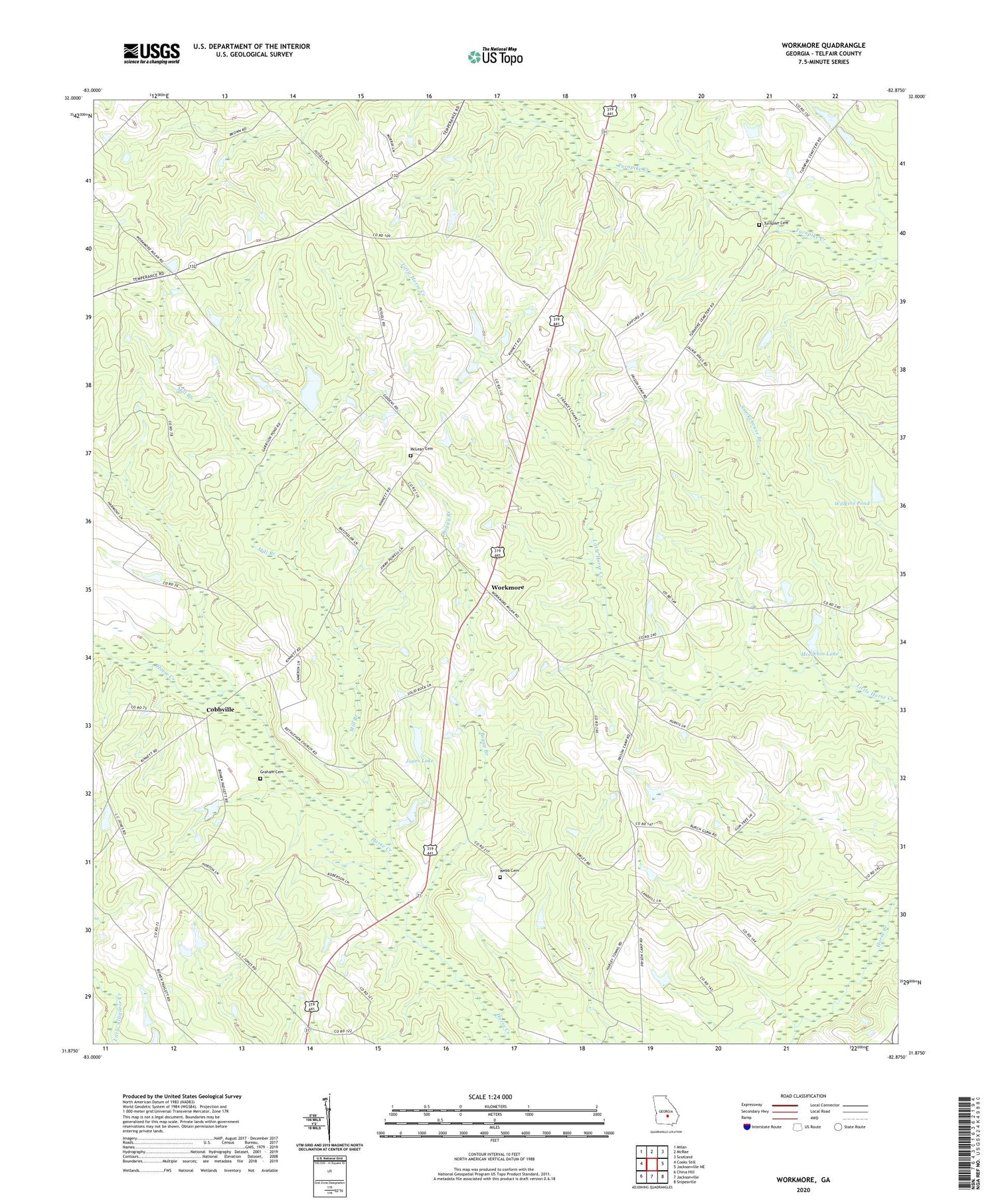
2024 topographic map quadrangle Workmore in the state of Georgia. Scale: 1:24000. Based on the newly updated USGS 7.5' US Topo map series, this map is in the following counties: Telfair. The map contains contour data, water features, and other items you are used to seeing on USGS maps, but also has updated roads and other features. This is the next generation of topographic maps. Printed on high-quality waterproof paper with UV fade-resistant inks.
Quads adjacent to this one:
West: Cooks Still
Northwest: Milan
North: McRae
Northeast: Scotland
East: Jacksonville NE
Southeast: Snipesville
South: Jacksonville
Southwest: China Hill
This map covers the same area as the classic USGS quad with code o31082h8.
Contains the following named places: Bethelehem Church, Boggy Branch, Central Grove Church, Cobbville, Frances Chapel, Graham Cemetery, Harmony Church, Jones Lake, Jones Lake Dam, Macedonia Church, Mceachin Lake, Mceachin Lake Dam, McLean Cemetery, Midway Church, Mill Branch, Neily, Rockwell Church, Smokehouse Branch, Telfair County, Telfair Lookout Tower, Turnpike Church, Turnpike Church Cemetery, Walkers Pond, Walkers Pond Dam, Webb Cemetery, Workmore, Workmore High School


