
MyTopo
Climax South Georgia US Topo Map
Couldn't load pickup availability
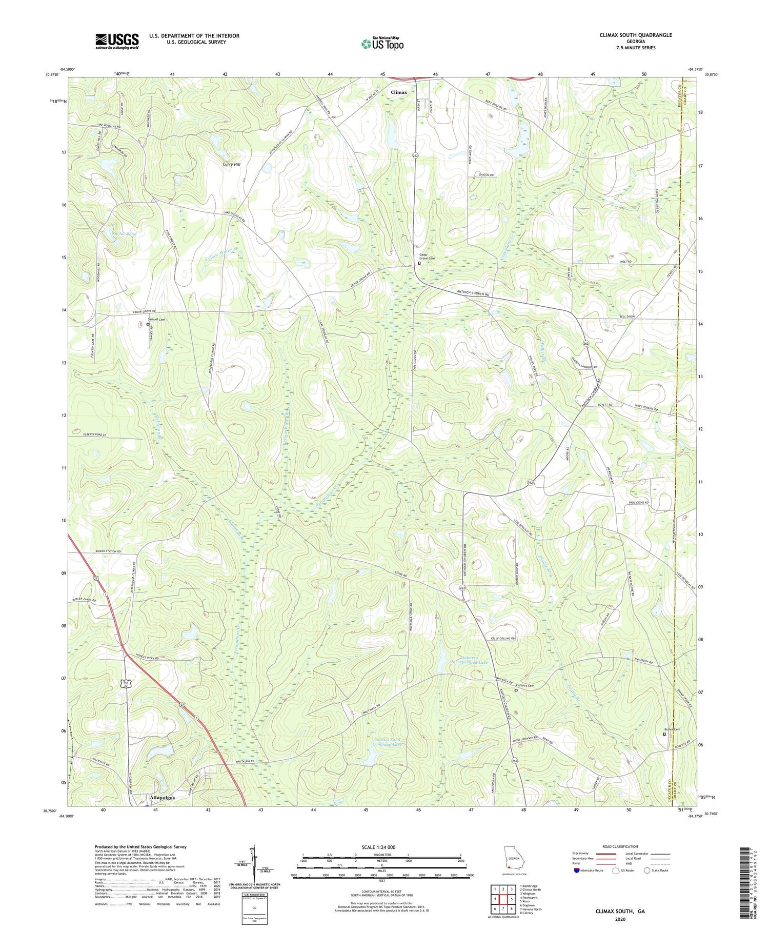
2024 topographic map quadrangle Climax South in the state of Georgia. Scale: 1:24000. Based on the newly updated USGS 7.5' US Topo map series, this map is in the following counties: Decatur, Grady. The map contains contour data, water features, and other items you are used to seeing on USGS maps, but also has updated roads and other features. This is the next generation of topographic maps. Printed on high-quality waterproof paper with UV fade-resistant inks.
Quads adjacent to this one:
West: Fowlstown
Northwest: Bainbridge
North: Climax North
Northeast: Whigham
East: Reno
Southeast: Calvary
South: Havana North
Southwest: Dogtown
This map covers the same area as the classic USGS quad with code o30084g4.
Contains the following named places: Advent Church, Antioch Church, Attapulgus Division, Bell-Dixon School, Bethel Church, Bethel Church Cemetery, Beulah Thomas Church, Beulah Thomas Church Cemetery, Butler Cemetery, Callahan Branch, Cedar Grove Cemetery, Climax Division, Coastal Loan Company Lake, Coastal Loan Company Lake Dam, Conyers Cemetery, Dubarco Incorporated Lake, Dubarco Incorporated Lake Dam, Lillian E Williams Elementary School, Mount Moriah Church Number 1, Mount Moriah Church Number 2, Mount Moriah School, New Jerusalem Church, Otisco, Pine Forest Church, Pine Forest Church Cemetery, Pisgah Church, Pisgah Church Cemetery, Saint Andrews Church, Saint Mary Church, Saint Marys Church, Samuel Cemetery, Sholar Pond, Walker Branch, Yellow Water Branch


