MyTopo
Reno Georgia US Topo Map
Couldn't load pickup availability
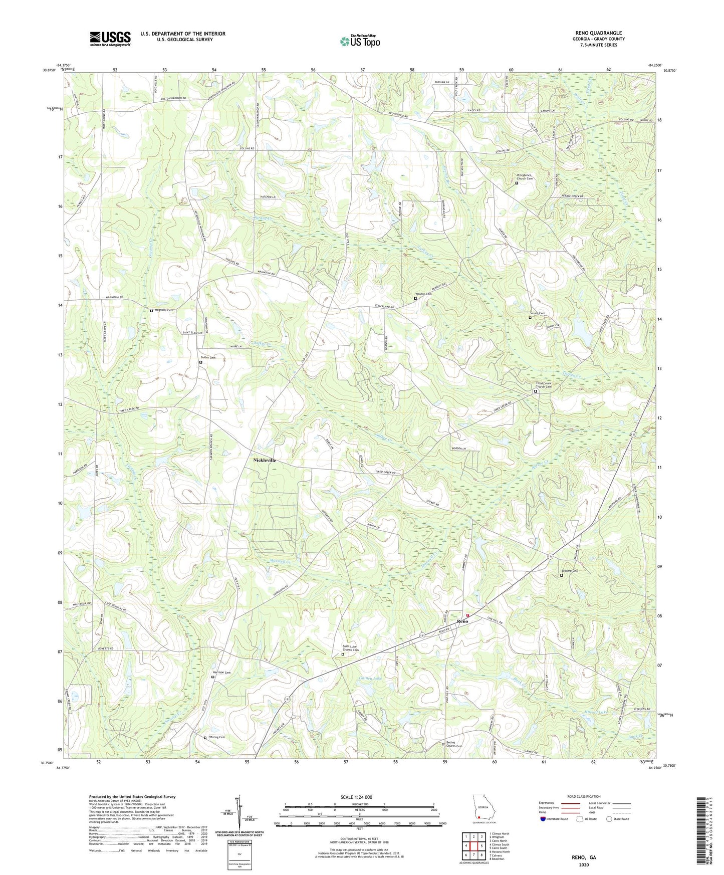
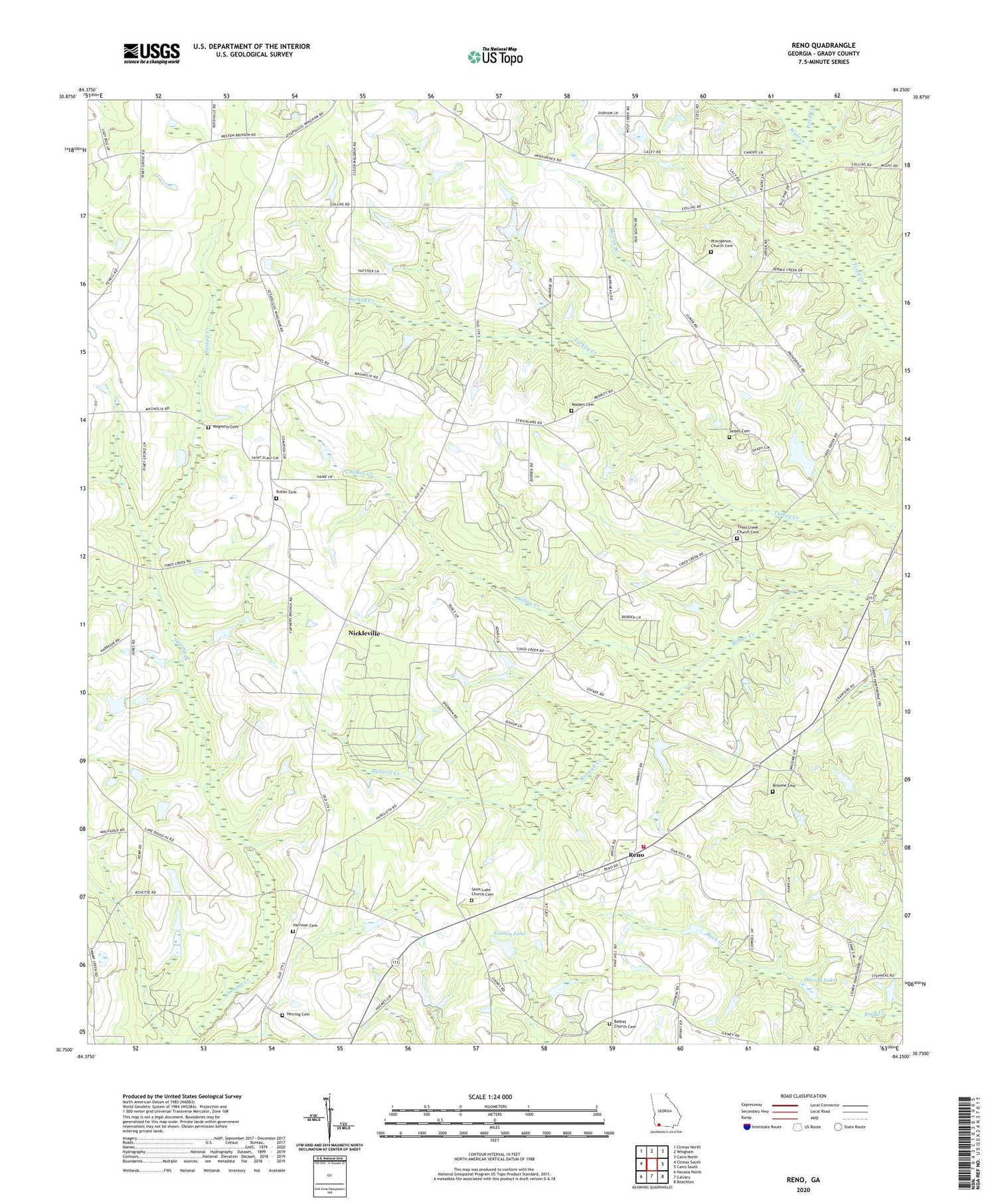
2024 topographic map quadrangle Reno in the state of Georgia. Scale: 1:24000. Based on the newly updated USGS 7.5' US Topo map series, this map is in the following counties: Grady. The map contains contour data, water features, and other items you are used to seeing on USGS maps, but also has updated roads and other features. This is the next generation of topographic maps. Printed on high-quality waterproof paper with UV fade-resistant inks.
Quads adjacent to this one:
West: Climax South
Northwest: Climax North
North: Whigham
Northeast: Cairo North
East: Cairo South
Southeast: Beachton
South: Calvary
Southwest: Havana North
This map covers the same area as the classic USGS quad with code o30084g3.
Contains the following named places: Bethel, Bethel Church, Bethel Church Cemetery, Broome Cemetery, Bryant Church, Butler Cemetery, El Bethel Church, Gainey Lake, Gainey Lake Dam, Good Hope, Grady County Volunteer Fire Department Reno Station, Harold Lake, Harold Lake Dam, Harrison Cemetery, Herring Cemetery, Magnolia, Magnolia Cemetery, Magnolia Church, Maxwell Creek, Merritt Branch, Nickleville, Orange Springs, Orange Springs Church, Piney Grove Church, Pleasant Hill Church, Princes Still, Providence, Providence Church, Providence Church Cemetery, Reno, Reno Baptist Church, Saint Luke Church Cemetery, Saint Lukes Church, Saint Stephens Church, Sasser Cemetery, Sofkee, Tama Reservation, Tired Creek Church, Tired Creek Church Cemetery, Turkey Creek Community Center, Turkey Creek School, Walden Cemetery, Wolf Creek, WTLH-TV (Bainbridge)