MyTopo
Clyattville Georgia US Topo Map
Couldn't load pickup availability
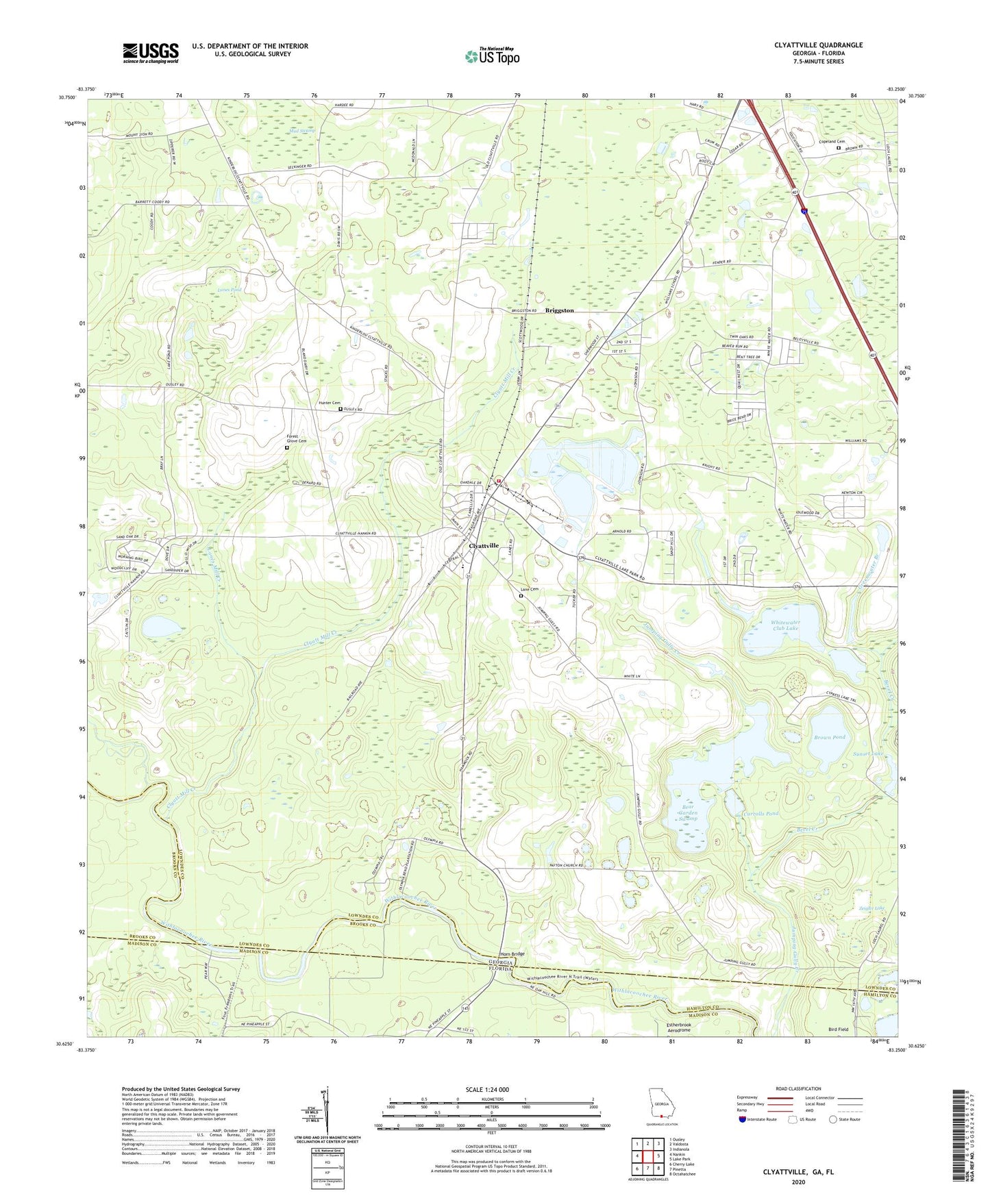
2024 topographic map quadrangle Clyattville in the states of Georgia, Florida. Scale: 1:24000. Based on the newly updated USGS 7.5' US Topo map series, this map is in the following counties: Lowndes, Madison, Brooks, Hamilton. The map contains contour data, water features, and other items you are used to seeing on USGS maps, but also has updated roads and other features. This is the next generation of topographic maps. Printed on high-quality waterproof paper with UV fade-resistant inks.
Quads adjacent to this one:
West: Nankin
Northwest: Ousley
North: Valdosta
Northeast: Indianola
East: Lake Park
Southeast: Octahatchee
South: Pinetta
Southwest: Cherry Lake
This map covers the same area as the classic USGS quad with code o30083f3.
Contains the following named places: Alpha and Omega Church, Bear Garden Swamp, Bear Garden Swamp Dam, Benevolence Church, Bevel Creek, Briggston, Brown Pond, Carrolls Pond, Carrolls Pond Dam, Clyatt Mill Creek, Clyattville, Clyattville Census Designated Place, Clyattville Elementary School, Clyattville Lake Park School, Clyattville Post Office, Clyattville Volunteer Fire Department Station 2, Copeland Cemetery, Forest Grove Cemetery, Greenwater Branch, Horn Bridge, Hunter Cemetery, Jackson School, Lane Cemetery, Lanes Mill Creek, Lanes Pond, Little Bethel Church, Loch Laurel Church, McIntyre Spring, Mount Calvary Church, Mount Zion Church, New Mount Zion Church, Ochlawilla Church, Old Clyattville, Olympia, Owens Illinois Lake, Owens Illinois Lake Dam, Owens-Illinois Corporation Lake, Owens-Illinois Corporation Lake Dam, Payton Church, Smith, Sunset Lake, Union Church, Whitewater Club Lake, Whitewater Club Lake Dam, Whitewater Creek, Woods Chapel Church, Zeigler Lake