MyTopo
Ousley Georgia US Topo Map
Couldn't load pickup availability
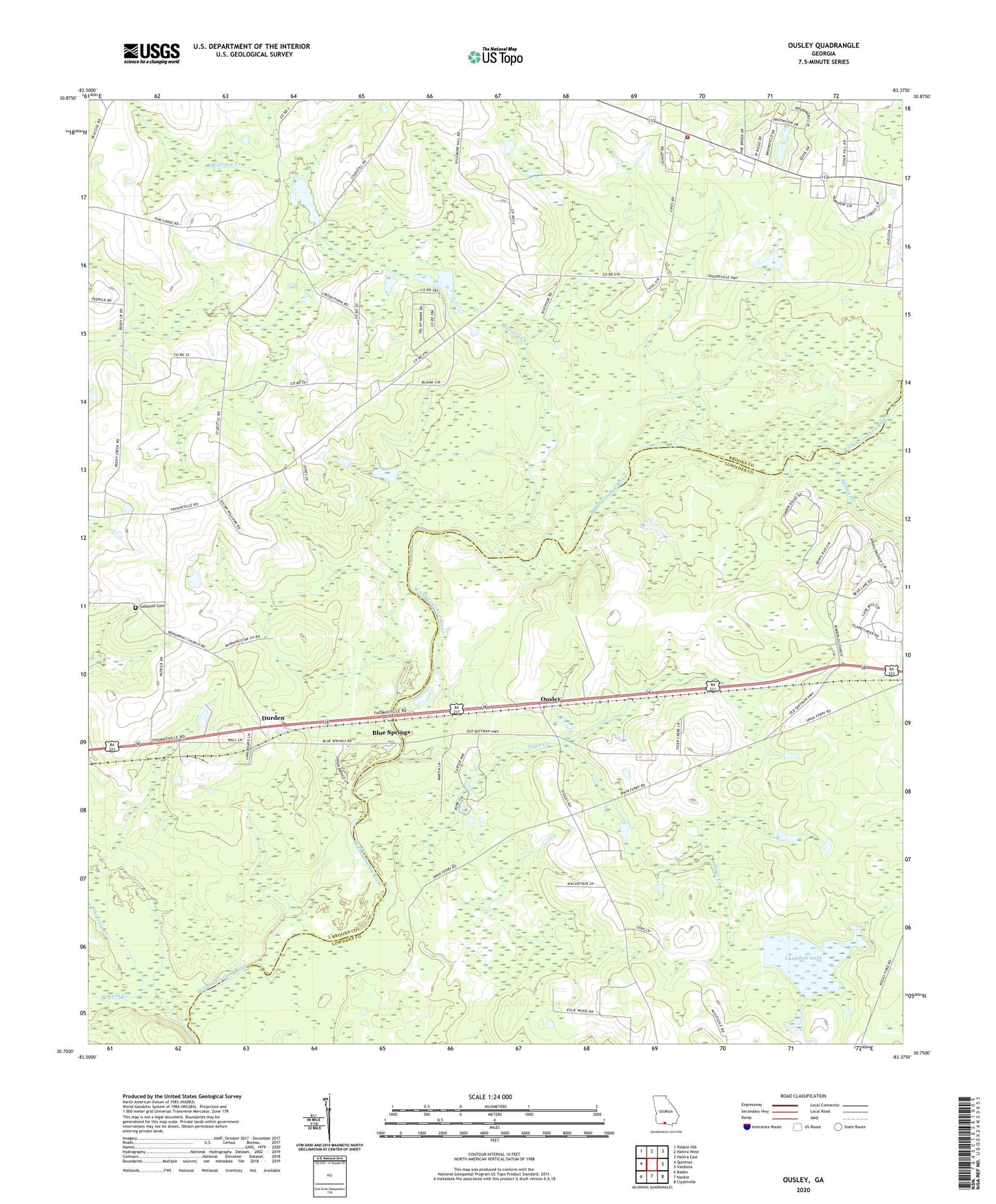
2024 topographic map quadrangle Ousley in the state of Georgia. Scale: 1:24000. Based on the newly updated USGS 7.5' US Topo map series, this map is in the following counties: Brooks, Lowndes. The map contains contour data, water features, and other items you are used to seeing on USGS maps, but also has updated roads and other features. This is the next generation of topographic maps. Printed on high-quality waterproof paper with UV fade-resistant inks.
Quads adjacent to this one:
West: Quitman
Northwest: Pebble Hill
North: Hahira West
Northeast: Hahira East
East: Valdosta
Southeast: Clyattville
South: Nankin
Southwest: Baden
This map covers the same area as the classic USGS quad with code o30083g4.
Contains the following named places: Blue Springs, Chappell Lake, Chappell Lake Dam, Durden, East Brooks Volunteer Fire Department, Gates, Gateway Church, Golden, Langdale Company Dam, Langdale Lake, Langdale Lake Dam, Lebanon Cemetery, Lebanon Church, Millrace Creek, Morning Star Church, Mount Pleasant Church, Oak Grove Church, Oakhill School, Okapilco Creek, Ousley, Ousley Church, Philadelphia Church, Pine Grove School, Piscola Creek, Pleasant Hill Church, Primrose Church, Richardson Creek Church, Spring Branch, Tiger Creek, WAFT-FM (Valdosta), Welcome Hill Church, West Side Volunteer Fire Department