MyTopo
Octahatchee Florida US Topo Map
Couldn't load pickup availability
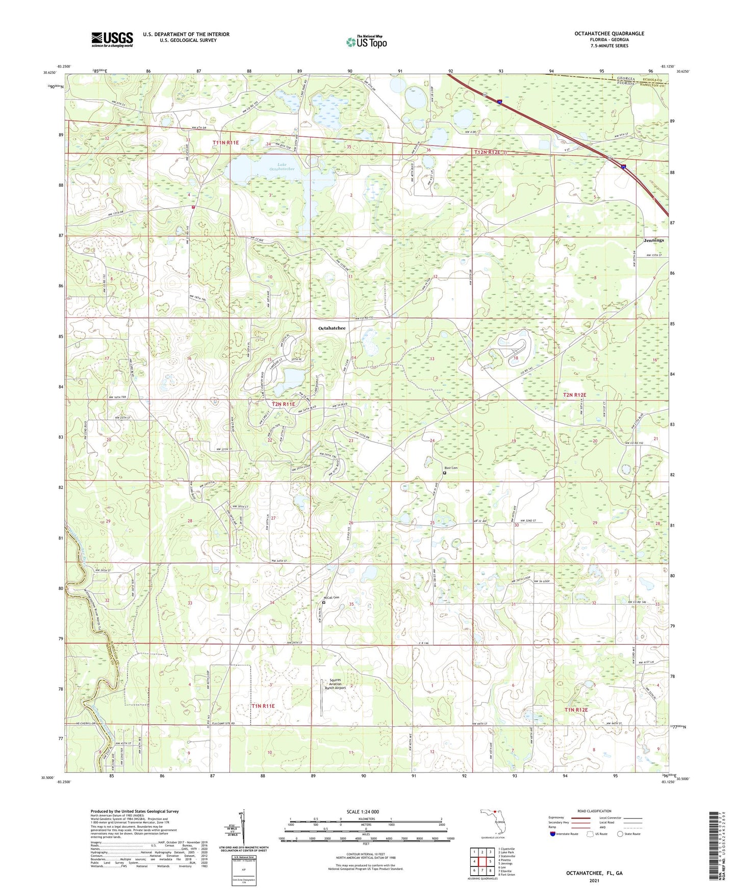
2024 topographic map quadrangle Octahatchee in the state of Florida. Scale: 1:24000. Based on the newly updated USGS 7.5' US Topo map series, this map is in the following counties: Hamilton, Madison, Echols, Lowndes. The map contains contour data, water features, and other items you are used to seeing on USGS maps, but also has updated roads and other features. This is the next generation of topographic maps. Printed on high-quality waterproof paper with UV fade-resistant inks.
Quads adjacent to this one:
West: Pinetta
Northwest: Clyattville
North: Lake Park
Northeast: Statenville
East: Jennings
Southeast: Fort Union
South: Ellaville
Southwest: Lee
Contains the following named places: Bellville High School, Bethel Church, Blair Cemetery, Burnham Christian Church, Burnham Church, Hamilton County Fire and Rescue Department Bellville Station, Jennings Division, Lake Octahatechee, McCall Cemetery, Mount Olive Church, Octahatchee, Squires Aviation Ranch Airport, Triumph Church, Triumph Holines Church, ZIP Code: 32053