MyTopo
Cumberland Island North Georgia US Topo Map
Couldn't load pickup availability
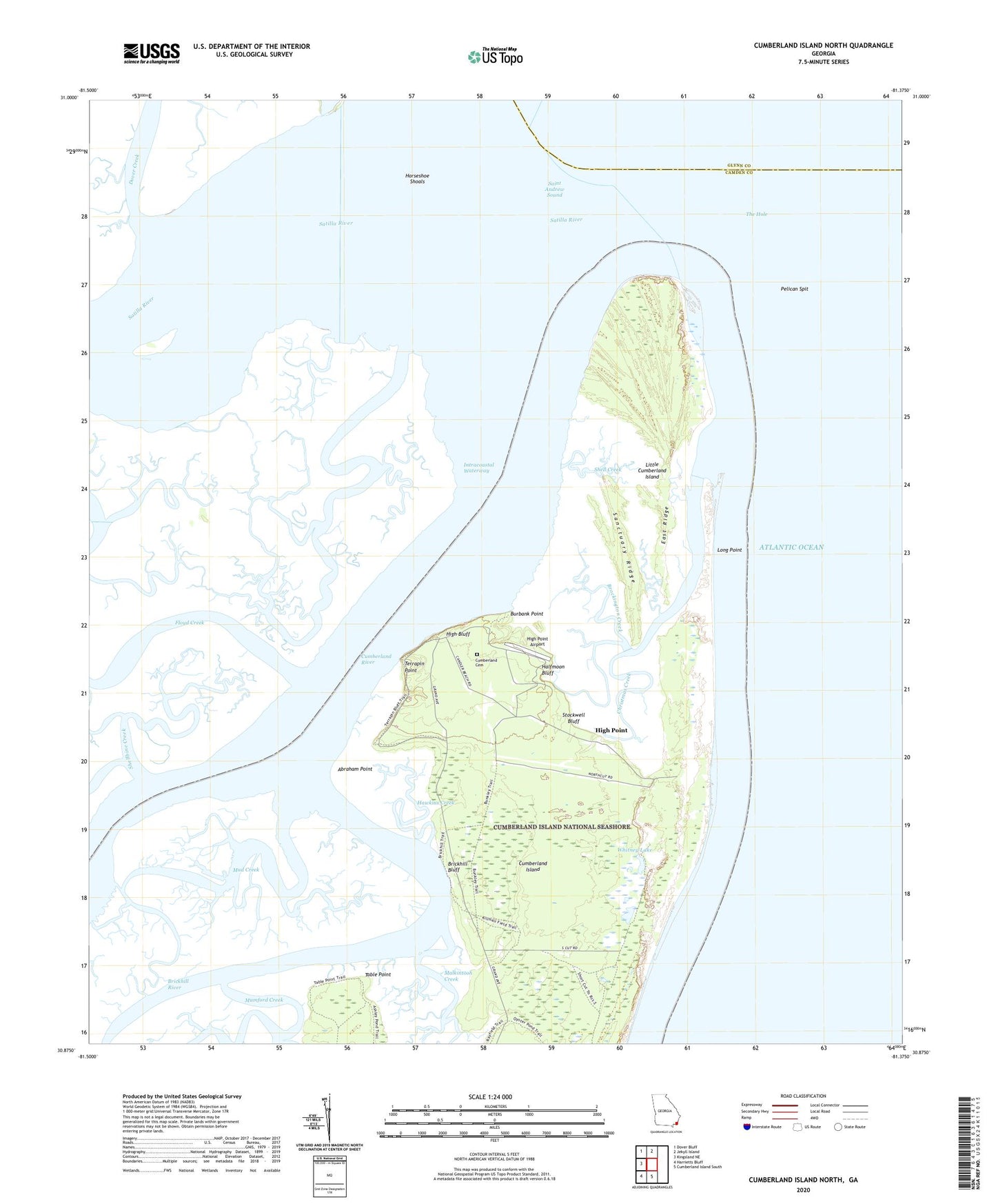
2024 topographic map quadrangle Cumberland Island North in the state of Georgia. Scale: 1:24000. Based on the newly updated USGS 7.5' US Topo map series, this map is in the following counties: Camden, Glynn. The map contains contour data, water features, and other items you are used to seeing on USGS maps, but also has updated roads and other features. This is the next generation of topographic maps. Printed on high-quality waterproof paper with UV fade-resistant inks.
Quads adjacent to this one:
West: Kingsland NE
Northwest: Dover Bluff
North: Jekyll Island
South: Cumberland Island South
Southwest: Harrietts Bluff
This map covers the same area as the classic USGS quad with code o30081h4.
Contains the following named places: Abraham Point, Brickhill Bluff, Brickhill River, Brockington Creek, Burbank Point, Christmas Creek, Cumberland Cemetery, Cumberland Wharf, Dover Creek, East Ridge, First African Baptist Church, First African Church, Halfmoon Bluff, Hawkins Creek, High Bluff, High Point, High Point Airport, High Point-Halfmoon Bluff Historic District, Horseshoe Shoals, Little Cumberland Island, Little Cumberland Island Lighthouse, Long Point, Malkintooh Creek, Mud Creek, Mumford Creek, North Breakers, Pelican Spit, Red Bridge, Saint Andrew Sound, Sanctuary Ridge, Satilla River, Shell Creek, Shellbine Creek, Stockwell Bluff, Table Point, Terrapin Point, The Hole, Whitney Lake, ZIP Code: 31558