MyTopo
Kingsland NE Georgia US Topo Map
Couldn't load pickup availability
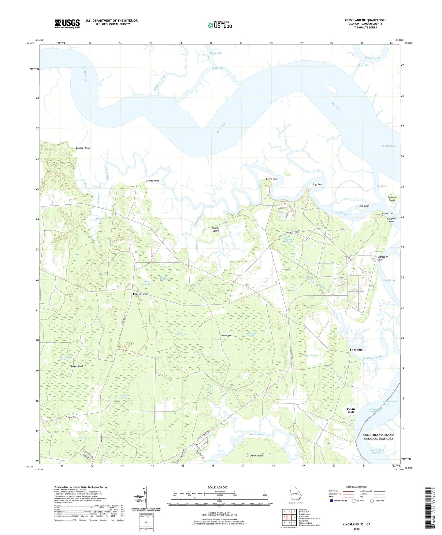
2024 topographic map quadrangle Kingsland NE in the state of Georgia. Scale: 1:24000. Based on the newly updated USGS 7.5' US Topo map series, this map is in the following counties: Camden. The map contains contour data, water features, and other items you are used to seeing on USGS maps, but also has updated roads and other features. This is the next generation of topographic maps. Printed on high-quality waterproof paper with UV fade-resistant inks.
Quads adjacent to this one:
West: Woodbine
Northwest: Waverly
North: Dover Bluff
Northeast: Jekyll Island
East: Cumberland Island North
Southeast: Cumberland Island South
South: Harrietts Bluff
Southwest: Kingsland
This map covers the same area as the classic USGS quad with code o30081h5.
Contains the following named places: African Island, Bailey Cut, Barrel Head Swamp, Bell View, Bellevue Plantation, Big Cypress Pond, Boys Point, Butler Branch, Cabin Bluff, Camp Creek, Caney Flats, Cooper Swamp, Copeland Swamp, Cottage Creek, Crews Point, Cumberland Dividings, Cumberland River, Deep Creek, Dover Cut, Duck Pond, Fairfield Cemetery, Fairfield Point, Fairview Church, Floyd Basin, Floyd Creek, Floyd Cut, Floyds Neck, Forestview, Grants Point, Grover Creek, Grover Island, Grover View, Halls Swamp, Hermitage Plantation, Hermitage Swamp, Horsepen Bluff, Long Island, Lookout Point, Negro House Bay, Noyles Cut, Ocean Pond, Pine Barren Swamp, Pompey Island, Schooner Landing, Shellbine, Sparkman Creek, The Bulkhead, Todd Creek, Union Carbide Plant Strip