MyTopo
Denmark Georgia US Topo Map
Couldn't load pickup availability
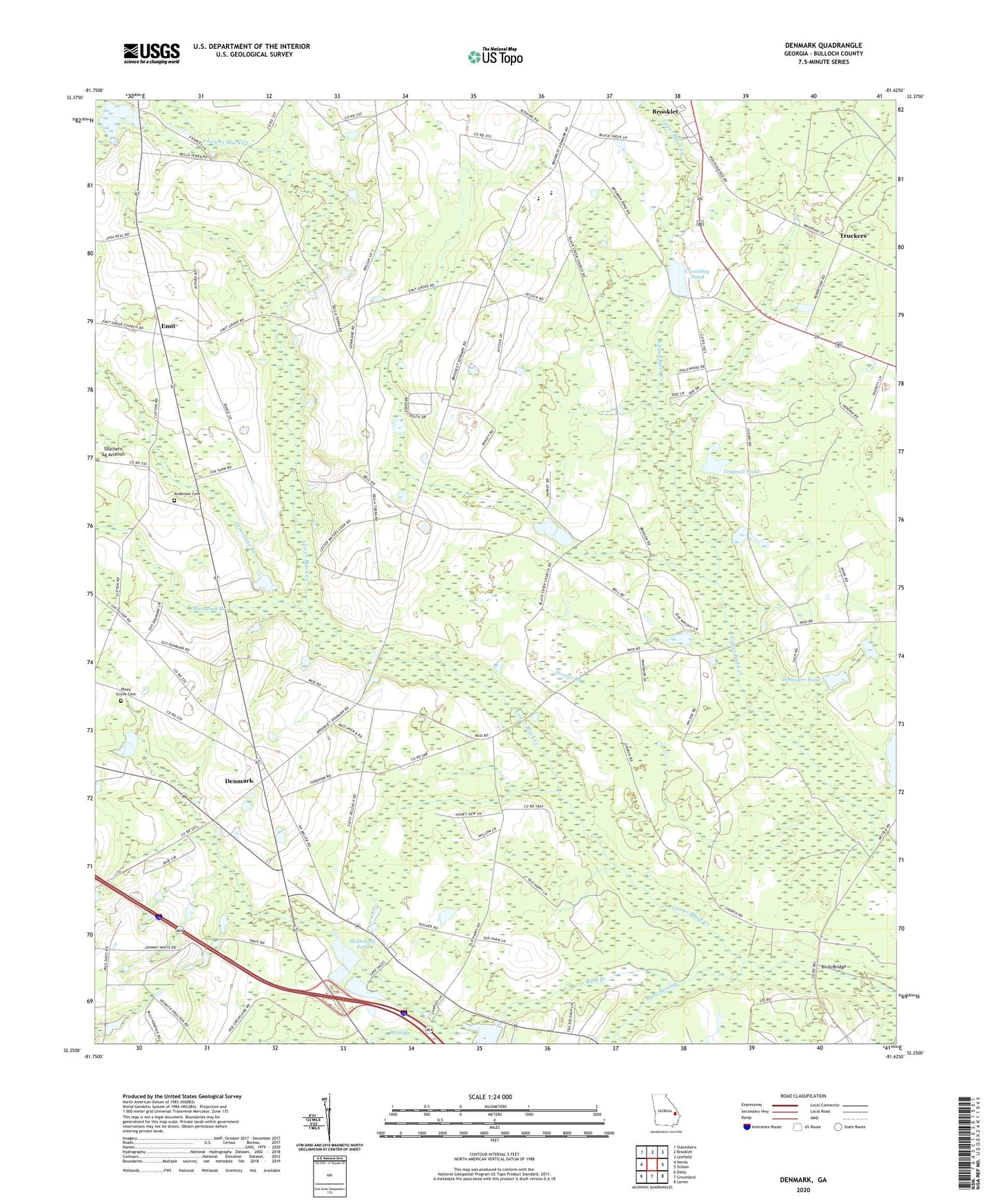
2024 topographic map quadrangle Denmark in the state of Georgia. Scale: 1:24000. Based on the newly updated USGS 7.5' US Topo map series, this map is in the following counties: Bulloch. The map contains contour data, water features, and other items you are used to seeing on USGS maps, but also has updated roads and other features. This is the next generation of topographic maps. Printed on high-quality waterproof paper with UV fade-resistant inks.
Quads adjacent to this one:
West: Nevils
Northwest: Statesboro
North: Brooklet
Northeast: Leefield
East: Stilson
Southeast: Lanier
South: Groveland
Southwest: Daisy
This map covers the same area as the classic USGS quad with code o32081c6.
Contains the following named places: Anderson Cemetery, Antioch Baptist Church, Birds Bridge, Brannen School, Brooklet Division, Crombley Pond, Crombley Pond Dam, De Loach School, Denmark, Eb Lee Ford, Emit, Emit Grove Church, Faith Tabernacle, Harville Baptist Church, High Hope School, Holly Grove School, Little Bethel Church, Luke Swamp, McDonald Pond, McDonald Pond Dam, Piney Grove Cemetery, Piney Grove Church, Quattebaum Pond Dam, Quattlebaum Pond, Reed Branch, Saint Marys Church, Simmons Pond, Slabville School, Sorrier Branch, Southeast Bulloch High School, Southeast Bulloch Middle School, Trapnell Pond, Trapnell Pond Dam, Trinity Baptist Church, Trinity Church, Truckers, Upper Black Creek Church, Whitaker Pond, Whitaker Pond Dam, Woodcock Branch, Zeiterower Branch