MyTopo
Nevils Georgia US Topo Map
Couldn't load pickup availability
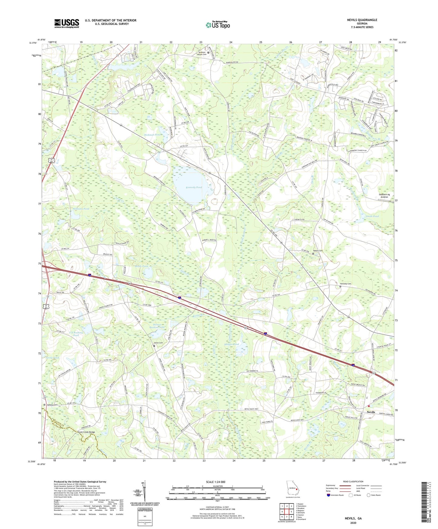
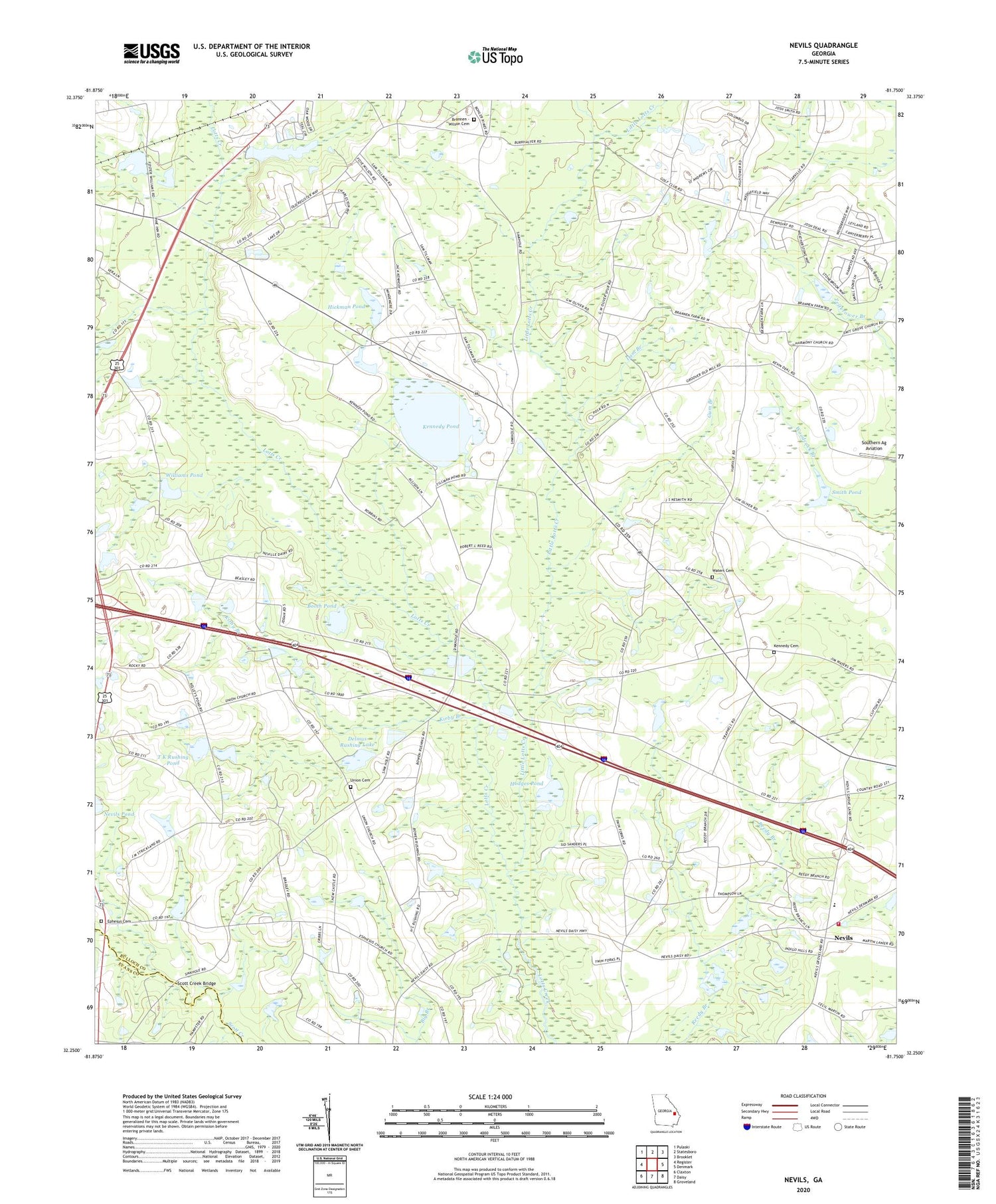
2024 topographic map quadrangle Nevils in the state of Georgia. Scale: 1:24000. Based on the newly updated USGS 7.5' US Topo map series, this map is in the following counties: Bulloch, Evans. The map contains contour data, water features, and other items you are used to seeing on USGS maps, but also has updated roads and other features. This is the next generation of topographic maps. Printed on high-quality waterproof paper with UV fade-resistant inks.
Quads adjacent to this one:
West: Register
Northwest: Pulaski
North: Statesboro
Northeast: Brooklet
East: Denmark
Southeast: Groveland
South: Daisy
Southwest: Claxton
This map covers the same area as the classic USGS quad with code o32081c7.
Contains the following named places: Booth Pond, Brannen - Wilson Cemetery, Dam Branch, Delmus Rushing Lake, Delmus Rushing Lake Dam, Enal, Ephesus Church Cemetery, Ephesus Old Line Church, Ewell Pond School, Groover Pond, Gum Branch, Harmony Church, Hickman Pond, Hickman Pond Dam, Hodges Pond, Hodges Pond Dam, Kennedy Cemetery, Kennedy Pond, Kirby Branch, Little Lotts Creek, Lower Lotts Creek Church, Nevils, Nevils - Denmark Fire Department, Nevils School, Nevils United Methodist Church, New Corent Church, Newcastle School, Reedy Branch School, Riggs Lake, Riggs Lake Dam, Rimes School, Rushing Mobile Home Park, Scott Creek Bridge, Smith Pond, Smith Pond Dam, Southern Ag Aviation, Southern Links Golf Club, Spring Hill Church, Sylvester School, T K Rushing Pond, T K Rushing Pond Dam, Tillman Pond, Union Church, Union Church Cemetery, Union School, Waters Cemetery, Williams Pond, Williams Pond Dam, WOTR-FM (Statesboro)