
MyTopo
Lanier Georgia US Topo Map
Couldn't load pickup availability
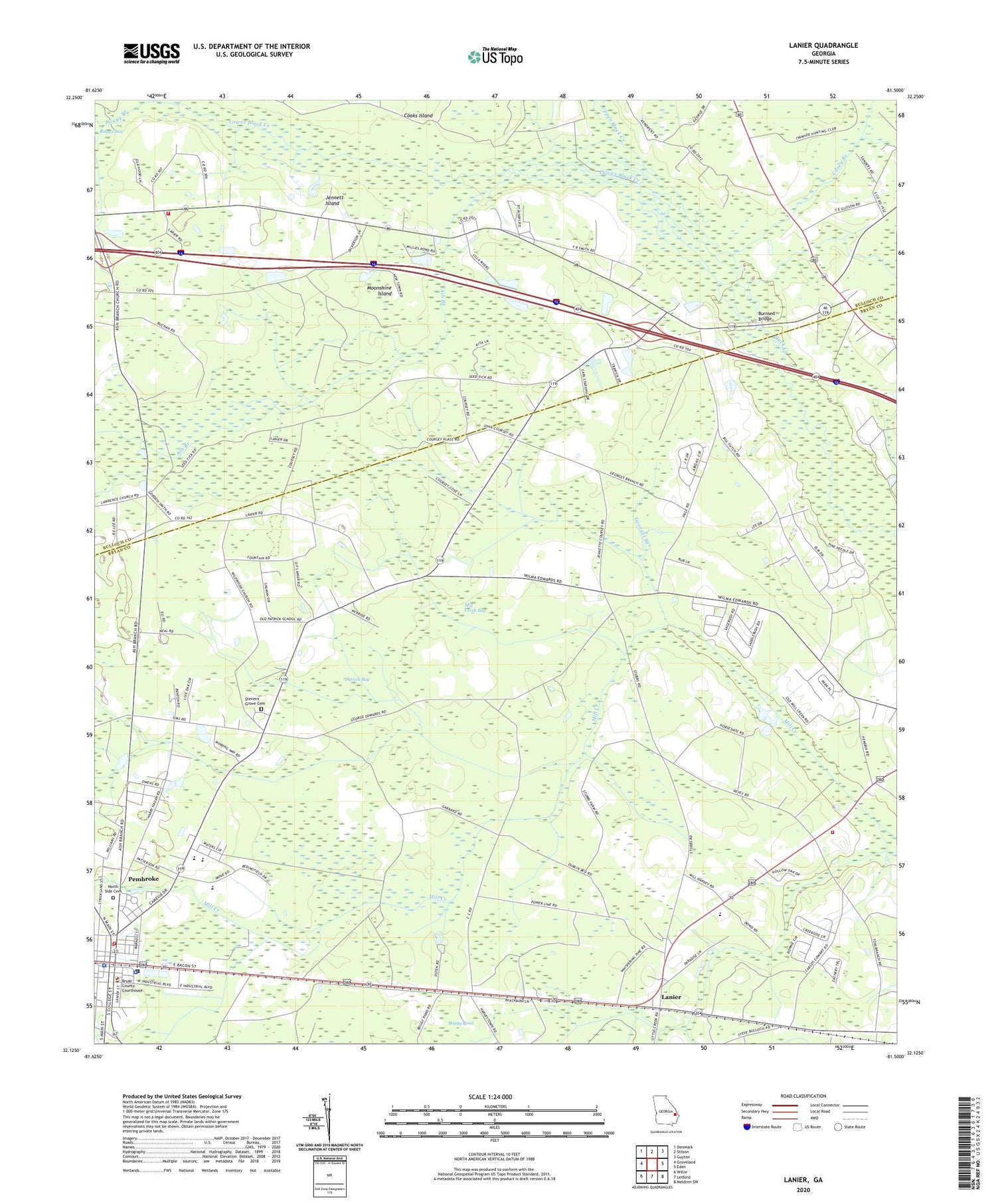
2024 topographic map quadrangle Lanier in the state of Georgia. Scale: 1:24000. Based on the newly updated USGS 7.5' US Topo map series, this map is in the following counties: Bryan, Bulloch. The map contains contour data, water features, and other items you are used to seeing on USGS maps, but also has updated roads and other features. This is the next generation of topographic maps. Printed on high-quality waterproof paper with UV fade-resistant inks.
Quads adjacent to this one:
West: Groveland
Northwest: Denmark
North: Stilson
Northeast: Guyton
East: Eden
Southeast: Meldrim SW
South: Letford
Southwest: Willie
This map covers the same area as the classic USGS quad with code o32081b5.
Contains the following named places: Ash Branch, Ash Branch Church, Athens Church, Bay District Volunteer Fire Department, Black Creek Golf Club, Black Creek School, Boggy Branch, Bryan County Church, Bryan County Courthouse, Bryan County Elementary School, Bryan County High School, Bryan County Jail, Bryan County Middle School, Bryan County Sheriff's Office, Bryan Normal Institute, Burnsed Bridge, Caney Branch, Christ Baptist Church, City of Pembroke, Esla School, Faith Harvest Sanctuary Church, First Baptist Church, Georges Branch, Groover Ford, Jennett Island, Lanier, Lanier Church, Lanier Elementary School, Lanier Primary School, Lower Black Creek, Mill Creek Bay, Mill Creek School, Moonshine Island, North Bryan County Fire Department Station 5, North Side Cemetery, Patrick Bay, Pembroke, Pembroke City Hall, Pembroke Division, Pembroke Fire Department, Pembroke Police Department, Pembroke United Methodist Church, Pembroke Water Pollution Control Plant, Purvis School, Scott Ford, Stevens Grove Cemetery, Stevens Grove School, Upper Black Creek, WVAN-TV (Savannah)


