
MyTopo
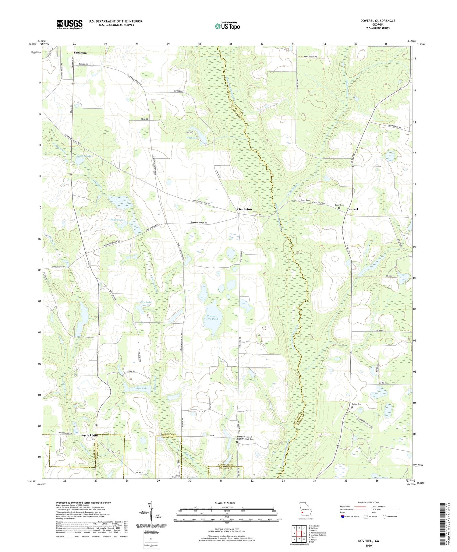
Doverel Georgia US Topo Map
Couldn't load pickup availability
2024 topographic map quadrangle Doverel in the state of Georgia. Scale: 1:24000. Based on the newly updated USGS 7.5' US Topo map series, this map is in the following counties: Randolph, Terrell, Calhoun. The map contains contour data, water features, and other items you are used to seeing on USGS maps, but also has updated roads and other features. This is the next generation of topographic maps. Printed on high-quality waterproof paper with UV fade-resistant inks.
Quads adjacent to this one:
West: Martins Crossroads
Northwest: Brooksville
North: Shellman
Northeast: Dawson
East: Chickasawhatchee
Southeast: Holt
South: Morgan
Southwest: Edison
This map covers the same area as the classic USGS quad with code o31084f5.
Contains the following named places: Aycock Mill, Bentley Lake, Bentley Lake Dam, Bethelem Freewill Baptist Church Cemetery, Bethlehem Church, Bones Mill, Bynum Lake, Bynum Lake Dam, Cherry Hill Church, Cherry Hill School, Collier Cemetery, Dover Cemetery, Dover Church, Doverel, Enterprise Church, Five Points, Friendship Church, Hundred Acre Pond, Millirons Mill, Oak Grove Church, Prospect Church, Rice Lake, Rice Lake Dam, Rice Lake Dam North, Rice Lake North, Rocky Bottom Church, Salem Baptist Church, Sweet Home Church, Terrell School, Walk-Ikey Creek, Wall Lake, Wall Lake Dam, ZIP Code: 39886


