
MyTopo
Martins Crossroads Georgia US Topo Map
Couldn't load pickup availability
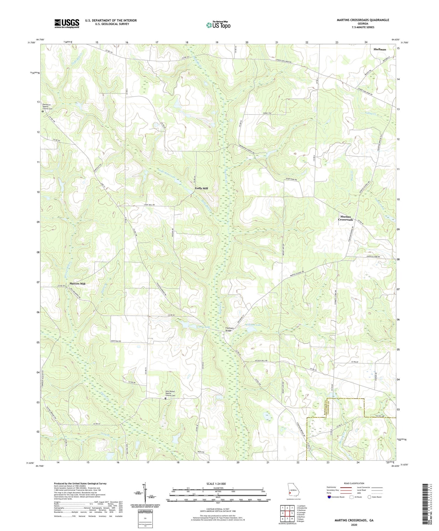
2024 topographic map quadrangle Martins Crossroads in the state of Georgia. Scale: 1:24000. Based on the newly updated USGS 7.5' US Topo map series, this map is in the following counties: Randolph, Calhoun. The map contains contour data, water features, and other items you are used to seeing on USGS maps, but also has updated roads and other features. This is the next generation of topographic maps. Printed on high-quality waterproof paper with UV fade-resistant inks.
Quads adjacent to this one:
West: Carnegie
Northwest: Cuthbert
North: Brooksville
Northeast: Shellman
East: Doverel
Southeast: Morgan
South: Edison
Southwest: Bluffton
This map covers the same area as the classic USGS quad with code o31084f6.
Contains the following named places: Beulah Church, Bridges Lake, Bridges Lake Dam, Curry Lake, Curry Lake Dam, Damascus Baptist Church Cemetery, Damascus Church, Fountain Bridge, Goffs Mill, Goffs Mill Creek, Grubbs Airport, Hopewell Church, Jacobs Chapel, Long Branch, Martins Crossroads, Mount Airy Church, Mount Calvary Church, New Bethel Baptist Church Cemetery, New Bethel Church, Shellman Division, Shivers Mill, Shivers Mill Creek, Taylor Branch, Union Hill Church, Vilulah Church, Williams Lake, Williams Lake Dam, Zion Rock Church


