MyTopo
Morgan Georgia US Topo Map
Couldn't load pickup availability
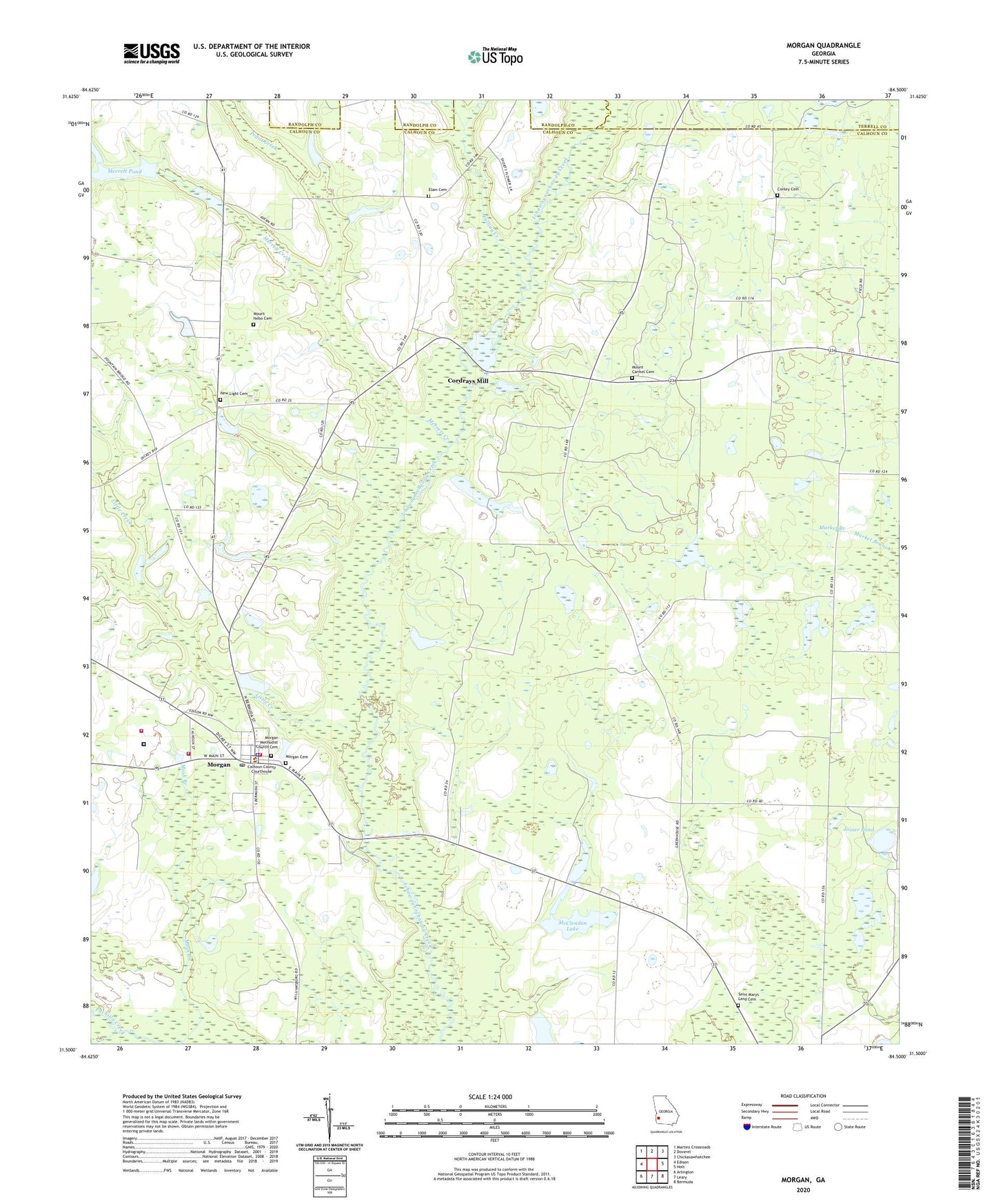
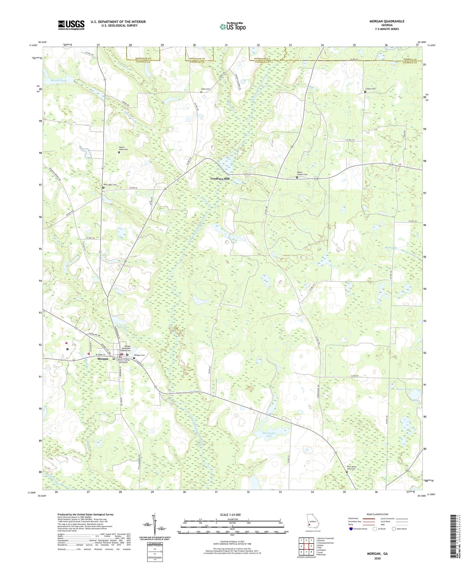
2024 topographic map quadrangle Morgan in the state of Georgia. Scale: 1:24000. Based on the newly updated USGS 7.5' US Topo map series, this map is in the following counties: Calhoun, Terrell, Randolph. The map contains contour data, water features, and other items you are used to seeing on USGS maps, but also has updated roads and other features. This is the next generation of topographic maps. Printed on high-quality waterproof paper with UV fade-resistant inks.
Quads adjacent to this one:
West: Edison
Northwest: Martins Crossroads
North: Doverel
Northeast: Chickasawhatchee
East: Holt
Southeast: Bermuda
South: Leary
Southwest: Arlington
This map covers the same area as the classic USGS quad with code o31084e5.
Contains the following named places: Calhoun County, Calhoun County Courthouse, Calhoun County Emergency Management Agency Fire and Rescue Headquarters, Calhoun County Sheriff's Office, Calhoun State Prison, Calhoun State Prison Fire Services, City of Morgan, Conley Cemetery, Cordray Church, Cordrays Mill, Cordrays Pond, East Calhoun Division, Elam Cemetery, Elam Church, Falling Creek, Folks, Joiner Pond, Leary Division, Little Creek, McClendon Lake, McClendon Lake Dam, Merrett Creek, Merrett Pond, Merrett Pond Dam, Morgan, Morgan Baptist Church, Morgan Cemetery, Morgan Methodist Church, Morgan Methodist Church Cemetery, Morgan Post Office, Morgan Volunteer Fire Department, Mosh Branch, Mount Carmel Cemetery, Mount Carmel Church, Mount Nebo Cemetery, Mount Nebo Church, Mount Zion Church, New Light Cemetery, New Light Church, Oak Grove Church, Pilgrims Rest Church, Pruitt Creek, Saint Maryland Church, Saint Marys Land Cemetery, Saint Peters Church, Singleton Junior High School, ZIP Code: 39866