MyTopo
Durand Georgia US Topo Map
Couldn't load pickup availability
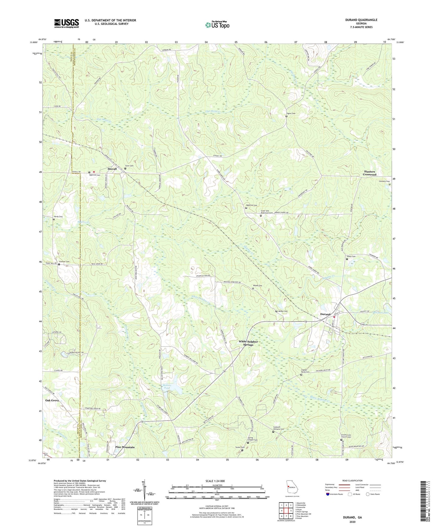
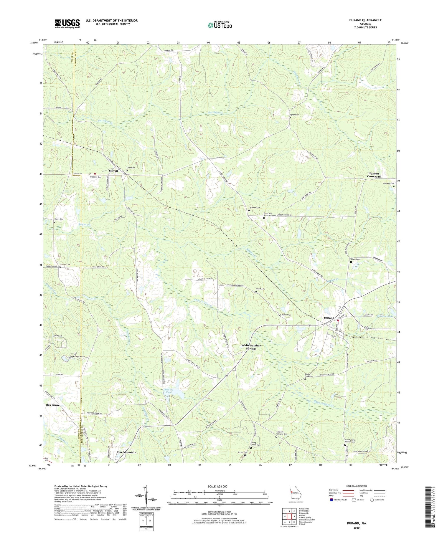
2024 topographic map quadrangle Durand in the state of Georgia. Scale: 1:24000. Based on the newly updated USGS 7.5' US Topo map series, this map is in the following counties: Meriwether, Troup. The map contains contour data, water features, and other items you are used to seeing on USGS maps, but also has updated roads and other features. This is the next generation of topographic maps. Printed on high-quality waterproof paper with UV fade-resistant inks.
Quads adjacent to this one:
West: Hilyer
Northwest: Mountville
North: Odessadale
Northeast: Greenville
East: Warm Springs
Southeast: Shiloh
South: Pine Mountain
Southwest: Pine Mountain SW
This map covers the same area as the classic USGS quad with code o32084h7.
Contains the following named places: Arbor Chapel, Arbors Church Cemetery, Bethlehem Church, Caldwell-Williams Cemetery, Cameo, Clemens Cemetery, Coplan-Perry Cemetery, County Line, County Line Church, County Line Church Cemetery, Dallas Mill, Durand, Glanton Cemetery, Greer and Robertson Cemetery, Grier Cemetery, Hardy Cemetery, Hills Lake, Hills Lake Dam, Hunters Crossroad, McGees Pond, McKee Cemetery, Meriwether County Volunteer Fire Department Station 10, Meriwether County Volunteer Fire Department Station 8, Meriwether White Sulphur, Mitcham Dam, Mitcham Lake, Oak Grove, Ogletree Cemetery, Sharp Cemetery, Spring Chapel, Spring Chapel Cemetery, Stovall, Stovall Baptist Church, Tigner Cemetery, Tigners Cross Roads, Trinity Church, Trinity Church Cemetery, Tucker Cemetery, Vandegrift Dam, Warm Springs Division, White Sulphur Creek, White Sulphur Springs, Williamson Lake, Williamson Lake Dam, Wilson Chapel, Wilson Dickerson Cemetery, Woods Cemetery