MyTopo
Odessadale Georgia US Topo Map
Couldn't load pickup availability
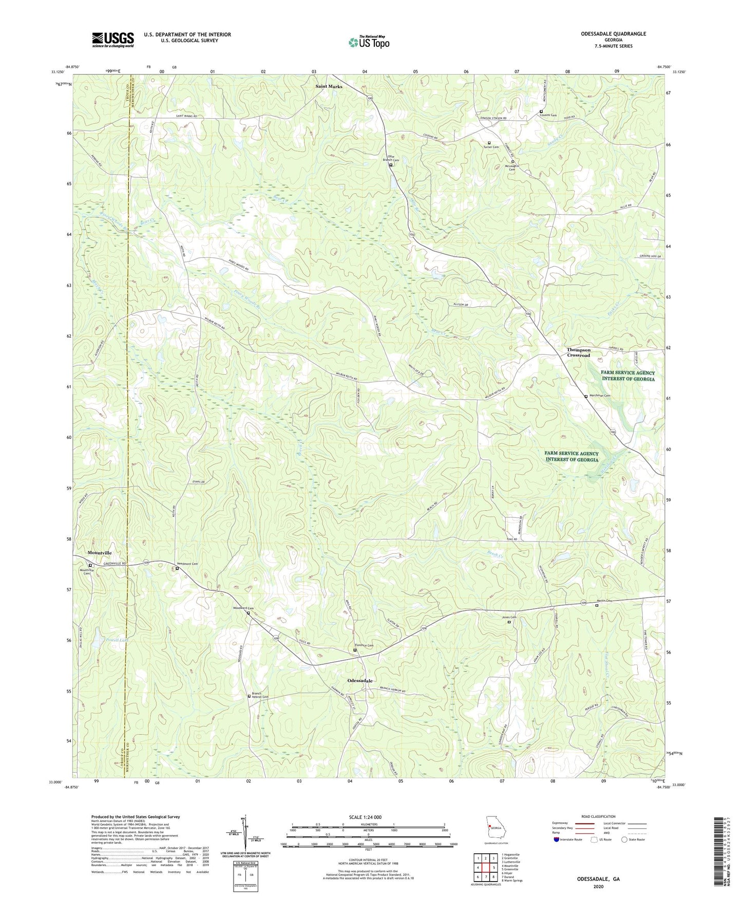
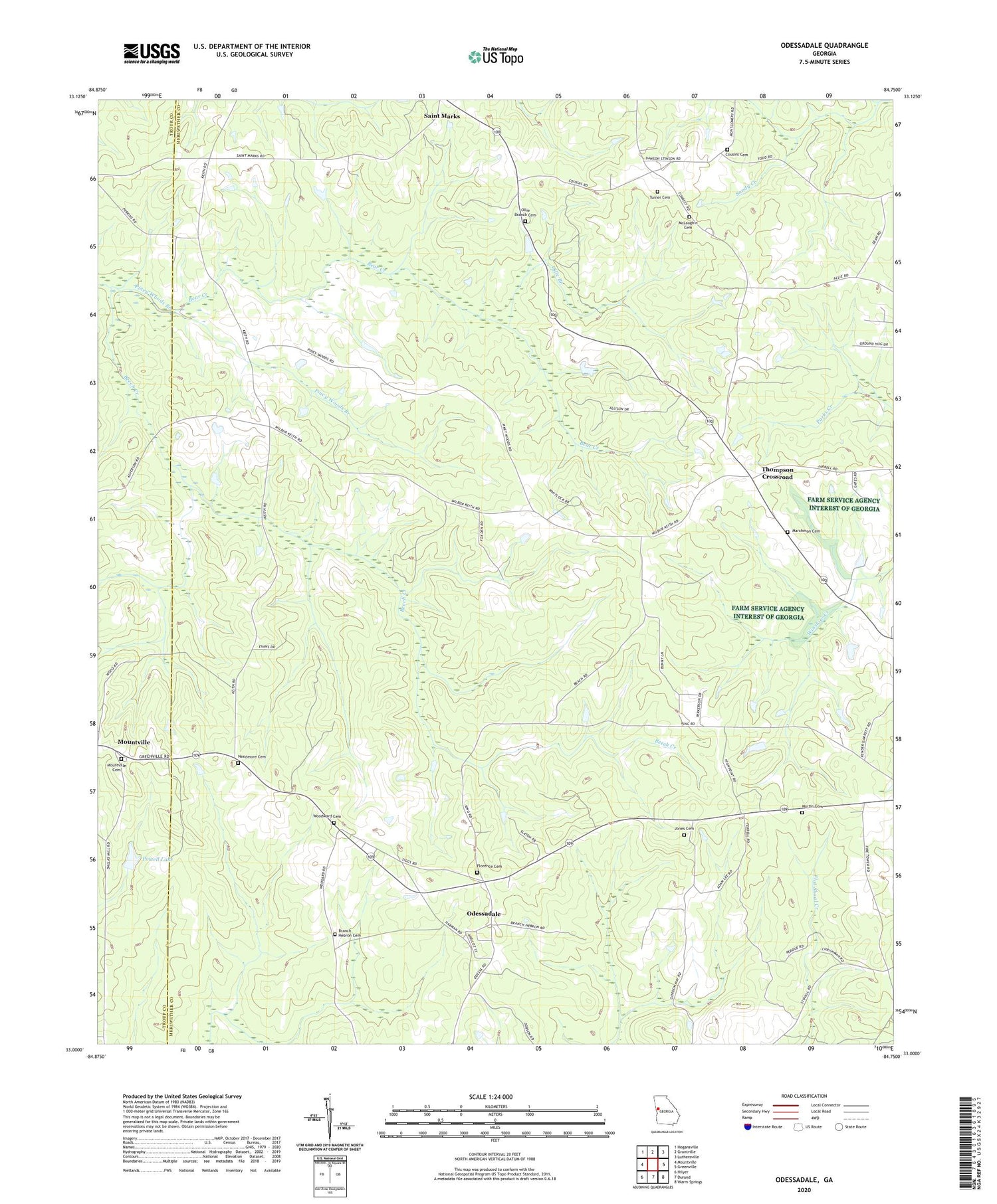
2024 topographic map quadrangle Odessadale in the state of Georgia. Scale: 1:24000. Based on the newly updated USGS 7.5' US Topo map series, this map is in the following counties: Meriwether, Troup. The map contains contour data, water features, and other items you are used to seeing on USGS maps, but also has updated roads and other features. This is the next generation of topographic maps. Printed on high-quality waterproof paper with UV fade-resistant inks.
Quads adjacent to this one:
West: Mountville
Northwest: Hogansville
North: Grantville
Northeast: Luthersville
East: Greenville
Southeast: Warm Springs
South: Durand
Southwest: Hilyer
This map covers the same area as the classic USGS quad with code o33084a7.
Contains the following named places: Bear Creek, Bethlehem Church, Branch Hebron Cemetery, Branch Hebron Church, Cousins Cemetery, Florence Cemetery, Jones Cemetery, Jones-Florence Plantation, Marchman Cemetery, Martin Cemetery, McLaughin Cemetery, Meriwether Lookout Tower, Mountville Cemetery, Needmore Cemetery, Oak Ridge Church, Odessadale, Odessadale Church, Odessadale United Methodist Church, Ollie Branch, Ollie Branch Cemetery, Piney Woods Branch, Powell Dam, Powell Lake, Thompson Crossroad, Turner Cemetery, White Plain Church, Woodward Cemetery