MyTopo
Eden Georgia US Topo Map
Couldn't load pickup availability
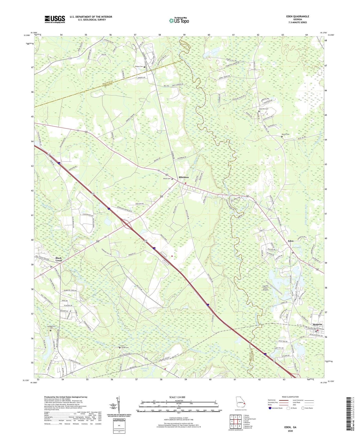
2024 topographic map quadrangle Eden in the state of Georgia. Scale: 1:24000. Based on the newly updated USGS 7.5' US Topo map series, this map is in the following counties: Bryan, Effingham, Bulloch. The map contains contour data, water features, and other items you are used to seeing on USGS maps, but also has updated roads and other features. This is the next generation of topographic maps. Printed on high-quality waterproof paper with UV fade-resistant inks.
Quads adjacent to this one:
West: Lanier
Northwest: Stilson
North: Guyton
Northeast: Springfield South
East: Meldrim
Southeast: Meldrim SE
South: Meldrim SW
Southwest: Letford
This map covers the same area as the classic USGS quad with code o32081b4.
Contains the following named places: Anderson Temple, Bird - Smith Cemetery, Black Creek, Black Creek Church, Black Creek School, Blitch Cemetery, Blitchon Church, Blitchton, Blitchton Bryan County Volunteer Fire Department Unmanned Station, Bloomingdale Church of the Nazarene, Boyds Temple, Bryan Academy, Campground Cemetery, Church of Christ at Ellabell, Cypress Lakes Airport, Doswell, Downs Cemetery, Eden, Eden Church, Eden Post Office, Eden School, Effingham Fire / Rescue Station 5, Eldora Cemetery, Eldora Church, Ellabell Church, Ellabell Post Office, Gartrell Lake, Haarley Lake, Lake Lorraine Dam, Liberty Church, Little Creek, Lower Black Creek Church, Macedonia Church, Meldrim, Meldrim Baptist Church, Meldrim Christian Church, Meldrim Post Office, Miles Branch, Miles Branch Church, Miles Branch School, Mill Creek, Mill Creek Baptist Church, Mill Creek Church, Missionary Church, Ogeechee Run, Olive Branch Church, Onley School, Powers Church, Saint James Church, Saint Paul Church, Sand Hill Cemetery, Sand Hill Church, Sand Hill Elementary School, ZIP Codes: 31307, 31308