MyTopo
Egypt Georgia US Topo Map
Couldn't load pickup availability
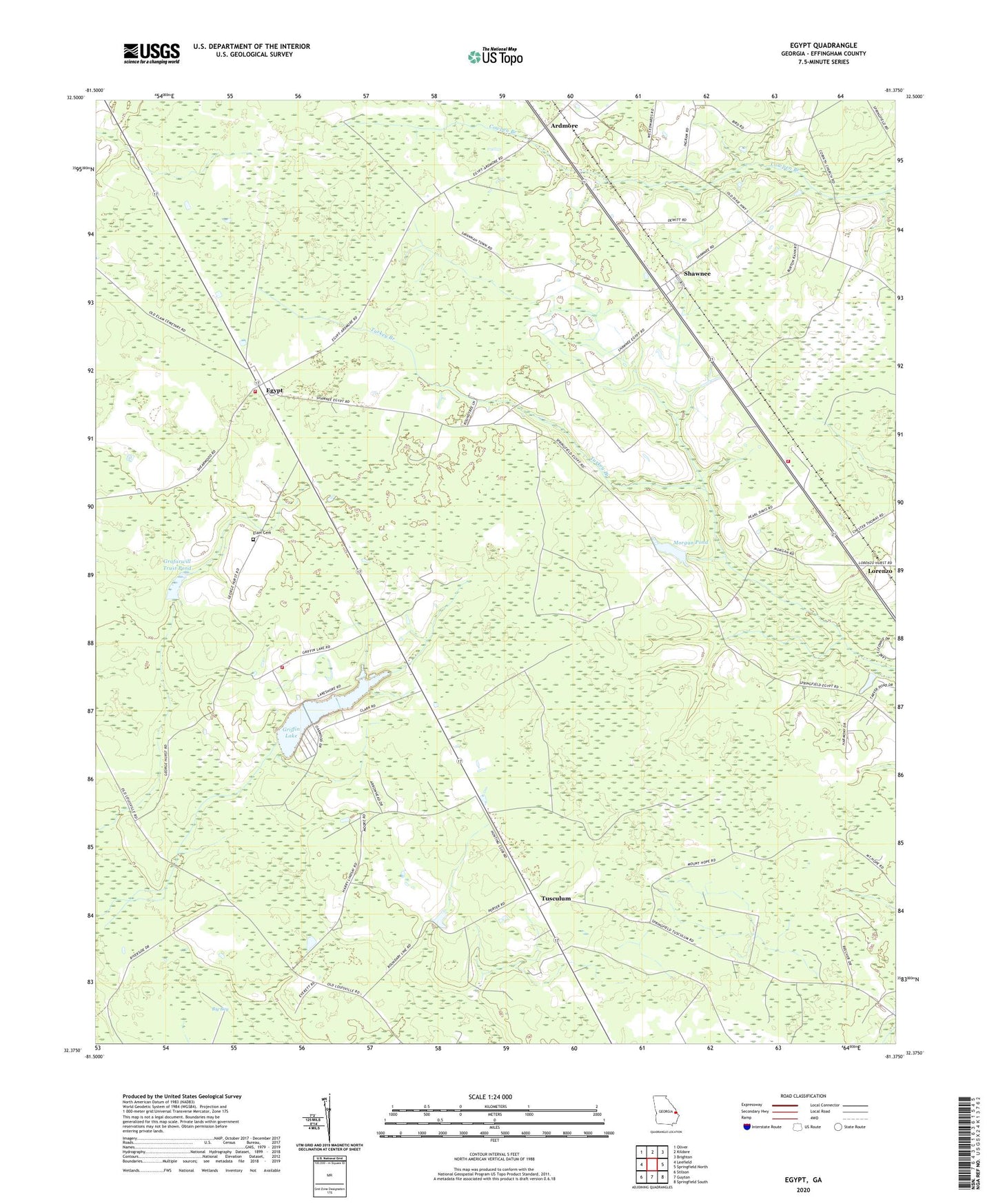
2024 topographic map quadrangle Egypt in the state of Georgia. Scale: 1:24000. Based on the newly updated USGS 7.5' US Topo map series, this map is in the following counties: Effingham. The map contains contour data, water features, and other items you are used to seeing on USGS maps, but also has updated roads and other features. This is the next generation of topographic maps. Printed on high-quality waterproof paper with UV fade-resistant inks.
Quads adjacent to this one:
West: Leefield
Northwest: Oliver
North: Kildare
Northeast: Brighton
East: Springfield North
Southeast: Springfield South
South: Guyton
Southwest: Stilson
This map covers the same area as the classic USGS quad with code o32081d4.
Contains the following named places: Allison Dam, Allison Lake, Ardmore, Corinth Church, Effingham County Fire Rescue Station 10, Effingham County Fire Rescue Station 6, Effingham County Sheriff's Department Shawnee Substation, Egypt, Egypt Church, Elam Cemetery, Elam Church, Grafarwill Trust Dam, Grafarwill Trust Pond, Griffin Lake, Griffin Lake Dam, Guyton Volunteer Fire Department Station 2, Lorenzo, Morgan Pond, Morgan Pond Dam, Mount Hope Church, Pine Grove School, Rahn's Greenhouses, Shawnee, Shawnee Division, Thomas Chapel, Turkey Branch Church, Turkey Creek Church, Tusculum, Tusculum Church