MyTopo
Kildare Georgia US Topo Map
Couldn't load pickup availability
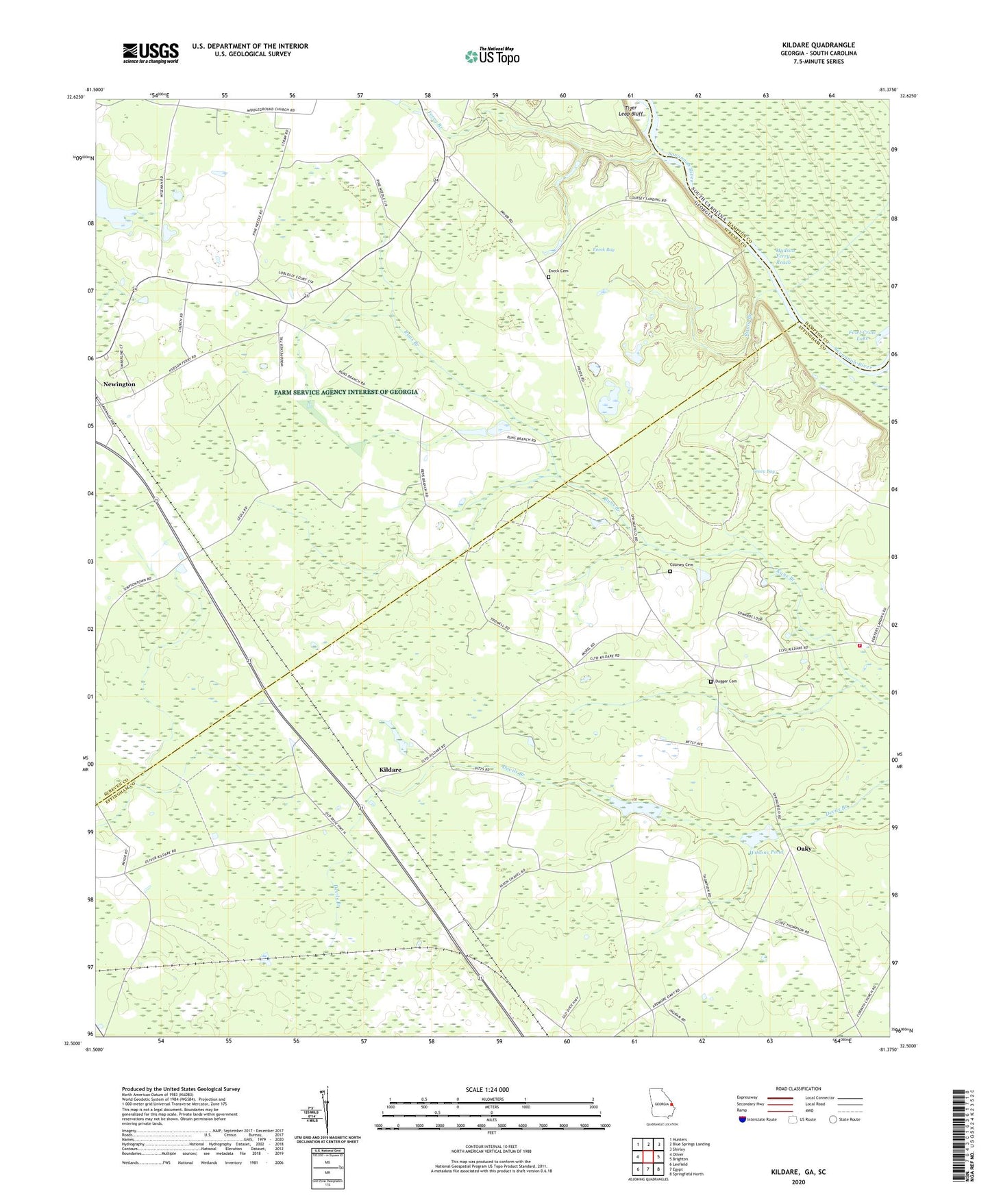
2024 topographic map quadrangle Kildare in the states of Georgia, South Carolina. Scale: 1:24000. Based on the newly updated USGS 7.5' US Topo map series, this map is in the following counties: Effingham, Screven, Hampton. The map contains contour data, water features, and other items you are used to seeing on USGS maps, but also has updated roads and other features. This is the next generation of topographic maps. Printed on high-quality waterproof paper with UV fade-resistant inks.
Quads adjacent to this one:
West: Oliver
Northwest: Hunters
North: Blue Springs Landing
Northeast: Shirley
East: Brighton
Southeast: Springfield North
South: Egypt
Southwest: Leefield
Contains the following named places: Bethel Church, Colson School, Coursey Cemetery, Coursey School, Dugger Cemetery, Effingham County Fire Rescue Station 7, Eneck, Eneck Bay, Eneck Cemetery, Eneck Landing, Ferry Branch, Friendship Tabernacle, Green Bay, Hudson Ferry, Hudson Ferry Landing, Hudson Ferry Reach, Kildare, Mariah Grove School, Mizpah Church, Mizpah School, Nixon Chapel, North Newington Church, Oakgrove Church, Oaky, Rooty Branch, Saint Peters Church, Saint Peters School, Sand Pond, Southside School, Tiger Leap Bluff, Walker Grove School, Wallace Temple, Wilsons Pond, ZIP Code: 30446