MyTopo
Ellaville North Georgia US Topo Map
Couldn't load pickup availability
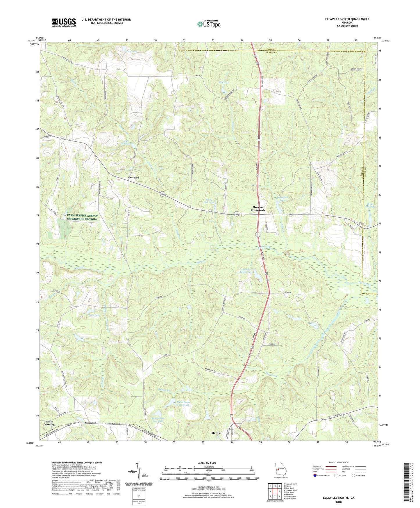
2024 topographic map quadrangle Ellaville North in the state of Georgia. Scale: 1:24000. Based on the newly updated USGS 7.5' US Topo map series, this map is in the following counties: Schley, Macon, Taylor. The map contains contour data, water features, and other items you are used to seeing on USGS maps, but also has updated roads and other features. This is the next generation of topographic maps. Printed on high-quality waterproof paper with UV fade-resistant inks.
Quads adjacent to this one:
West: Tazewell South
Northwest: Tazewell North
North: Rupert
Northeast: Ideal North
East: Ideal South
Southeast: Andersonville
South: Ellaville South
Southwest: Draneville
This map covers the same area as the classic USGS quad with code o32084c3.
Contains the following named places: American Legion Dam, American Legion Lake, Beaver Run, Brays Mill Pond, Cedar Church, Concord, Concord Methodist Church, Coon Creek, Deer Creek, Ellaville North Division, Fox Branch, Hill Dam, Hill Lake, Hills Millpond, Hills Millpond Dam, Hopewell Church, Hopewell Methodist Church Cemetery, Lanceford Lake, Lanceford Lake Dam, Mount Vernon Church, Murrays Crossroads, Owens Lake, Owens Lake Dam, Philippi Church, Pleasant Hill Church, Rice Branch, Rock Hill Church, Rufus Peepe Dam North, Rufus Peepe Dam South, Rufus Peepe Lake North, Rufus Peepe Lake Suth, Schley County, Sellars Store, Trice Lake, Trice Lake Dam, Usry Creek, Walls Crossing, Walls Fish Pond, Wells Lake, Zion Hill Church, ZIP Code: 31806