MyTopo
Rupert Georgia US Topo Map
Couldn't load pickup availability
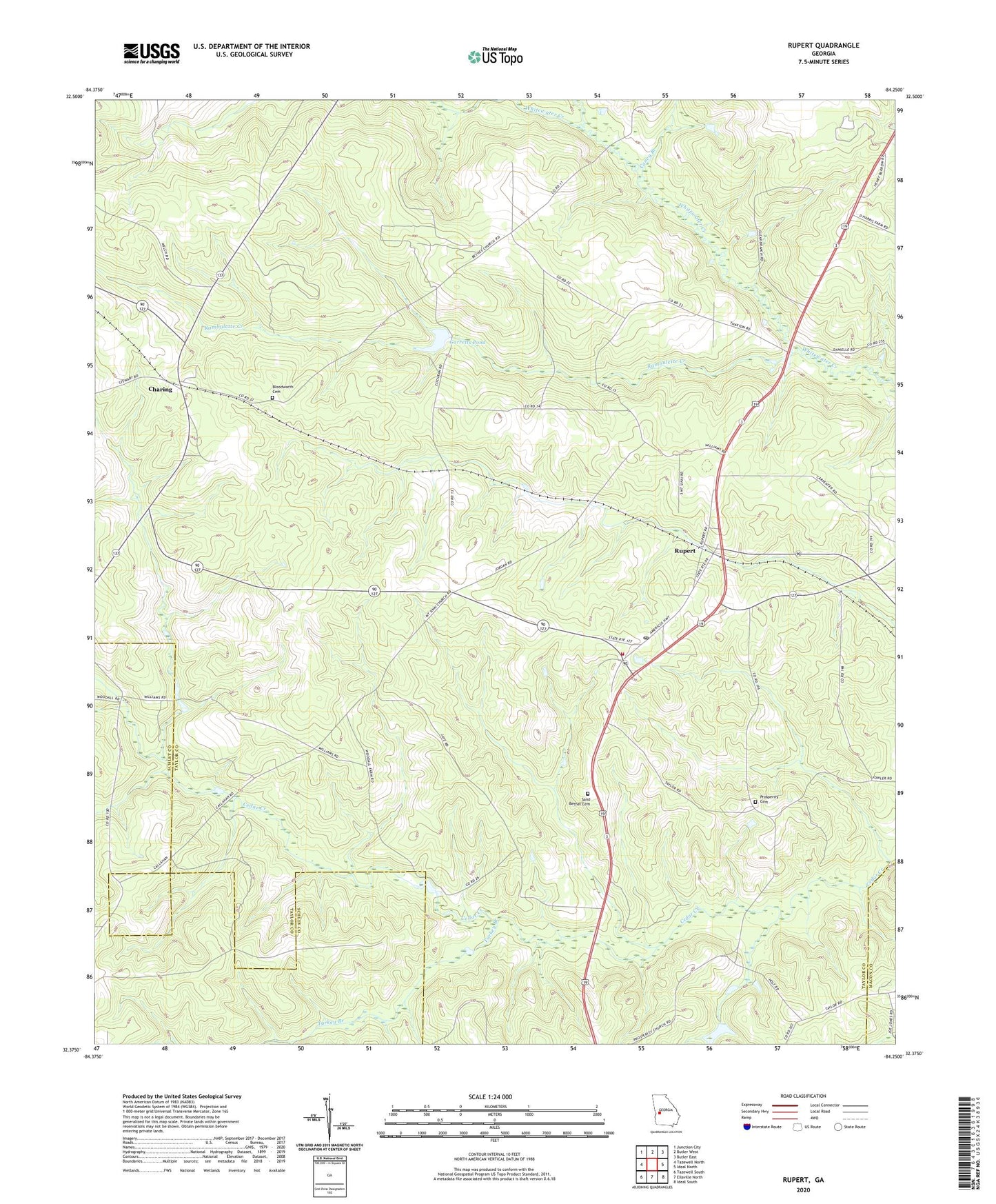
2024 topographic map quadrangle Rupert in the state of Georgia. Scale: 1:24000. Based on the newly updated USGS 7.5' US Topo map series, this map is in the following counties: Taylor, Schley, Macon. The map contains contour data, water features, and other items you are used to seeing on USGS maps, but also has updated roads and other features. This is the next generation of topographic maps. Printed on high-quality waterproof paper with UV fade-resistant inks.
Quads adjacent to this one:
West: Tazewell North
Northwest: Junction City
North: Butler West
Northeast: Butler East
East: Ideal North
Southeast: Ideal South
South: Ellaville North
Southwest: Tazewell South
This map covers the same area as the classic USGS quad with code o32084d3.
Contains the following named places: Beulah Lookout Tower, Bloodworth Cemetery, Caney Branch, Charing, Charing Church, Charing Post Office, Faith Church, Garretts Pond, Garretts Pond Dam, Lebanon Church, Little Whitewater Creek, Mount Nebo Church, Mount Sinai Church, Prosperity Cemetery, Prosperity Church, Rambulette Creek, Rogers Mill Dam, Rogers Mill Lake, Rupert, Rupert Division, Rupert Post Office, Rupert Volunteer Fire Department, Sand Bethel Cemetery, Sand Bethel Church, Turkey Branch, Wells Lake Dam, ZIP Code: 31081