MyTopo
Ideal South Georgia US Topo Map
Couldn't load pickup availability
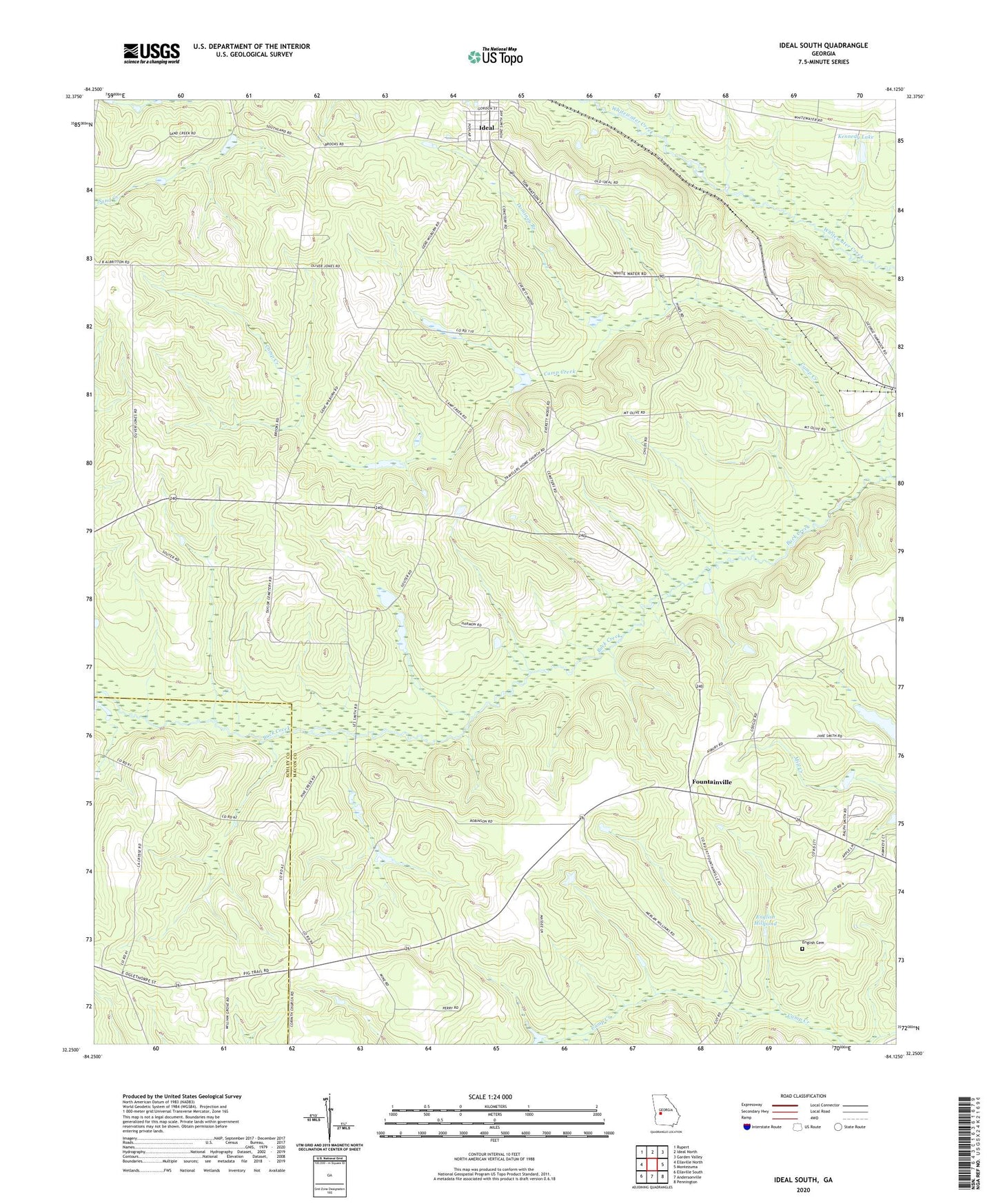
2024 topographic map quadrangle Ideal South in the state of Georgia. Scale: 1:24000. Based on the newly updated USGS 7.5' US Topo map series, this map is in the following counties: Macon, Schley. The map contains contour data, water features, and other items you are used to seeing on USGS maps, but also has updated roads and other features. This is the next generation of topographic maps. Printed on high-quality waterproof paper with UV fade-resistant inks.
Quads adjacent to this one:
West: Ellaville North
Northwest: Rupert
North: Ideal North
Northeast: Garden Valley
East: Montezuma
Southeast: Pennington
South: Andersonville
Southwest: Ellaville South
This map covers the same area as the classic USGS quad with code o32084c2.
Contains the following named places: Antioch Church, Camp Creek, City of Ideal, Corinth Church, County Line Church, Davis Chapel, Dominey Branch, English Cemetery, English Millpond, Fellowship Baptist Church Cemetery, Fountainville, Ideal, Ideal Health Care Center, Kennedy Lake, Kennedy Lake Dam, Lulla Chapel, Mount Olive Church, Mount Zion Church, Shady Grove Church, Spring Hill Church, Travel Home Church, William Grove Church, ZIP Code: 31041