MyTopo
Gay Georgia US Topo Map
Couldn't load pickup availability
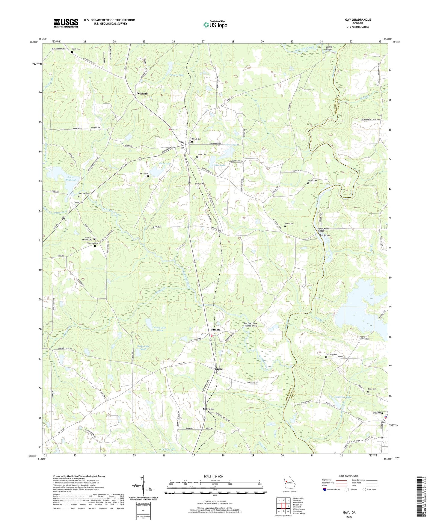
2024 topographic map quadrangle Gay in the state of Georgia. Scale: 1:24000. Based on the newly updated USGS 7.5' US Topo map series, this map is in the following counties: Meriwether, Pike. The map contains contour data, water features, and other items you are used to seeing on USGS maps, but also has updated roads and other features. This is the next generation of topographic maps. Printed on high-quality waterproof paper with UV fade-resistant inks.
Quads adjacent to this one:
West: Greenville
Northwest: Luthersville
North: Haralson
Northeast: Hollonville
East: Concord
Southeast: Sunset Village
South: Woodbury
Southwest: Warm Springs
This map covers the same area as the classic USGS quad with code o33084a5.
Contains the following named places: Barron Cemetery, Baughan - Strozier Cemetery, Bethel Church, Big Branch, Birch Creek, Blunt Cemetery, Carrolls, City of Molena, Cowtail Branch, Crouch Cemetery, David Knott Bridge, Double Bridges, Edman, Enon Primitive Baptist Church, Estes Dam, Estes Lake, Estes Lake Dam, Flat Shoals, Ganoname769 Dam, Gay, Gay Post Office, Head Cemetery, Imlac, Jones Mill, Jones Millpond, Jones Millpond Dam, Keith Cemetery, Keiths Store, Lawrence Lake, Lawrence Lake Dam, Little Creek, Mann Cemetery, Mathews Cemetery, Meriwether County Volunteer Fire Department Station 6, Meriwether County Volunteer Fire Department Station 7, Milam Cemetery, Molena, Molena Baptist Church, Molena Methodist Church, Molena Police Department, Molena Volunteer Fire Department, Neely Lake Dam North, Neely Lake Dam South, Neely Lake North, Neely Lake South, New Friendship Church, Oakland, Oakland Baptist Church, Pentecostal Church, Powell Bridge, Quercus Farms Lake, Quercus Farms Lake Dam, Red Oak Cemetery, Red Oak Church, Red Oak Creek, Red Oak Creek Covered Bridge, Red Oak Grove Baptist Church Cemetery, Riggins - Bagwell Cemetery, Rocky Ford Branch, Still Branch, Stribling Cemetery, Strozier Branch, Thrash Cemetery, Town of Gay, Twin Lakes, Walnut Creek, Weaver Dam, Weaver Lake, White Oak Creek