MyTopo
Hollonville Georgia US Topo Map
Couldn't load pickup availability
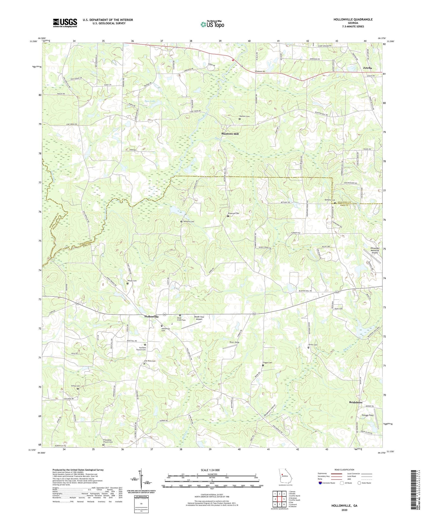
2024 topographic map quadrangle Hollonville in the state of Georgia. Scale: 1:24000. Based on the newly updated USGS 7.5' US Topo map series, this map is in the following counties: Pike, Spalding, Meriwether, Coweta. The map contains contour data, water features, and other items you are used to seeing on USGS maps, but also has updated roads and other features. This is the next generation of topographic maps. Printed on high-quality waterproof paper with UV fade-resistant inks.
Quads adjacent to this one:
West: Haralson
Northwest: Senoia
North: Brooks
Northeast: Griffin North
East: Griffin South
Southeast: Zebulon
South: Concord
Southwest: Gay
This map covers the same area as the classic USGS quad with code o33084b4.
Contains the following named places: Ackiss Cemetery, Alexander Memorial Airport, Anderson Cemetery, B & L Strip, Beeks, Bethany Cemetery, Bethany Church, Blanton Cemetery, Blantons Mill, Blantons Mill Division, Coggin Cemetery, Crosspointe Christian Academy, Digbey Division, Driver Cemetery, Fairfield Church, Fairfield Church Cemetery, Fairfield School, Fairview Church, Flat Creek, Flat Rock Cemetery, Flat Rock Methodist Church, Friendship Church, Friendship Church Cemetery, Hollonville, Hollonville Cemetery, Hollonville Church, Johnson Lake, Johnson Lake Dam, Johnston Cemetery, Line Creek, Mount Hebron Church, Mount Zion Church, Pike County Volunteer Fire Department Hollonville Station, Powers Airport, Reidsboro, Shade Tree Airport, Shoal Creek Cemetery, Shoal Creek Church, Shoal Creek School, Spalding County Fire Department Station 5, Sullivans Bridge, Syes Lake, Vintage Field, Williamson Division, Wilson Cemetery, Winship Lake Dam, Zetella, ZIP Code: 30292