MyTopo
Luthersville Georgia US Topo Map
Couldn't load pickup availability
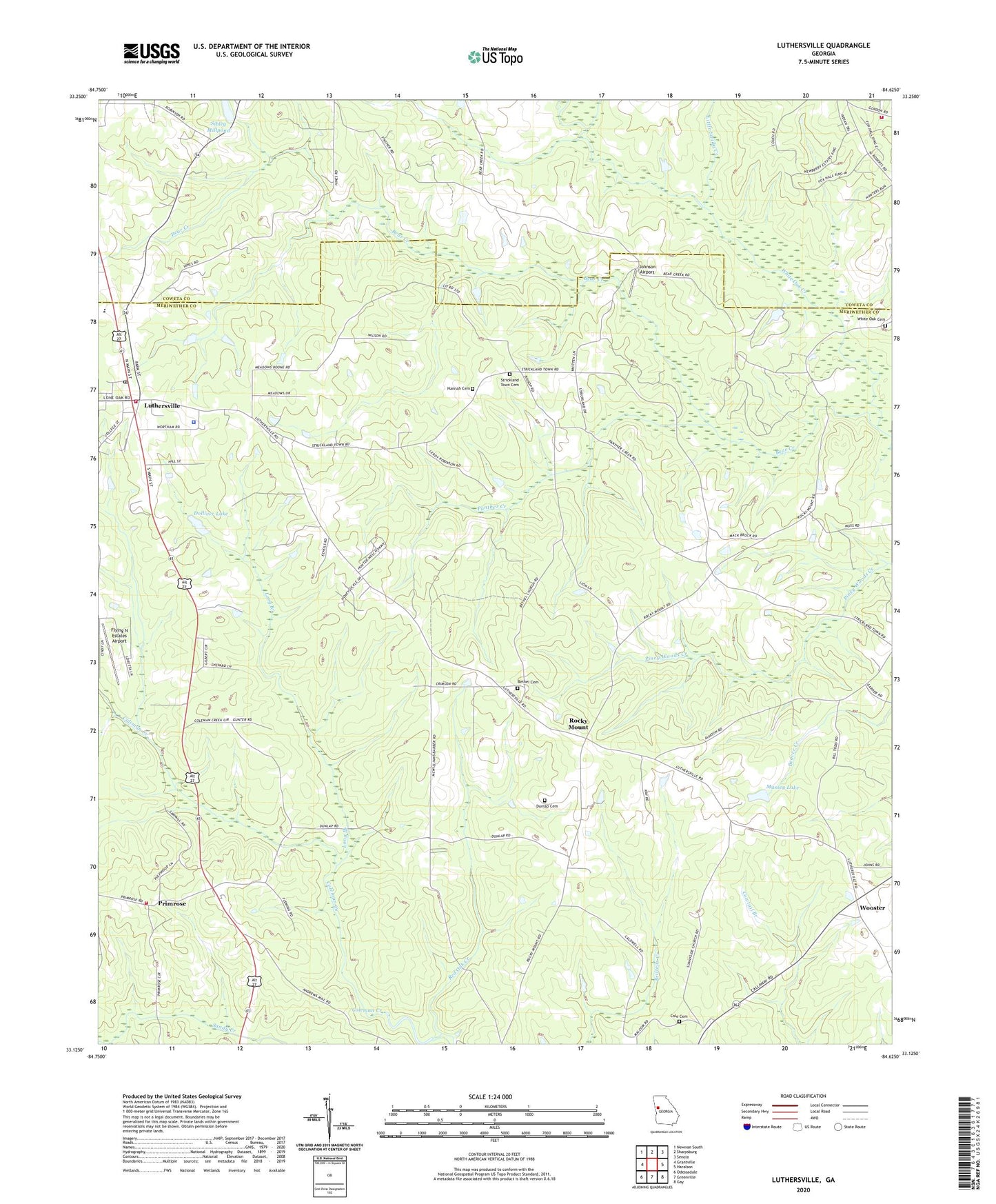
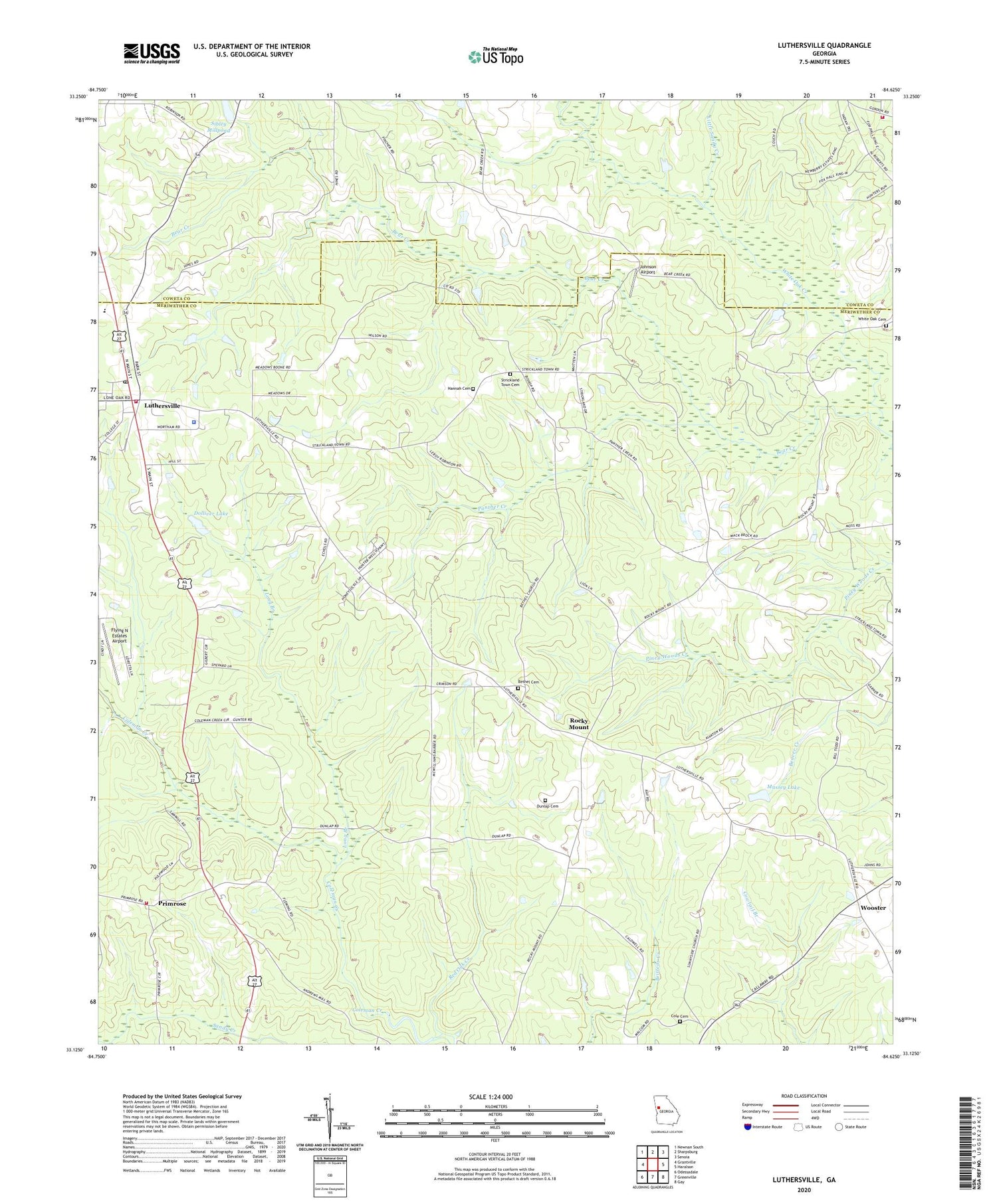
2024 topographic map quadrangle Luthersville in the state of Georgia. Scale: 1:24000. Based on the newly updated USGS 7.5' US Topo map series, this map is in the following counties: Meriwether, Coweta. The map contains contour data, water features, and other items you are used to seeing on USGS maps, but also has updated roads and other features. This is the next generation of topographic maps. Printed on high-quality waterproof paper with UV fade-resistant inks.
Quads adjacent to this one:
West: Grantville
Northwest: Newnan South
North: Sharpsburg
Northeast: Senoia
East: Haralson
Southeast: Gay
South: Greenville
Southwest: Odessadale
This map covers the same area as the classic USGS quad with code o33084b6.
Contains the following named places: Andrews Mill, Bear Creek, Bethel Cemetery, Bethel Church, Binghams Mill, City of Luthersville, Cole Cemetery, Coleman Creek, Coweta County Fire Department Station 15, Dolliver Dam, Dolliver Lake, Dunlap Cemetery, Faith Church, Flying N Estates Airport, Hannah Cemetery, Johnson Airport, Little Sandy Creek, Long Branch, Luthersville, Luthersville Elementary School, Luthersville Fire Department, Luthersville Police Department, Luthersville Post Office, Massey Dam, Massey Lake, Meriwetherco Volunteer Fire Station, Midway, New Hope Church, New Mount Bethel Church, Panther Creek, Primrose, Primrose United Methodist Church, Rocky Mount, Rocky Mount Bethel Church, Sibley Millpond, Sibley Millpond Dam, Strickland Town Cemetery, Sunnyside Church, Sunnyside School, Unity Elementary School, Walker Temple Church, White Oak Cemetery, Williams Mill, Wooster, ZIP Code: 30251