
MyTopo
Glissons Millpond Georgia US Topo Map
Couldn't load pickup availability
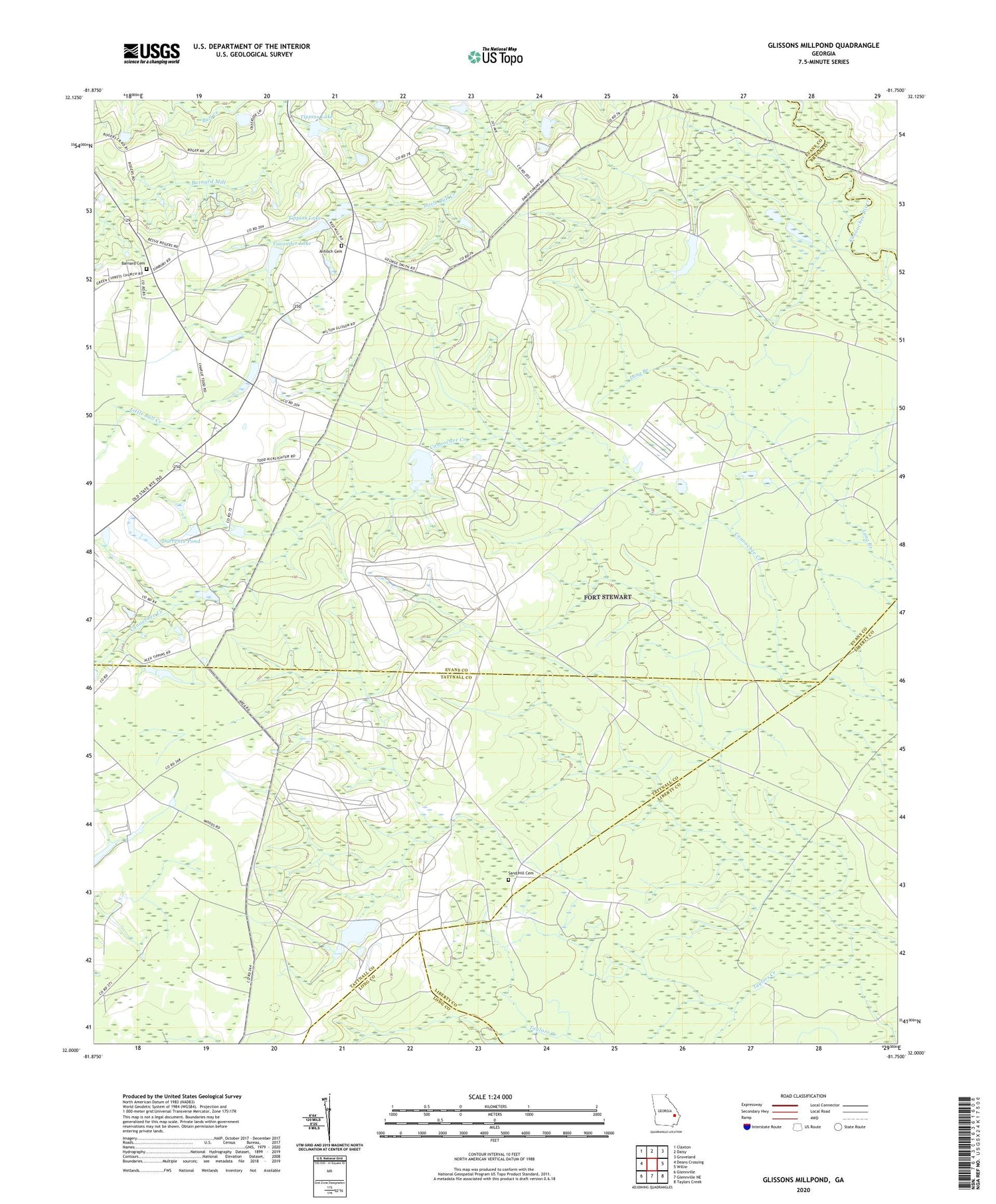
2024 topographic map quadrangle Glissons Millpond in the state of Georgia. Scale: 1:24000. Based on the newly updated USGS 7.5' US Topo map series, this map is in the following counties: Evans, Tattnall, Liberty, Long, Bryan. The map contains contour data, water features, and other items you are used to seeing on USGS maps, but also has updated roads and other features. This is the next generation of topographic maps. Printed on high-quality waterproof paper with UV fade-resistant inks.
Quads adjacent to this one:
West: Deans Crossing
Northwest: Claxton
North: Daisy
Northeast: Groveland
East: Willie
Southeast: Taylors Creek
South: Glennville NE
Southwest: Glennville
This map covers the same area as the classic USGS quad with code o32081a7.
Contains the following named places: Antioch Cemetery, Antioch Missionary Baptist Church, Antioch School, Barnard Cemetery, Camp Oliver, Cavender Dam, Cavender Lake, Cherry Grove Missionary Baptist Church, Cherry Grove School, Claxton Division, Durrence Pond, Easterling, Glisson Pond, Glissons Millpond, Grice Creek, Hampton School, Hay Grove School, Hays Grove School, Hillview School, Liberia School, Long Branch School, Moodys Crossing, Park View School, Pine View Lake Dam, Rogers Pond, Rogers School, Sand Hill Cemetery, Tippins Dam, Tippins Lake, Todd - Tippins Mill


