MyTopo
Deans Crossing Georgia US Topo Map
Couldn't load pickup availability
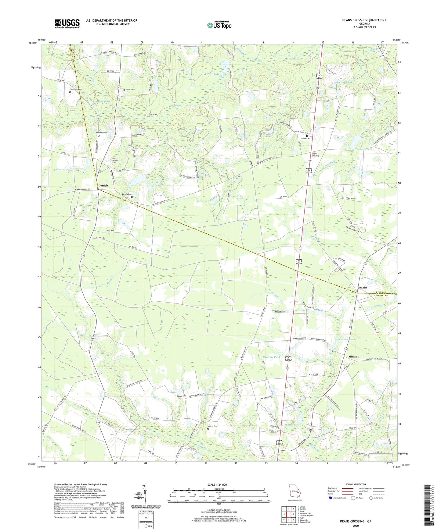
2024 topographic map quadrangle Deans Crossing in the state of Georgia. Scale: 1:24000. Based on the newly updated USGS 7.5' US Topo map series, this map is in the following counties: Tattnall, Evans. The map contains contour data, water features, and other items you are used to seeing on USGS maps, but also has updated roads and other features. This is the next generation of topographic maps. Printed on high-quality waterproof paper with UV fade-resistant inks.
Quads adjacent to this one:
West: Reidsville East
Northwest: Collins
North: Claxton
Northeast: Daisy
East: Glissons Millpond
Southeast: Glennville NE
South: Glennville
Southwest: Tison
This map covers the same area as the classic USGS quad with code o32081a8.
Contains the following named places: Bay Branch, Bay Branch Cemetery, Bay Branch Primitive Baptist Church, Bay Branch School, Beulah Church, Beulah School, Billy Fork Creek, Blocker Ford, Brazell Pond, Brewton Mill School, Clarks Siding, Collins Pond, Cross Roads Church, Cypress Grove Church, Daniels, Daniels Cemetery, Daniels Pond, Daniels Pond Dam, Deans Crossing, Dowdy Cemetery, Durrence Dam, Durrence Lake, Durrence Pond, Dyess Pond, East Daniels Pond, East Daniels Pond Dam, Ennis Branch, Eunice School, Evans Heights Golf Club, Gartrell Lake, Gospel Temple, Green Cypress Baptist Church, Green Cypress School, Griners Lake, Griners Lake Dam, Groover Pond, Hammock Cemetery, Harmony Church, Holiness Church, Jennie, Jennie School, Kennedy Cemetery, Midway, Midway School, Mount Zion Church, Mount Zion School, Purvis, Rehoboth Baptist Church, Rehovah Church, Smith Cemetery, Smith School, Smyrna Church, Tar City Church, Trinity Church, Trinity Church of the Nazarene, Union Cemetery, Union Church, Waters Cemetery, Waters Pond, Waters Pond Dam, WKIG-FM (Glennville)