MyTopo
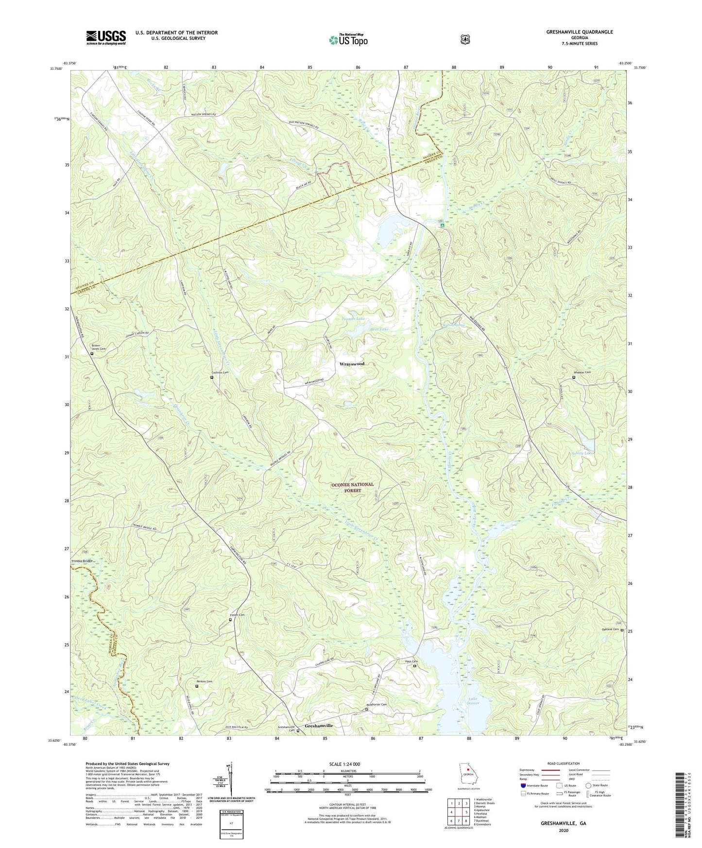
Greshamville Georgia US Topo Map
Couldn't load pickup availability
Also explore the Greshamville Forest Service Topo of this same quad for updated USFS data
2024 topographic map quadrangle Greshamville in the state of Georgia. Scale: 1:24000. Based on the newly updated USGS 7.5' US Topo map series, this map is in the following counties: Greene, Oconee, Morgan, Oglethorpe. The map contains contour data, water features, and other items you are used to seeing on USGS maps, but also has updated roads and other features. This is the next generation of topographic maps. Printed on high-quality waterproof paper with UV fade-resistant inks.
Quads adjacent to this one:
West: Apalachee
Northwest: Watkinsville
North: Barnett Shoals
Northeast: Maxeys
East: Penfield
Southeast: Greensboro
South: Buckhead
Southwest: Madison
This map covers the same area as the classic USGS quad with code o33083f3.
Contains the following named places: Ashley Lake, Ashley Lake Dam, Bear Lake, Bonds Academy, Briar Creek, Brown-Jones Cemetery, Center School, Cloverfield Hunt Camp, Cochran Cemetery, Dyar Pasture Hunt Camp, Ellison Creek, Fishing Creek, Fishing Creek Hunt Camp, Fork Chapel, Foster Cemetery, Greenbrier Creek, Greshamville, Greshamville Cemetery, Greshamville Division, Hard Labor Creek, Harris Creek, Harris Creek Hunt Camp, Hays Cemetery, Little Creek Church, Little Greenbrier Creek, Macedonia Hunt Camp, Magnolia Hunt Camp, McWhorter Cemetery, Mother Word Church, Mount Olive Church, New Hope Church, Oakland Cemetery, Oakland Lookout Tower, Oconee Lake Hunt Camp, Oconee River Campground and Picnic Area, Perkins Cemetery, Rose Creek, Sandy Creek, Scull Shoals, Scull Shoals Historic Area, Scull Shoals Trail, Smith Airport, Spring Creek Church, Thompson Grove School, Toombs Lake, Toombs Lake Dam, Trembling Bridge Hunt Camp, Trembling Bridge Shooting Range, W S Ashley Dam, Watson Spring, Wheeler Cemetery, Wrayswood