MyTopo
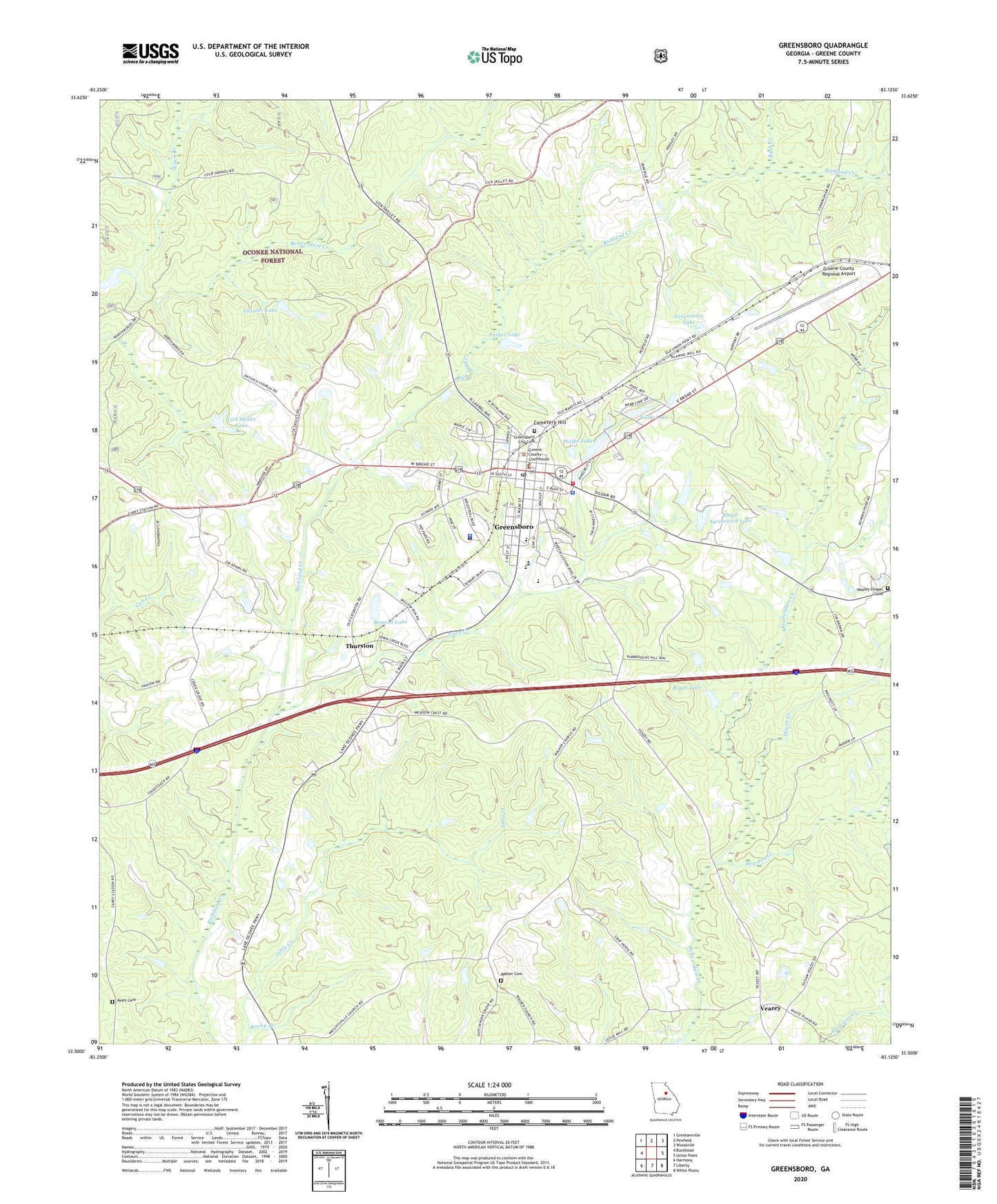
Greensboro Georgia US Topo Map
Couldn't load pickup availability
Also explore the Greensboro Forest Service Topo of this same quad for updated USFS data
2024 topographic map quadrangle Greensboro in the state of Georgia. Scale: 1:24000. Based on the newly updated USGS 7.5' US Topo map series, this map is in the following counties: Greene. The map contains contour data, water features, and other items you are used to seeing on USGS maps, but also has updated roads and other features. This is the next generation of topographic maps. Printed on high-quality waterproof paper with UV fade-resistant inks.
Quads adjacent to this one:
West: Buckhead
Northwest: Greshamville
North: Penfield
Northeast: Woodville
East: Union Point
Southeast: White Plains
South: Liberty
Southwest: Harmony
This map covers the same area as the classic USGS quad with code o33083e2.
Contains the following named places: Allens Trailer Park, Anita White Carson Middle School, Antioch Church, Ayers Cemetery, Beaverdam Creek, Bethel Church, Boswell Hospital, Boswell Lake, Boswell Lake Dam, Bowden Creek, Cedar Grove School, Cemetery Hill, City of Greensboro, Cold Springs Hunt Camp, Corry Junior High School, Dogwood Plaza Shopping Center, Enon Church, Fellowship Tabernacle, First Baptist Church, Greene County, Greene County Courthouse, Greene County Emergency Medical Services, Greene County High School, Greene County Industrial Park, Greene County Jail, Greene County Library, Greene County Regional Airport, Greene County Sheriff's Office, Greensboro, Greensboro City Cemetery, Greensboro City Hall, Greensboro Commercial Historic District, Greensboro Division, Greensboro Elementary School, Greensboro Fire Department, Greensboro Lake, Greensboro Male and Female Academy, Greensboro Police Department, Greensboro Post Office, Greensboro Water Reservoir Dam, Greensboro Water Treatment Station, Hutchinson Church, Lassiter Lake, Lassiter Lake Dam, Lenore Church, Lick Skillet Lake, Lick Skillet Lake Dam, Macedonia Church, Margarets Grove Church, Meadow Crest School, North Street-East Street Historic District, Oak Grove School, Oliver Creek, Parker Lake, Parker Lake Dam, Phelps Lake, Robinson Park, Rock Chapel, Rocky Branch, Roper Lake, Roper Lake Dam, Rush Creek, Sanders Mill, Small Agresearch Lake, Small Agresearch Lake Dam, South Street-Broad Street-Main Street-Laurel Street Historic District, South Walnut Street Historic District, Springfield Church, Thurston, Town Creek, Veazey, Walker Cemetery, Walker Church, WDDK-FM (Greensboro), Webb Lake, Webb Lake Dam, Webb Trailer Park, Wesley Chapel Cemetery, Wrightsville Church, ZIP Code: 30642