MyTopo
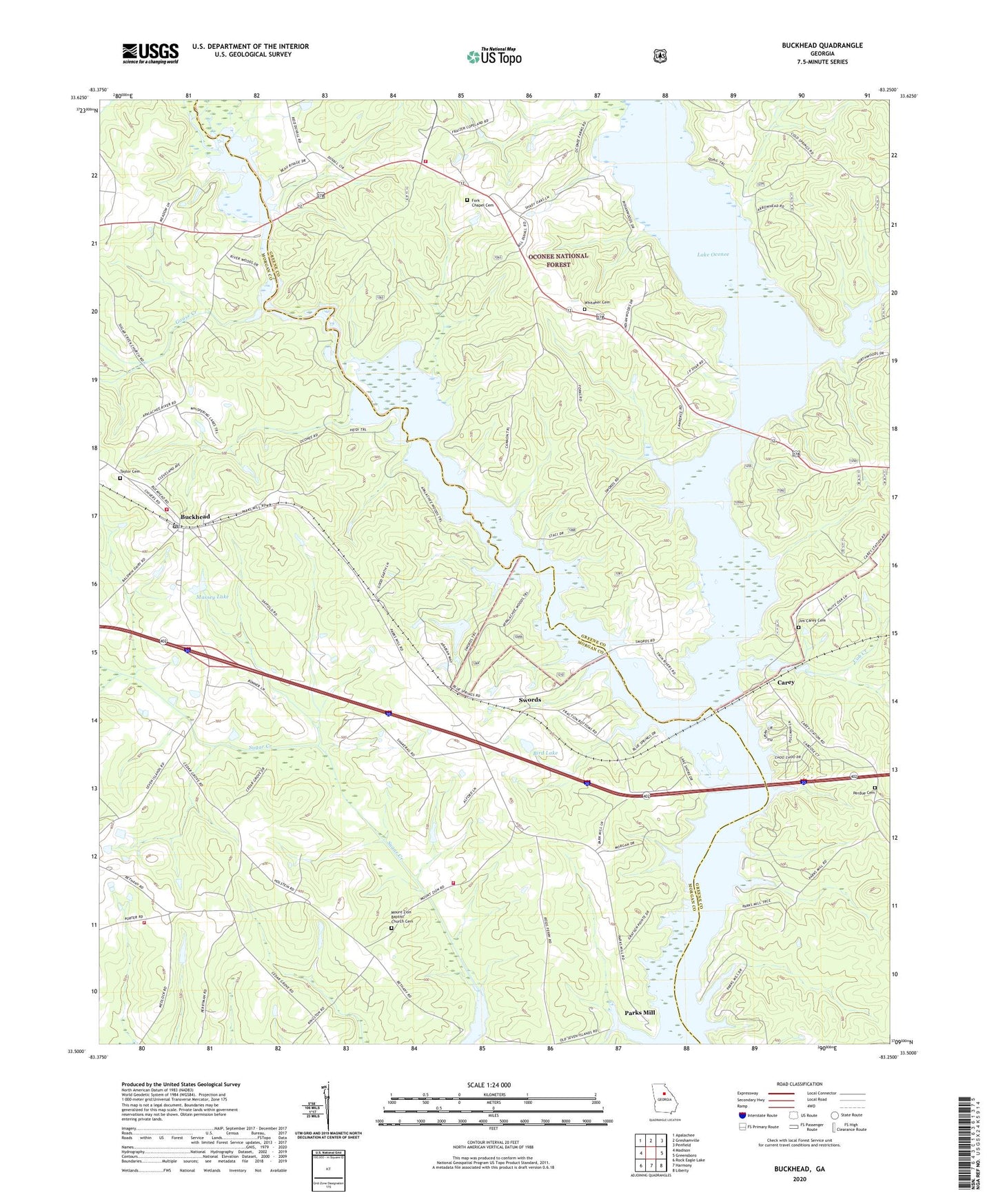
Buckhead Georgia US Topo Map
Couldn't load pickup availability
Also explore the Buckhead Forest Service Topo of this same quad for updated USFS data
2024 topographic map quadrangle Buckhead in the state of Georgia. Scale: 1:24000. Based on the newly updated USGS 7.5' US Topo map series, this map is in the following counties: Morgan, Greene. The map contains contour data, water features, and other items you are used to seeing on USGS maps, but also has updated roads and other features. This is the next generation of topographic maps. Printed on high-quality waterproof paper with UV fade-resistant inks.
Quads adjacent to this one:
West: Madison
Northwest: Apalachee
North: Greshamville
Northeast: Penfield
East: Greensboro
Southeast: Liberty
South: Harmony
Southwest: Rock Eagle Lake
This map covers the same area as the classic USGS quad with code o33083e3.
Contains the following named places: Apalachee River, Bird Lake, Bird Lake Dam, Buckhead, Buckhead Baptist Church, Buckhead Division, Buckhead Post Office, Buckhead Town Hall, Buckhead Worship Center Congregational Holiness Church, Carey, Carey Station Hunt Camp, Cob Creek, Fork Chapel Cemetery, Goose Creek, Greenville Church, Greshamville Fire Department, Harmony Grove School, Jim Carey Cemetery, Kingston School, Massey Lake, Massey Lake Dam, McCalls Hunt Camp, Moon Hunt Camp, Morgan County Fire Rescue Department Station 14, Morgan County Fire Rescue Department Station 15, Morgan County Fire Rescue Department Station 4, Moses Chapel, Mount Zion Baptist Church, Mount Zion Baptist Church Cemetery, North Sugar Creek, Oconee Church, Parks Ferry, Parks Ferry Recreational Area, Parks Mill, Perdue Cemetery, Redlands Boat Ramp, South Sugar Creek, Springfield Church, Swords, Swords Boat Ramp, Taylor Cemetery, Town Creek, Town of Buckhead, Whitaker Cemetery, ZIP Code: 30625