MyTopo
Hoboken West Georgia US Topo Map
Couldn't load pickup availability
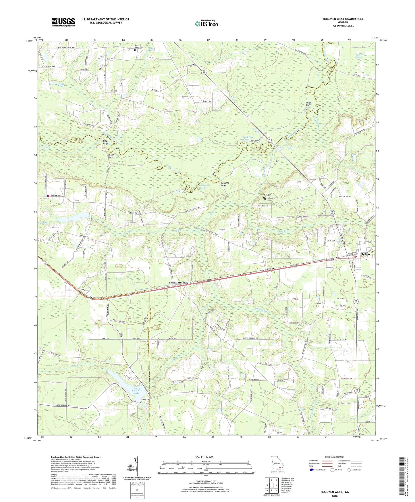
2024 topographic map quadrangle Hoboken West in the state of Georgia. Scale: 1:24000. Based on the newly updated USGS 7.5' US Topo map series, this map is in the following counties: Brantley, Pierce, Ware. The map contains contour data, water features, and other items you are used to seeing on USGS maps, but also has updated roads and other features. This is the next generation of topographic maps. Printed on high-quality waterproof paper with UV fade-resistant inks.
Quads adjacent to this one:
West: Waycross East
Northwest: Blackshear West
North: Blackshear East
Northeast: Patterson SE
East: Hoboken East
Southeast: Winokur
South: Fort Mudge
Southwest: Waycross SE
This map covers the same area as the classic USGS quad with code o31082b2.
Contains the following named places: Altman Bridge, Big Branch, Big Creek, Blue Hole Reach, Calvary Volunteer Fire Department, Cascade Church, City of Hoboken, Clay Bluff, Dark Hole Reach, Dix Branch, Dowling Bridge, Enon Cemetery, Enon Church, Georgia Lions Camp for the Blind, Gold Lake, Hickox's Cemetery, Higans Bluff, High Bluff Church, Hoboken, Hoboken Baptist Church, Hoboken Division, Hoboken Elementary School, Hoboken Fire Department, Hoboken Police Department, Hoboken Post Office, Jumping Bluff, Lake Floree, Lake Floree Dam, Laura S Walker Lake, Laura S Walker State Park, Laura S Walker State Park Lake Dam, Martin Cemetery, Mill Creek, Moore Cemetery, Mount Calvary Church, New Hope Church, Oak Hill Church, Pierce Chapel, Saint Johns Cemetery, Saint Johns Church, Sand Slough Bridge, Schlatterville, South Prong Big Creek, The Lakes Golf Couse at Laura S Walker, Thift Cemetery, Yellow Bluff