MyTopo
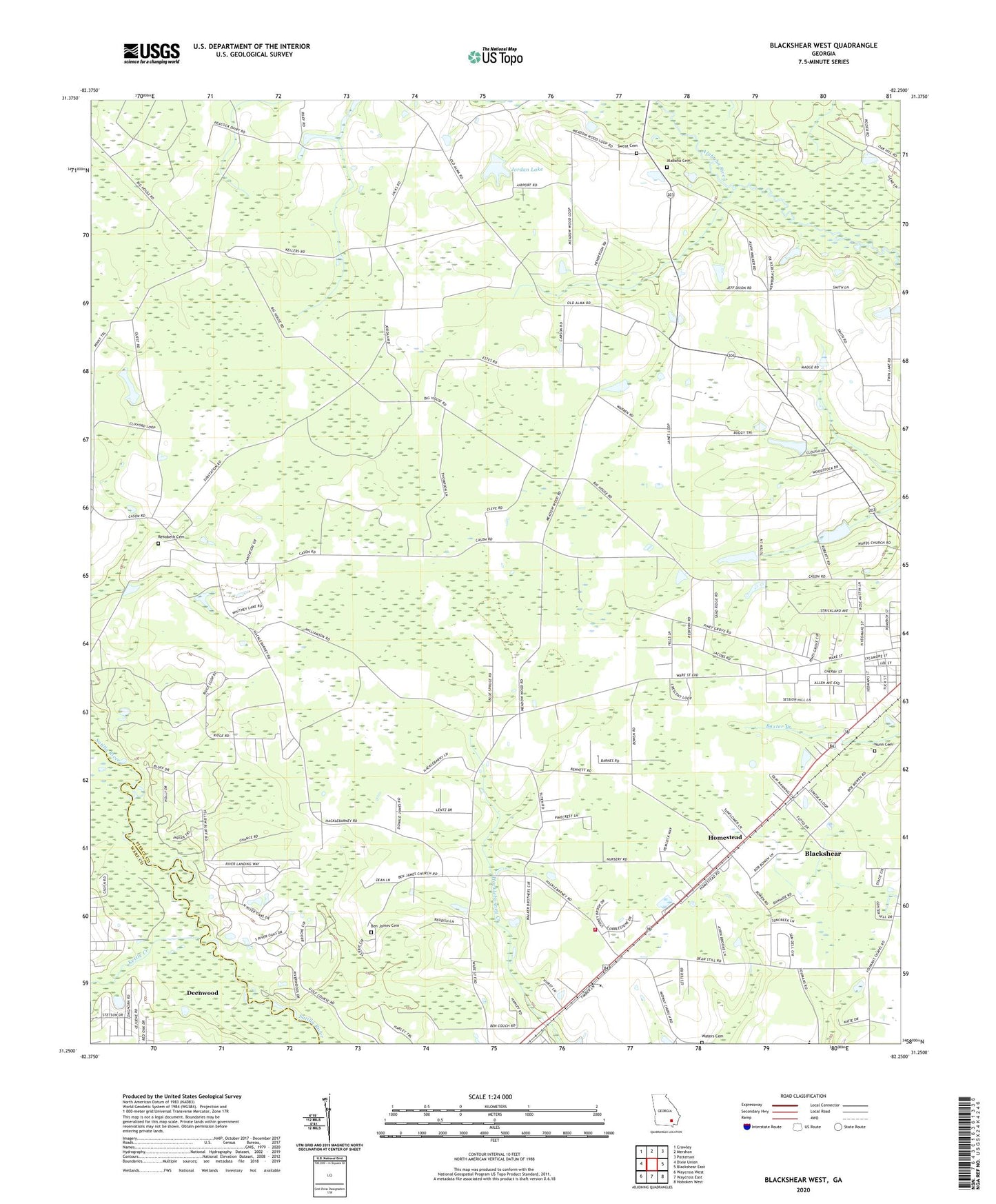
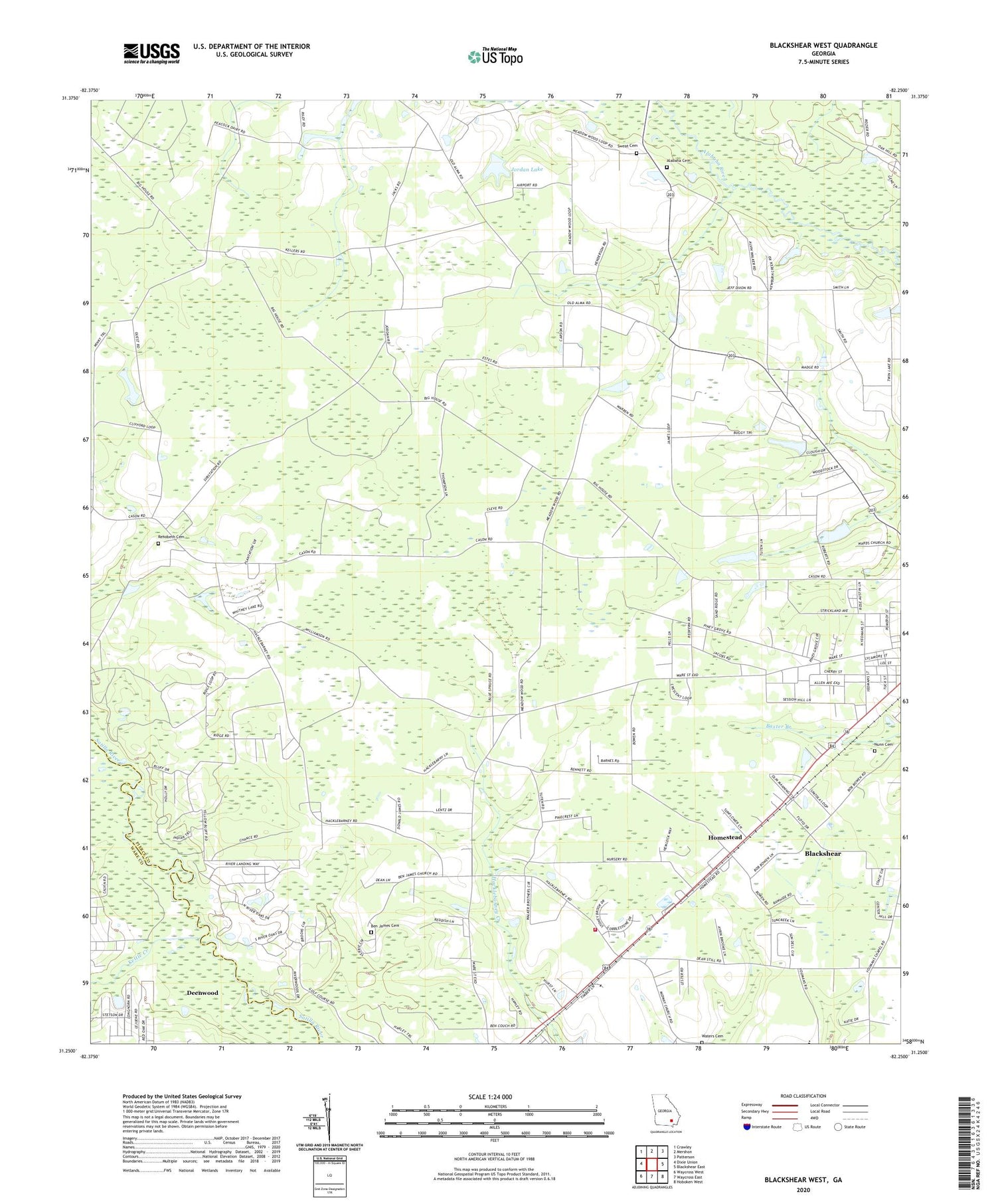
Blackshear West Georgia US Topo Map
Couldn't load pickup availability
2024 topographic map quadrangle Blackshear West in the state of Georgia. Scale: 1:24000. Based on the newly updated USGS 7.5' US Topo map series, this map is in the following counties: Pierce, Ware. The map contains contour data, water features, and other items you are used to seeing on USGS maps, but also has updated roads and other features. This is the next generation of topographic maps. Printed on high-quality waterproof paper with UV fade-resistant inks.
Quads adjacent to this one:
West: Dixie Union
Northwest: Crawley
North: Mershon
Northeast: Patterson
East: Blackshear East
Southeast: Hoboken West
South: Waycross East
Southwest: Waycross West
This map covers the same area as the classic USGS quad with code o31082c3.
Contains the following named places: Alabaha Cemetery, Alabaha Freewill Baptist Church, Alabaha School, Baxley School, Ben James Cemetery, Ben James Church, Bethel Temple Holiness Church, Blackshear Division, Deans Still, Greater Saint James African Methodist Episcopal Church, Hacklebarney Church, Hacklebarney Volunteer Fire Department, Homestead, Homestead Church, Jordan Lake, Jordan Lake Dam, Jot'Em Down Store, Kettle Creek, Marian Anderson Library, Martins Mobile Home Park, Nunn Cemetery, Okefenokee Golf and Country Club, Pine Bloom School, Piney Grove Church, Progress School, Rehobeth Cemetery, Rehobeth Church, Southgate Baptist Church, Sweat Cemetery, WACL-AM (Waycross), Ward Memorial Church, Ware Street Elementary School, Waters Cemetery, WKUB-FM (Blackshear), Youman, Youman Chapel, ZIP Code: 31516