MyTopo
Winokur Georgia US Topo Map
Couldn't load pickup availability
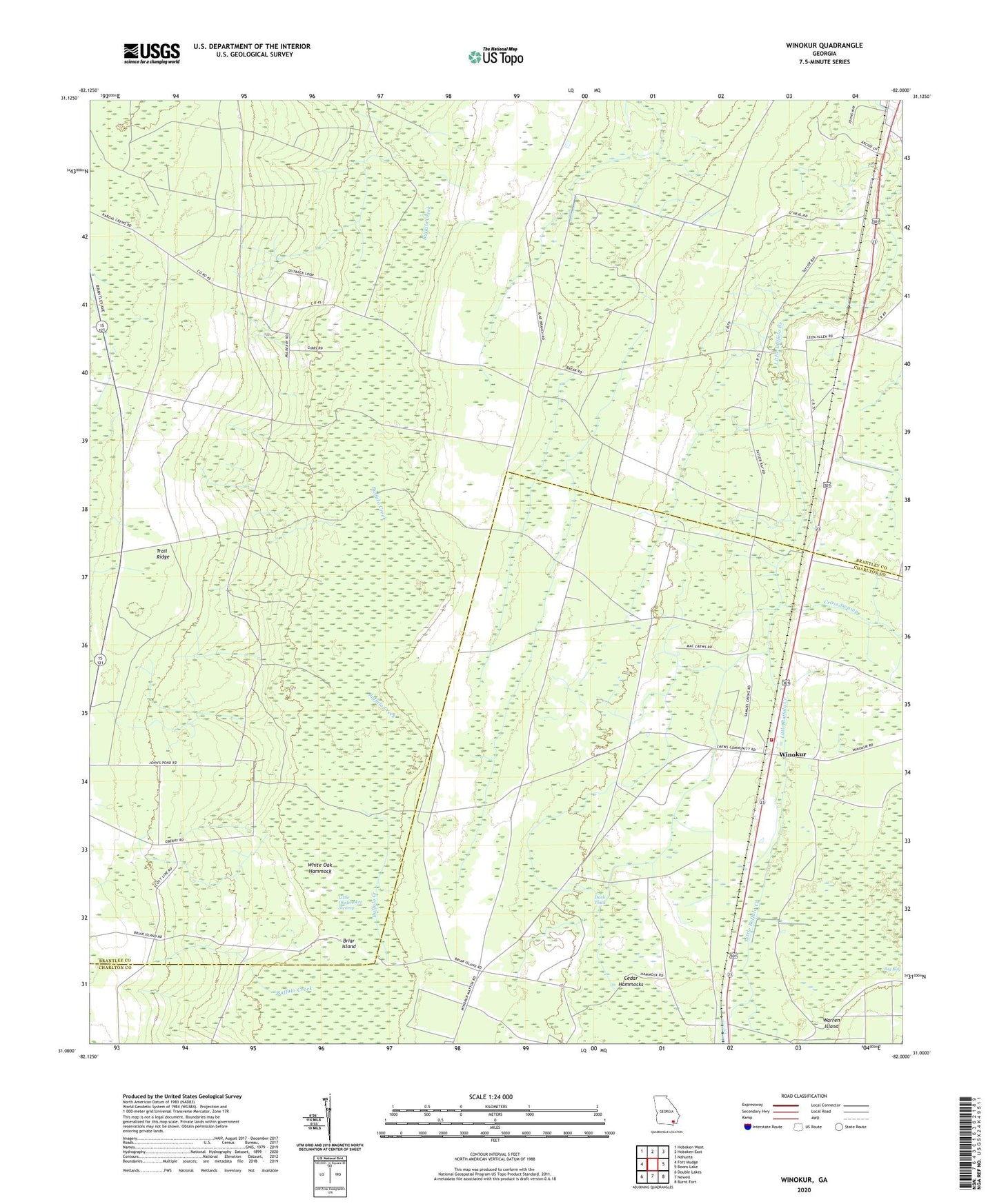
2024 topographic map quadrangle Winokur in the state of Georgia. Scale: 1:24000. Based on the newly updated USGS 7.5' US Topo map series, this map is in the following counties: Brantley, Charlton. The map contains contour data, water features, and other items you are used to seeing on USGS maps, but also has updated roads and other features. This is the next generation of topographic maps. Printed on high-quality waterproof paper with UV fade-resistant inks.
Quads adjacent to this one:
West: Fort Mudge
Northwest: Hoboken West
North: Hoboken East
Northeast: Nahunta
East: Boons Lake
Southeast: Burnt Fort
South: Newell
Southwest: Double Lakes
This map covers the same area as the classic USGS quad with code o31082a1.
Contains the following named places: Bachlott, Bachlott Church, Briar Island, Charlton County Fire Department Station 5, Cross Swamp, Little Okefenokee Swamp, White Oak Hammock, Winokur, Winokur Baptist Church