MyTopo
Irwins Crossroads Georgia US Topo Map
Couldn't load pickup availability
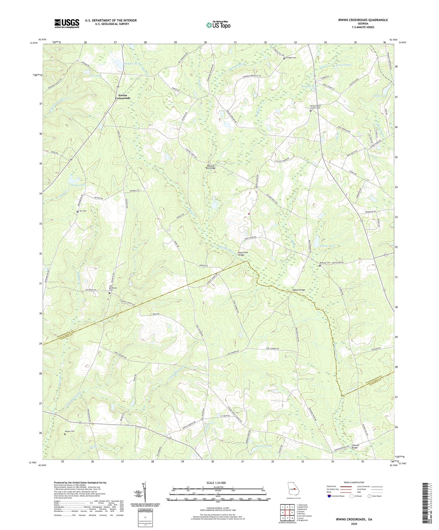
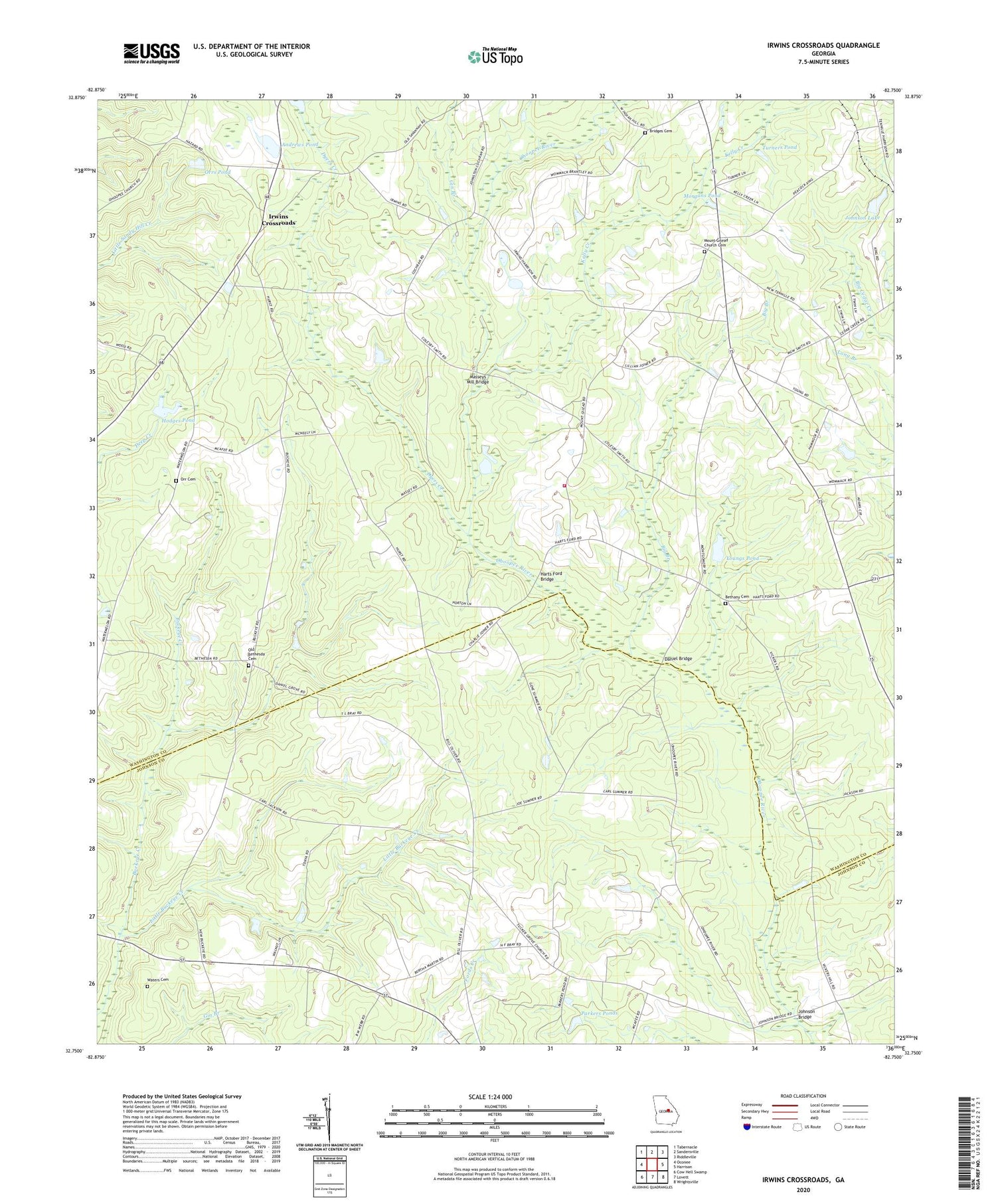
2024 topographic map quadrangle Irwins Crossroads in the state of Georgia. Scale: 1:24000. Based on the newly updated USGS 7.5' US Topo map series, this map is in the following counties: Washington, Johnson. The map contains contour data, water features, and other items you are used to seeing on USGS maps, but also has updated roads and other features. This is the next generation of topographic maps. Printed on high-quality waterproof paper with UV fade-resistant inks.
Quads adjacent to this one:
West: Oconee
Northwest: Tabernacle
North: Sandersville
Northeast: Riddleville
East: Harrison
Southeast: Wrightsville
South: Lovett
Southwest: Cow Hell Swamp
This map covers the same area as the classic USGS quad with code o32082g7.
Contains the following named places: Andrews Pond, Andrews Pond Dam, Beach Grove Church, Bethany Cemetery, Bethany Church, Bethel Church, Bethesda Church, Big Branch, Bridges Cemetery, Burnett Grove Church, Daniel Bridge, Daniel Grove Church, Dyers Creek, Gin Branch, Harts Ford Bridge, Hodges Pond, Hodges Pond Dam, Indian Hill School, Irwins Crossroads, Johnson Bridge, Johnson Lake, Johnson Lake Dam, Kelly Creek, Little Buckeye Creek, Masseys Mill Bridge, Mineral Springs Academy, Morgans Pond, Mount Gilead Church, Mount Gilead Church Cemetery, Mount Pleasant Church, Ohoopee Volunteer Fire Department, Old Bethesda Cemetery, Orr Cemetery, Orrs Pond, Parkers Ponds, Peacocks Crossing, Smith Grove Church, Smiths Grove School, Tucker Grove Church, Turners Pond, Vickers Hill Church, Waters Cemetery, Youngs Pond, ZIP Code: 31089