MyTopo
Kelleytown Georgia US Topo Map
Couldn't load pickup availability
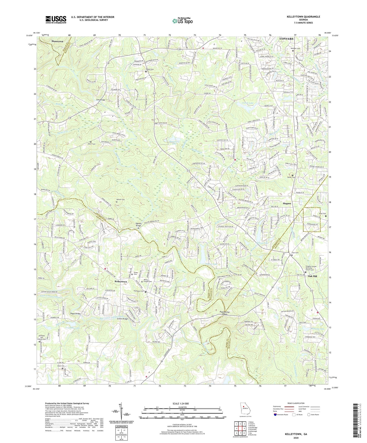
2024 topographic map quadrangle Kelleytown in the state of Georgia. Scale: 1:24000. Based on the newly updated USGS 7.5' US Topo map series, this map is in the following counties: Rockdale, Henry, Newton, DeKalb. The map contains contour data, water features, and other items you are used to seeing on USGS maps, but also has updated roads and other features. This is the next generation of topographic maps. Printed on high-quality waterproof paper with UV fade-resistant inks.
Quads adjacent to this one:
West: Stockbridge
Northwest: Redan
North: Conyers
Northeast: Milstead
East: Porterdale
Southeast: Worthville
South: Ola
Southwest: McDonough
This map covers the same area as the classic USGS quad with code o33084e1.
Contains the following named places: Albert Cemetery, Bailey Creek, Barksdale Elementary School, Barrington, Big Cotton Indian Creek, Blossom, Bonner Cemetery, Buck Branch, Buckingham, Calvary Community Cemetery, Camp Creek, Camp Smyrna, Conyers Church, Cowan Dam, Cowan Lake, Crumbley Lake, Crumbley Lake Dam, Deerun Lake, Deerun Lake Dam, Dickson Dam, Dickson Lake, Edwards Middle School, Elliot Cemetery, Elliotts Store, Fargasons Chapel, Ferguson School, Friendship Church, General Ray Davis Middle School, Gethsemane Church, Green Cemetery, Greens Bridge, Hartfield and Everitt Cemetery, Henry County Fire Department Station 13, Heritage Hills Baptist Church, Honey Creek, Honey Creek Church, Honey Creek Elementary School, Honey Creek Village Shopping Center, Hopewell Church, Jackson Creek, Journey Baptist Church, Julia, Kelley Chapel, Kelley Chapel Cemetery, Kelley Presbyterian Church, Kelleytown, Little Cotton Indian Creek, Lorraine Assembly of God Church, Lorraine Elementary School, Magnet, Magnet School, Manning Lake, Manning Lake Dam, McClane Creek, McKnight Bridge, Meadow Brook Dam, Midway Church of God, Monastery Lake, Monastery Lake Dam, Monastery of the Holy Ghost, Monastery of the Holy Spirit Cemetery, Newton County Fire Service Station 14, Newton Crossroads Shopping Center, Oak Hill, Oak Hill Elementary School, Oglesby Bridge, Owen Mill, Parker Cemetery, Peachstone Shoals, Persalls Mill, Plantation Manor Childrens Home, Pleasant Grove School, Pleasant Hill Church, Prospect Church, Prospect United Methodist Church Cemetery, Ragan Bridge, Rio Ranch, Rock Creek, Rockdale County Fire Department Station 2, Rockdale Evangelical Methodist Church, Rockdale Station Number 2 Fire Station, Rocky Branch, Scott Cemetery, Scott Creek, Shadydale Church, Shepherds Door Church, Sims Bridge, Sims Elementary School, Smyrna Presbyterian Church, South Rockdale Division, Stone Creek, The Hour of Deliverance Camp Ground, Thompson Cemetery, Timber Ridge Elementary School, Tucker Mill, Union Grove School, Velta, West Forest, Whitaker Cemetery, Williford Branch, Zion Cemetery, Zion Church, ZIP Code: 30094