MyTopo
Shirley South Carolina US Topo Map
Couldn't load pickup availability
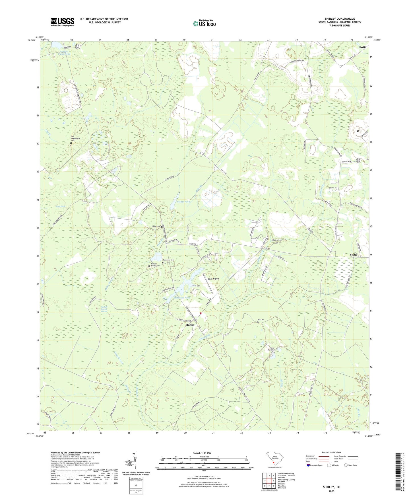
2024 topographic map quadrangle Shirley in the state of South Carolina. Scale: 1:24000. Based on the newly updated USGS 7.5' US Topo map series, this map is in the following counties: Hampton. The map contains contour data, water features, and other items you are used to seeing on USGS maps, but also has updated roads and other features. This is the next generation of topographic maps. Printed on high-quality waterproof paper with UV fade-resistant inks.
Quads adjacent to this one:
West: Blue Springs Landing
Northwest: Brier Creek Landing
North: Solomons Crossroads
Northeast: Gifford
East: Furman
Southeast: Pineland
South: Brighton
Southwest: Kildare
This map covers the same area as the classic USGS quad with code o32081f3.
Contains the following named places: Blake Plantation Pond Number One D-2607 Dam, Breeler Field Cemetery, Brighton School, Ceasars Camp Pond, Cypressvale School, Daley Branch, Davis Airport, Davis Cemetery, Federal Correctional Institution Estill, Furman-Scotia Division, Gracel Hill Plantation, Grant School, Hampton Fire Department Station 12, Haskell Barony Swamp, Heavenly Rest Church, Hill Cemetery, Hopewell Church, Hopewell School, Horse Pond Cemetery, Huntington Club, Jones Place, Kenyon Church, Lafitte Pond, Long Pond, McKenzie Pond, Millpond Branch, Millpond Cemetery, Morrison Store, Morrison Switch, Mount Pleasant Church, Old Lawtonville Cemetery, Ramseys Pond, Saint Lukes Church, Saint Marks Camp Ground, Saint Marks Church, Sand Hill School, Sandhill Church, Shirley, Shirley School, Solomons Cemetery, South Carolina Noname 25014 D-2593 Dam, South Carolina Noname 25020 D-2611 Dam, South Carolina Noname 25021 D-2598 Dam, Sweet Branch School, Union Cemetery, Union Church, ZIP Code: 29922