MyTopo
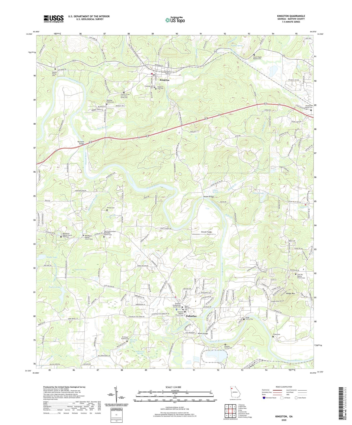
Kingston Georgia US Topo Map
Couldn't load pickup availability
2024 topographic map quadrangle Kingston in the state of Georgia. Scale: 1:24000. Based on the newly updated USGS 7.5' US Topo map series, this map is in the following counties: Bartow. The map contains contour data, water features, and other items you are used to seeing on USGS maps, but also has updated roads and other features. This is the next generation of topographic maps. Printed on high-quality waterproof paper with UV fade-resistant inks.
Quads adjacent to this one:
West: Wax
Northwest: Shannon
North: Adairsville
Northeast: White West
East: Cartersville
Southeast: Burnt Hickory Ridge
South: Taylorsville
Southwest: Rockmart North
This map covers the same area as the classic USGS quad with code o34084b8.
Contains the following named places: Arnold Cemetery, Ashpole Creek, Aylmer, Bartow County Fire Department Station 12, Bests Station, Black Pioneers Cemetery, Blue Hole Spring, Brandon Family Cemetery, Brookshire Family Cemetery, Burge Family Cemetery, Church of the Lord Jesus Christ Cemetery, City of Euharlee, City of Kingston, Confederate Cemetery, Connesena Creek, Corinth Church, Drummer Swamp Cemetery, Drummond Swamp, Etowah Bend Gliderport, Etowah Fields, Euharlee, Euharlee Baptist Church Cemetery, Euharlee Creek, Euharlee Elementary School, Euharlee Fire Department, Euharlee Police Department, Euharlee Presbyterian Church Cemetery, Euharlee-Taylorsville Division, Five Forks, Ford, Gillam Springs, Harden Bridge, Hodge Lake, Hodge Mountain, Island Ford, Kingston, Kingston Baptist Church, Kingston Church, Kingston City Cemetery, Kingston Elementary School, Kingston Fire Department, Kingston Police Department, Kingston Post Office, Liberty Hill Church, Limekiln Branch, Macedonia Baptist Church 1847 Cemetery, Macedonia Baptist Church Cemetery, Macedonia Church, Macedonia Slough, Malbone, Milams Bridge, Mission Road Elementary School, Mount Pisgah Baptist Cemetery, Mount Pisgah Church, New Vision Baptist Church, Oak Grove Church, Oak Grove United Methodist Church Cemetery, Queens Chapel, Raccoon Creek, Reynolds Bridge, Reynolds Family Cemetery, Reynolds School, Richland Creek, Rodgers Spring, Shanty Branch, Shellman, Shiloh Church, Stiles Cemetery, Stiles Creek, Taylors Lake, Taylors Lake Dam, Taylors Swamp, Tidwell Lake, Tidwell Lake Dam, Two Run Creek, Woodland Middle School, Wooley Family Cemetery, Woollys, Zion Hill Baptist Church Cemetery, Zion Hill Church, ZIP Code: 30145