MyTopo
Wax Georgia US Topo Map
Couldn't load pickup availability
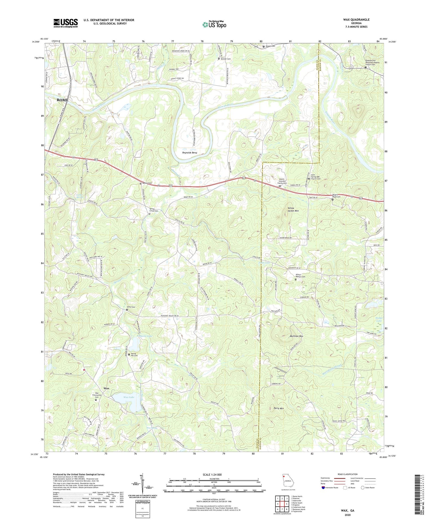
2024 topographic map quadrangle Wax in the state of Georgia. Scale: 1:24000. Based on the newly updated USGS 7.5' US Topo map series, this map is in the following counties: Floyd, Bartow. The map contains contour data, water features, and other items you are used to seeing on USGS maps, but also has updated roads and other features. This is the next generation of topographic maps. Printed on high-quality waterproof paper with UV fade-resistant inks.
Quads adjacent to this one:
West: Rome South
Northwest: Rome North
North: Shannon
Northeast: Adairsville
East: Kingston
Southeast: Taylorsville
South: Rockmart North
Southwest: Cedartown East
This map covers the same area as the classic USGS quad with code o34085b1.
Contains the following named places: Adams - Snowden Family Cemetery, Alford-Watson Cemetery, Bass Ferry, Bass Ford, Bass School, Bethel Cemetery, Bethel Church, Bryant Chapel, Bryants Mill, Carlier Springs, Chulio, Davis Ferry, Davis Ford, Dykes, Dykes Creek, Etowah, Eves Ferry, Eves Ford, Freeman Ferry, Freemans, Gore Spring AME Church Cemetery, Gore Spring Church, Ligon, Ligon School, Mizpah Cemetery, Mizpah Church, Mullinax Mountain, Murchisons, Padgetts Lake, Padgetts Lake Dam, Perry Mountain, Pineywoods Church, Pleasant Hill Church, Pleasant Hill Missionary Baptist Church Cemetery, Ransom School, Reynolds Bend, Reynolds Chapel, Rogers Road Cemetery, Rome - Floyd County Fire Department Station 10, Silver Creek Church, Skinner Cemetery, Spring Creek, Spring Creek Cemetery, Spring Creek Church, Spring Hill Cemetery, Spring Hill Church, Todd Lake, Todd Lake Dam, Toms Creek, Unity Cemetery, Unity Church, Unity School, Wax, Wax Baptist Church, Wax Community Cemetery, Wax Lake, Wax Lake Dam, Wax Spring, Woodlawn Church, Yellow Jacket Mountain