MyTopo
Lake Collins Georgia US Topo Map
Couldn't load pickup availability
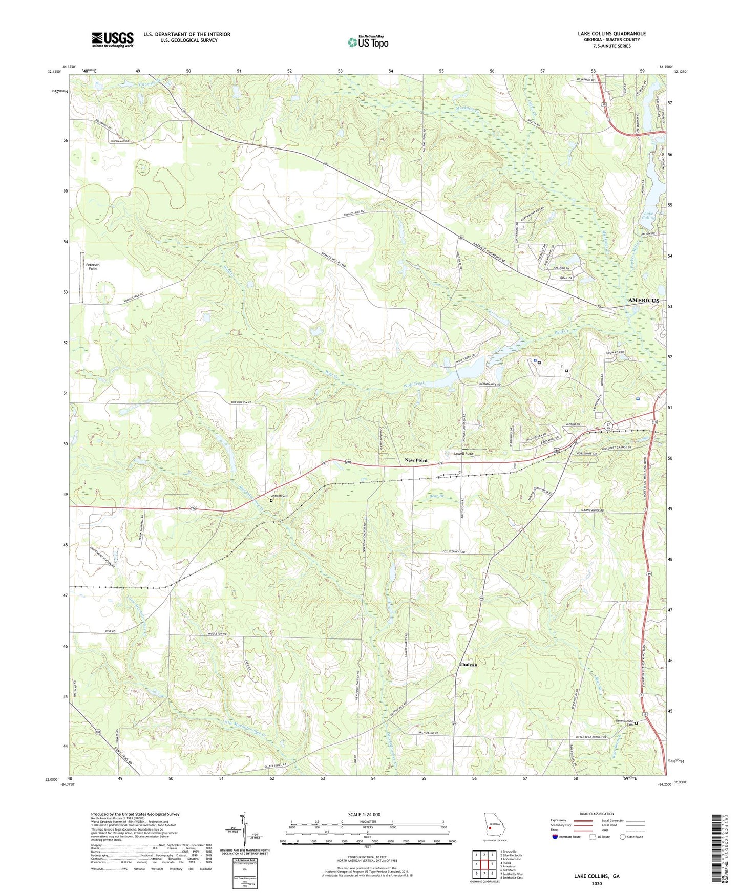
2024 topographic map quadrangle Lake Collins in the state of Georgia. Scale: 1:24000. Based on the newly updated USGS 7.5' US Topo map series, this map is in the following counties: Sumter. The map contains contour data, water features, and other items you are used to seeing on USGS maps, but also has updated roads and other features. This is the next generation of topographic maps. Printed on high-quality waterproof paper with UV fade-resistant inks.
Quads adjacent to this one:
West: Plains
Northwest: Draneville
North: Ellaville South
Northeast: Andersonville
East: Americus
Southeast: Smithville East
South: Smithville West
Southwest: Bottsford
This map covers the same area as the classic USGS quad with code o32084a3.
Contains the following named places: Antioch Cemetery, Antioch Church, Benevolence Cemetery, Benevolence Church, Christ Church, Ebenezer Church, Friendship School, Georgia State Patrol Troop G Post 10 Americus, Lake Collins, Lake Collins Dam, Lowell Field, McMath Mill, McMath Millpond, McMath Millpond Dam, Mount Salem Church, Mount Salem School, New Point, Open Door Church, Parkers Mill Creek, Peterson Field, Phoebe Sumter Medical Center, Plains Division, Seals Mill, Shipp Chapel, Southwest Georgia Agricultural Branch Station, Statham Lake, Statham Lake Dam, Sumter County Correctional Institution, Sumter County Sheriff's Office, Thalean, Thalean School, Union Whitely Church, WISK-AM (Americus), Wolf Creek, WPUR-FM (Americus), ZIP Code: 31719