MyTopo
Smithville East Georgia US Topo Map
Couldn't load pickup availability
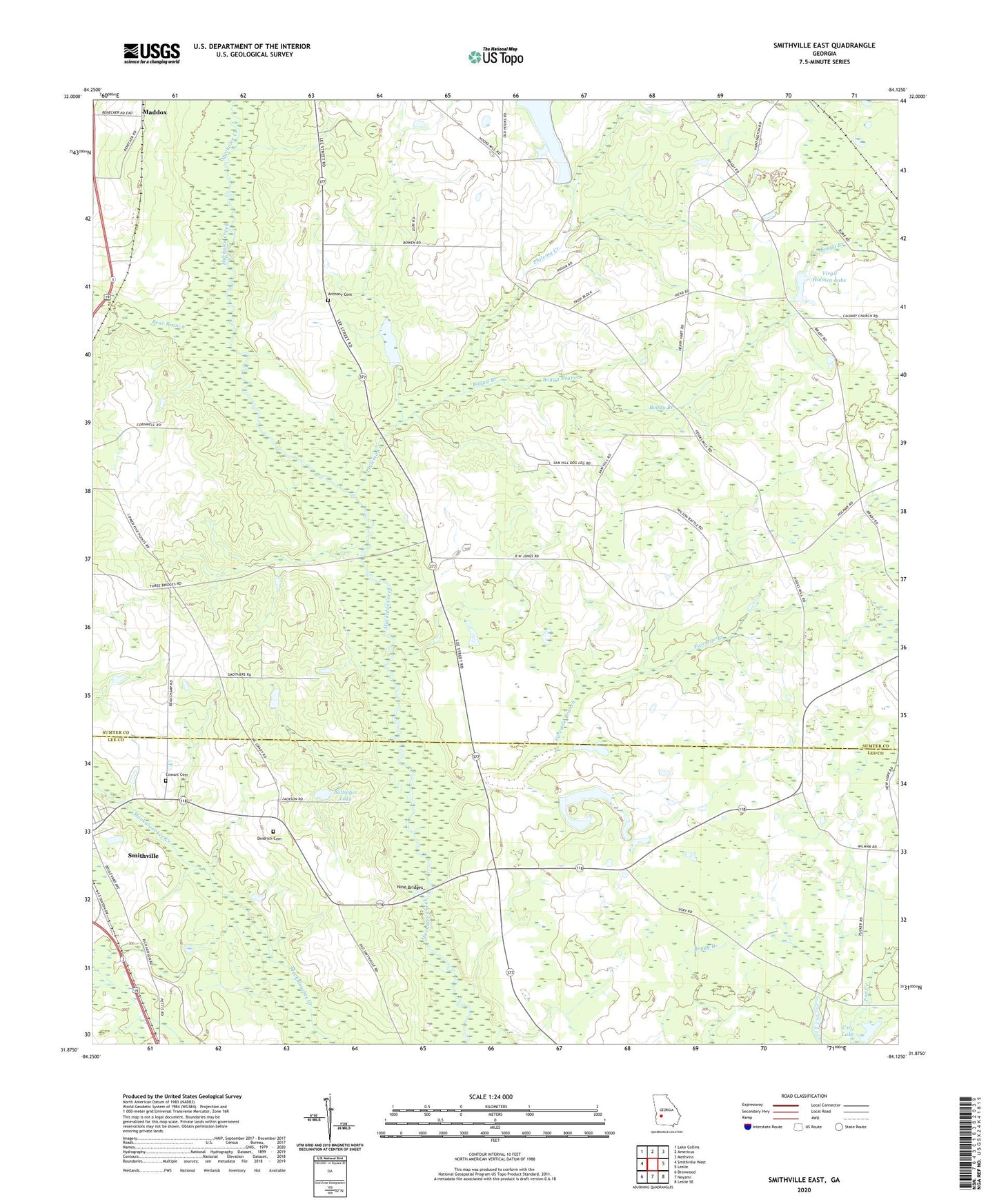
2024 topographic map quadrangle Smithville East in the state of Georgia. Scale: 1:24000. Based on the newly updated USGS 7.5' US Topo map series, this map is in the following counties: Sumter, Lee. The map contains contour data, water features, and other items you are used to seeing on USGS maps, but also has updated roads and other features. This is the next generation of topographic maps. Printed on high-quality waterproof paper with UV fade-resistant inks.
Quads adjacent to this one:
West: Smithville West
Northwest: Lake Collins
North: Americus
Northeast: Methvins
East: Leslie
Southeast: Leslie SE
South: Neyami
Southwest: Bronwood
This map covers the same area as the classic USGS quad with code o31084h2.
Contains the following named places: Anthony Cemetery, Anthony Chapel Methodist Church, Ballinger Lake, Ballinger Lake Dam, Bear Branch, Boggy Branch, Calvary Church, County Line Church, Cowart Cemetery, Deidrich Cemetery, Fivemile Branch, Lake Philema, Lake Philema Dam, Maddox, Midway Church, Mount Pleasant Church, New Kovent Church, Nine Bridges, Nunn Industrial School, Philema Creek, Phillips Pond, Phillips Pond Dam, Powell Dairy Farm Dam, Powell Dairy Farm Lake, Shady Grove Church, Smithville Lookout Tower, Usry Lake, Usry Lake Dam, Virgil Holmen Lake, Virgil Holmen Lake Dam, Wells Millpond Dam, ZIP Code: 31787