MyTopo
Americus Georgia US Topo Map
Couldn't load pickup availability
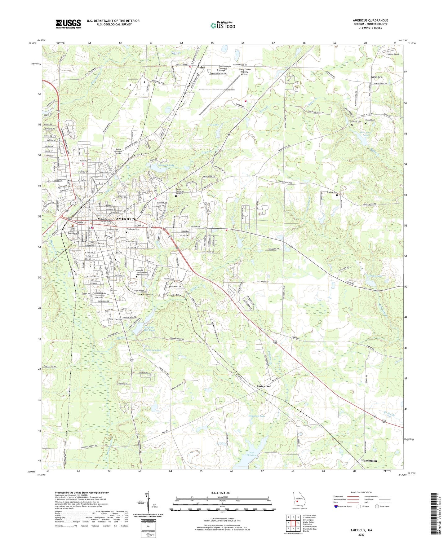
2024 topographic map quadrangle Americus in the state of Georgia. Scale: 1:24000. Based on the newly updated USGS 7.5' US Topo map series, this map is in the following counties: Sumter. The map contains contour data, water features, and other items you are used to seeing on USGS maps, but also has updated roads and other features. This is the next generation of topographic maps. Printed on high-quality waterproof paper with UV fade-resistant inks.
Quads adjacent to this one:
West: Lake Collins
Northwest: Ellaville South
North: Andersonville
Northeast: Pennington
East: Methvins
Southeast: Leslie
South: Smithville East
Southwest: Smithville West
This map covers the same area as the classic USGS quad with code o32084a2.
Contains the following named places: Able Acres Dam, Able Acres Lake, Acme Mill, Americas Village Shopping Center, Americus, Americus City Hall, Americus Country Club, Americus Division, Americus Fire and Emergency Services Station 1, Americus Fire and Emergency Services Station 2, Americus Fire and Emergency Services Station 3, Americus High School, Americus Historic District, Americus Police Department, Americus Post Office, Angelica Creek, Anthony School, Argo Lake, Argo Lake Dam, Arles, Belair Plaza Shopping Center, Bethesda Baptist Church, Big Bethel Baptist Church, Blooming Rose Church, Bradley Cemetery, Calvary Episcopal Church, Campbell Chapel African Methodist Episcopal Church, Carnegie Library, Central Church, Cheek Memorial Church, Cherokee School, Church of the Nazarene, City of Americus, Cobb School, Daniel Cemetery, Daniel Grove Church, East Forsyth Street Cemetery, East View Cemetery, East View School, Eastgate Shopping Center, Eastside Church, Edgemon Lake, Edgemon Lake Dam, Eurlow School, First Baptist Church, First Christian Church, First Methodist Church, First Presbyterian Church, Friendship Baptist Church, Gatewood, Gatewood School, Georgia Southwestern State University, Georgia Southwestern State University Department of Public Safety, Hancock Lake, Hancock Lake Dam, Hodges Field, Huntington, James Earl Carter Library, Jerusalem Church, Jerusalem School, Jimmy Carter Regional Airport, Lake Jennifer, Lake Jennifer Dam, Lee Street Baptist Church, Longbranch Church, Mill Creek, Mount Moriah Church, Mount Olivet Baptist Church, Murphys Mill Pond, New Era, New Era School, Northeast School, Northside Homes, Oak Grove Cemetery, Perlis Plaza Shopping Center, Pilgrim Holiness Church, Pine Pointe Shopping Center, Pleasant Grove Church, Reese Park, Reese Park Grammar School, Saint Marys Church, Saint Pauls Church, Salem Cemetery, Salem Church, Sanctified Church, Shady Grove Church, Shipp Lake, Shipp Lake Dam, South Georiga Home for the Aged, South Georiga Technical School, Southland Academy, Spring Hill Church, Staley Memorial Gardens, Staley Middle School, Sumter County, Sumter County Courthouse, Sumter Homes, Sumter Lookout Tower, Sumter School, Sunset Memorial Gardens, Town Creek, Triedstone Baptist Church, Union Tabernacle, WDEC-AM (Americus), WDEC-FM (Americus), Wheatley Plaza Shopping Center