MyTopo
Lenox Georgia US Topo Map
Couldn't load pickup availability
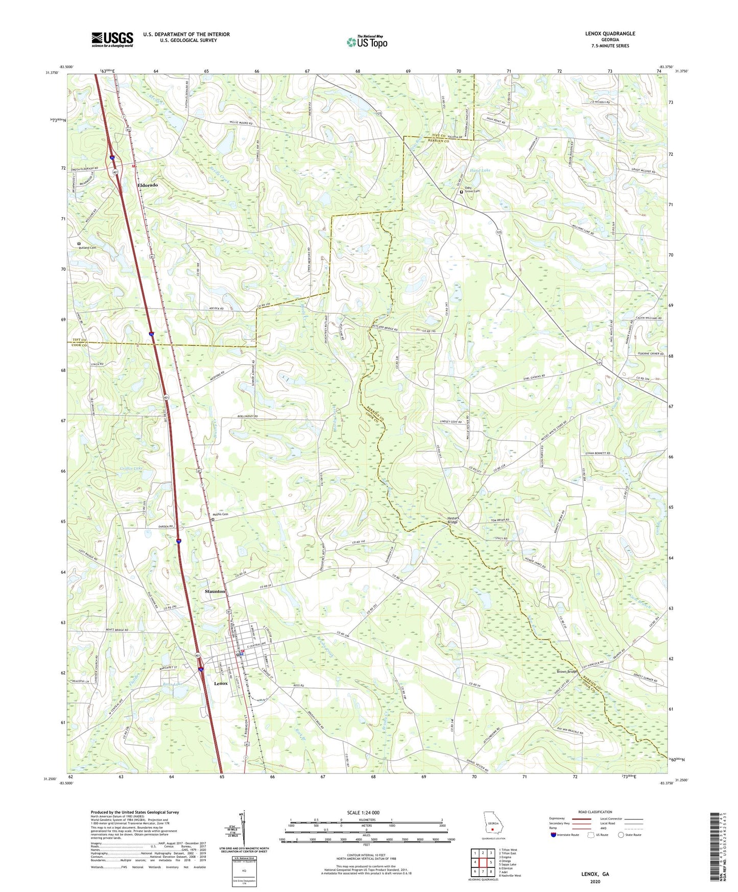
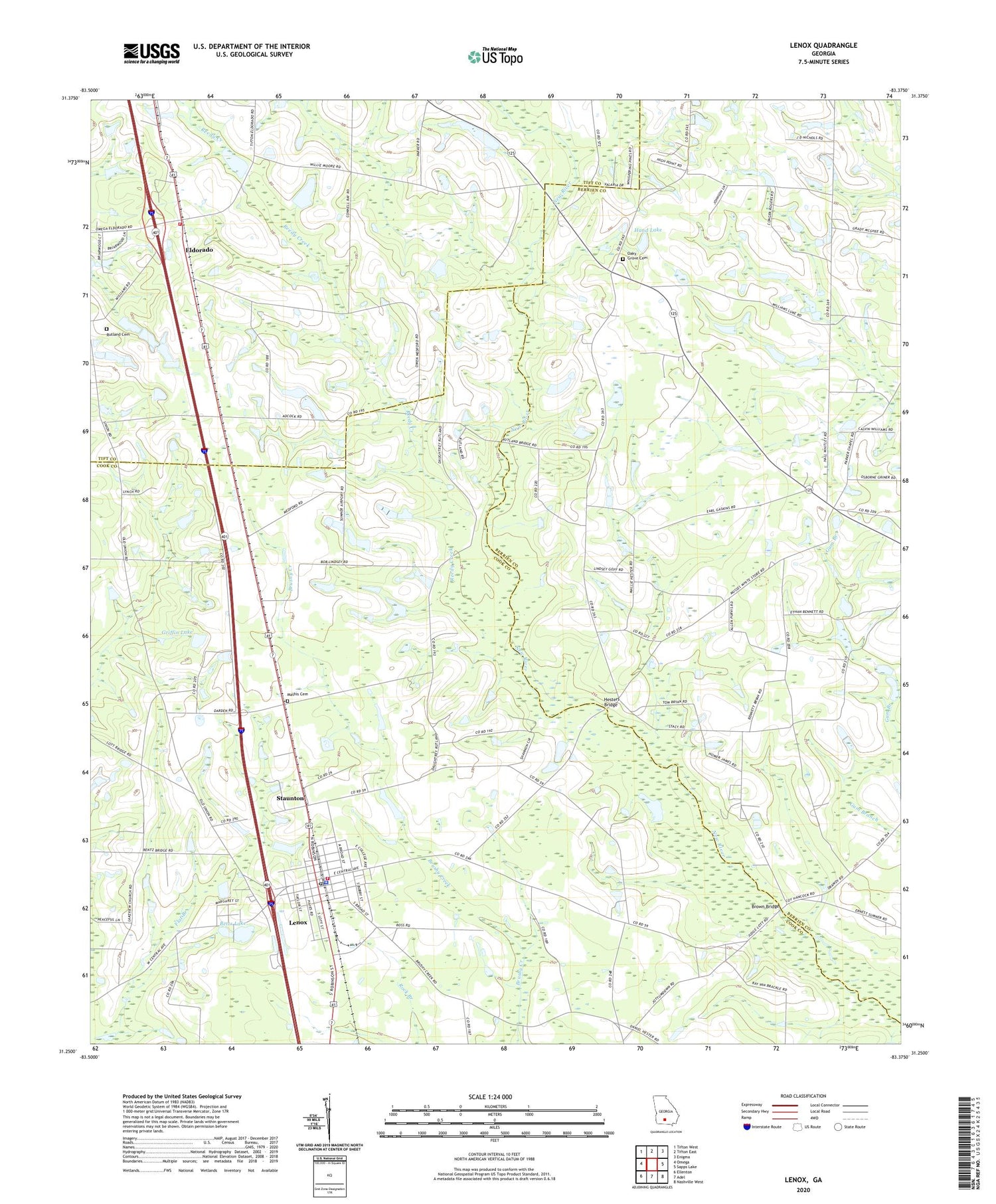
2024 topographic map quadrangle Lenox in the state of Georgia. Scale: 1:24000. Based on the newly updated USGS 7.5' US Topo map series, this map is in the following counties: Cook, Berrien, Tift. The map contains contour data, water features, and other items you are used to seeing on USGS maps, but also has updated roads and other features. This is the next generation of topographic maps. Printed on high-quality waterproof paper with UV fade-resistant inks.
Quads adjacent to this one:
West: Omega
Northwest: Tifton West
North: Tifton East
Northeast: Enigma
East: Sapps Lake
Southeast: Nashville West
South: Adel
Southwest: Ellenton
This map covers the same area as the classic USGS quad with code o31083c4.
Contains the following named places: Bethlehem Primitive Baptist Church, Betts Lake, Betts Lake Dam, Brown Bridge, Cherry Grove Church, Community Church, Eldorado, Eldorado Baptist Church Cemetery, Eldorado Church, Eldorado Consolidated School, Fender Post Office, Griffin Lake, Griffin Lake Dam, Hand Lake, Hand Lake Dam, Hesters Bridge, Lakeview Church, Lenox, Lenox Division, Lenox Elementary School, Lenox Police Department and City Hall, Lenox Post Office, Lenox Volunteer Fire Department, Little Creek, Mathis Cemetery, New River Church, New River School, Oak Grove Church, Oaky Grove Cemetery, Pine Grove Church, Reedy Creek, Rutland Cemetery, Staunton, Temple Church, Tift County Volunteer Fire Department Station 7, Town of Lenox, Union Grove Church, West Central Avenue Church of God, ZIP Code: 31637