MyTopo
Tifton East Georgia US Topo Map
Couldn't load pickup availability
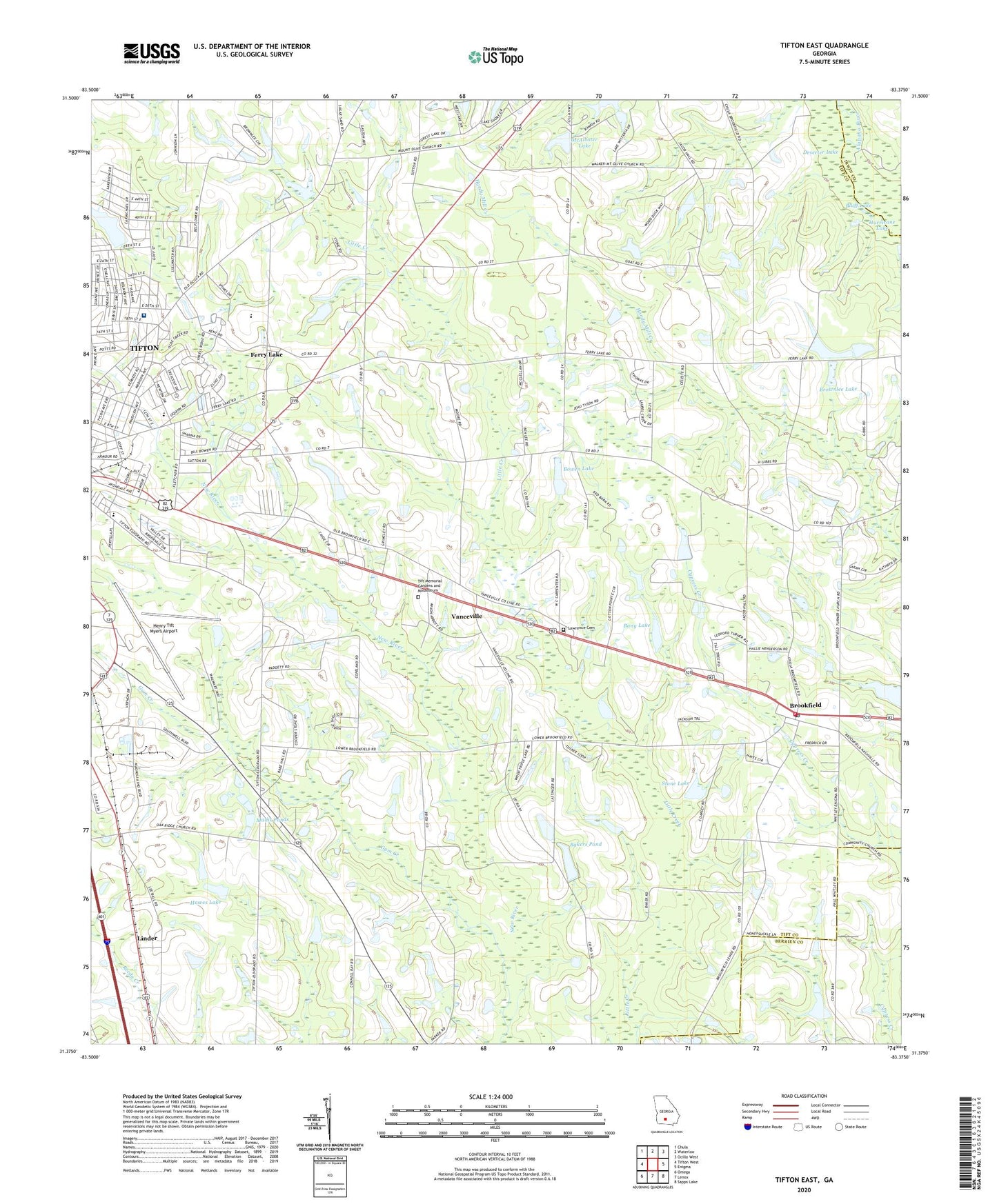
2024 topographic map quadrangle Tifton East in the state of Georgia. Scale: 1:24000. Based on the newly updated USGS 7.5' US Topo map series, this map is in the following counties: Tift, Berrien, Irwin. The map contains contour data, water features, and other items you are used to seeing on USGS maps, but also has updated roads and other features. This is the next generation of topographic maps. Printed on high-quality waterproof paper with UV fade-resistant inks.
Quads adjacent to this one:
West: Tifton West
Northwest: Chula
North: Waterloo
Northeast: Ocilla West
East: Enigma
Southeast: Sapps Lake
South: Lenox
Southwest: Omega
This map covers the same area as the classic USGS quad with code o31083d4.
Contains the following named places: Bailey School, Bakers Pond, Bakers Pond Dam, Bany Lake, Bany Lake Dam, Bessie Tift Chapel Baptist Church, Bluff Lake, Bowen Lake, Bowen Lake Dam, Brighton Church, Brookfield, Brookfield Baptist Church, Brookfield Division, Brookfield Methodist Church, Brookfield Post Office, Brownlee Lake, Brownlee Lake Dam, Corinth Church, Deserter Lake, Dillard Lake, Dillard Lake Dam, Eastside Church, Eldorado Division, Ferry Lake, Georgia State Patrol Troop H Post 13 - Tifton, Gum Creek, Hawes Lake, Hawes Lake Dam, Henry Tift Myers Airport, Hurricane Lake, Lawrence Cemetery, Linder, Magnolia Industrial Park, Marys Pond, Marys Pond Dam, McAllister Lake, McAllister Lake Dam, McCrain Lake, Mount Olive Church, Mullis Ponds, New Bethel Church, New River Church, Oak Ridge Church, Southside School, Stone Lake, Stone Lake Dam, Tift County Fire Department Station 6, Tift County Fire Rescue, Tift Memorial Gardens and Mausoleum, Tift Regional Medical Center, Tifton Army Air Field, Tifton-Tift County Industrial Park, Trinity Methodist Church, Vanceville, Vanceville Church, Wayside Church, Wilson Lake, Wilson Lake Dam, WTIF-AM (Tifton), ZIP Code: 31794