MyTopo
Ellenton Georgia US Topo Map
Couldn't load pickup availability
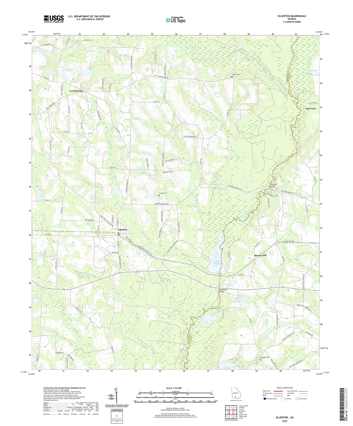
2024 topographic map quadrangle Ellenton in the state of Georgia. Scale: 1:24000. Based on the newly updated USGS 7.5' US Topo map series, this map is in the following counties: Colquitt, Cook. The map contains contour data, water features, and other items you are used to seeing on USGS maps, but also has updated roads and other features. This is the next generation of topographic maps. Printed on high-quality waterproof paper with UV fade-resistant inks.
Quads adjacent to this one:
West: Pineboro
Northwest: Norman Park
North: Omega
Northeast: Lenox
East: Adel
Southeast: Cecil
South: Berlin East
Southwest: Berlin West
This map covers the same area as the classic USGS quad with code o31083b5.
Contains the following named places: Baker Cemetery, Bayboro, Bayboro School, Berlin-Ellenton Division, Big Branch, Buck Creek, Buck Creek Church, Burney Hill, Colquitt County Volunteer Firefighters Association Fire Station 71 Ellenton, Cool Springs, Cool Springs Church, Doe Branch, Ellenton, Ellenton Post Office, Evergreen Church, Flat Branch, Flat Ford, Folsom Cemetery, Grist Lake, Grist Lake Dam, Gum Creek, Lone Star School, Mill Creek, Nola, Oak Grove School, Pervis Lake, Pervis Lake Dam, Poley Branch, Poplar Head Branch, Reed Bingham Park Lake, Reed Bingham Park Lake Dam, Reed Bingham State Park, Rountree Bridge, Saunders Lake, Saunders Lake Dam, Sylvester Cemetery, Town of Ellenton, Vickers Cemetery, Vickers Lake, Vickers Lake Dam, Warrior Creek, Weeks Chapel, Whitehurst Bridge, ZIP Code: 31747