MyTopo
Lexington Georgia US Topo Map
Couldn't load pickup availability
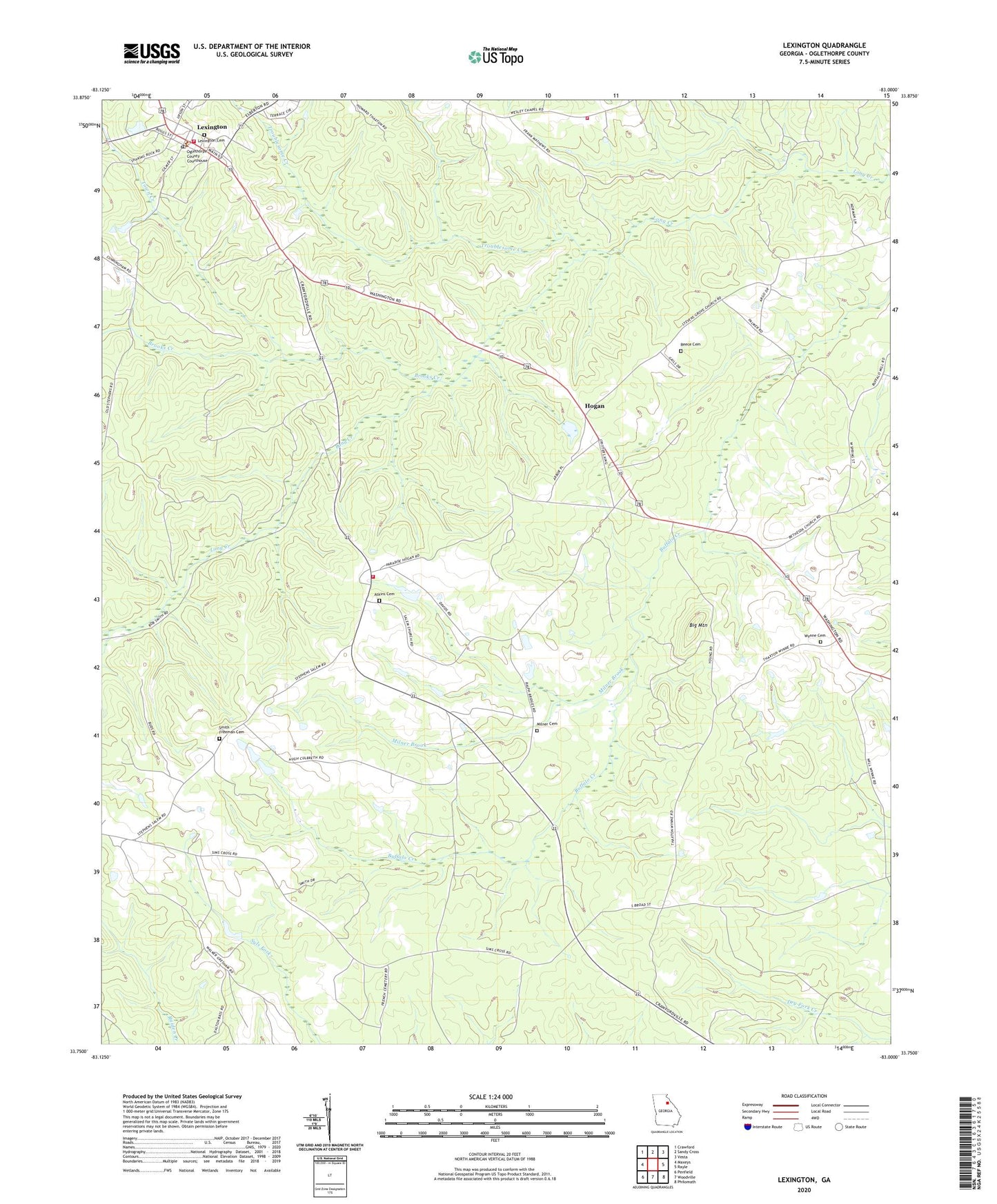
2024 topographic map quadrangle Lexington in the state of Georgia. Scale: 1:24000. Based on the newly updated USGS 7.5' US Topo map series, this map is in the following counties: Oglethorpe. The map contains contour data, water features, and other items you are used to seeing on USGS maps, but also has updated roads and other features. This is the next generation of topographic maps. Printed on high-quality waterproof paper with UV fade-resistant inks.
Quads adjacent to this one:
West: Maxeys
Northwest: Crawford
North: Sandy Cross
Northeast: Vesta
East: Rayle
Southeast: Philomath
South: Woodville
Southwest: Penfield
This map covers the same area as the classic USGS quad with code o33083g1.
Contains the following named places: Atkins Cemetery, Big Mountain, Bobby Maxwell Airstrip, Brooks Creek, City of Lexington, Clark Grove Church, Clarke Grove Baptist Cemetery, Guarentee Mine, Hogan, Lexington, Lexington Historic District, Lexington Post Office, Lexington Presbyterian Church, Lexington Presbyterian Church Cemetery, Lexington Volunteer Fire Department, Maxeys Division, Milner Brook, Milner Cemetery, Oglethorpe County Courthouse, Pentecost Church, Presbyterian Theological Seminary, Reece Cemetery, Salem Baptist Church, Salem Volunteer Fire Department, Smith - Freeman Cemetery, Town Creek, Troublesome Creek, Wesley Chapel, Wesley Chapel Volunteer Fire Department, Wynne Cemetery