MyTopo
Woodville Georgia US Topo Map
Couldn't load pickup availability
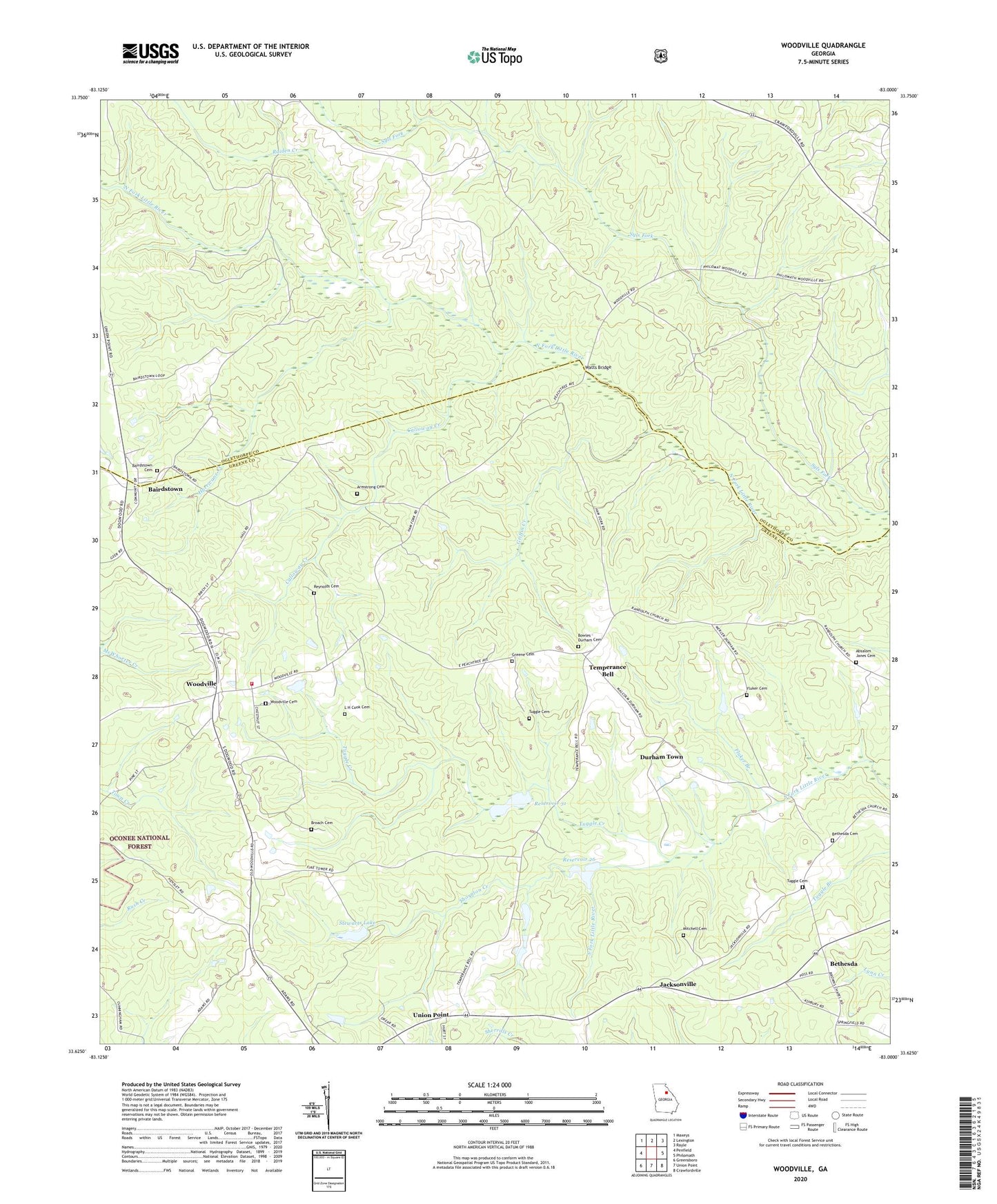
2024 topographic map quadrangle Woodville in the state of Georgia. Scale: 1:24000. Based on the newly updated USGS 7.5' US Topo map series, this map is in the following counties: Greene, Oglethorpe. The map contains contour data, water features, and other items you are used to seeing on USGS maps, but also has updated roads and other features. This is the next generation of topographic maps. Printed on high-quality waterproof paper with UV fade-resistant inks.
Quads adjacent to this one:
West: Penfield
Northwest: Maxeys
North: Lexington
Northeast: Rayle
East: Philomath
Southeast: Crawfordville
South: Union Point
Southwest: Greensboro
This map covers the same area as the classic USGS quad with code o33083f1.
Contains the following named places: Absalom Janes Cemetery, Armstrong Cemetery, Asbury Church, Bairds Church, Bairdstown, Bairdstown Cemetery, Bethesda, Bethesda Cemetery, Bethesda Church, Bowles - Durham Cemetery, Broach Cemetery, Buena Vista School, Calloway Creek, City of Woodville, Crossroads School, Durham Town, Fluker Branch, Fluker Cemetery, Grantville, Greene Cemetery, Griffin Creek, Hurricane Creek, Jacksonville, L H Cook Cemetery, Mitchell Cemetery, Raiden Creek, Randolph Church, Reservoir 26, Reservoir 31, Reynolds Cemetery, Saint Pauls Church, Stewarts Lake, Stewarts Lake Dam, Temperance Bell, Temple Bell School, Thornton Creek, Tuggle Cemetery, Tuggle Creek, Union Point Division, Watts Bridge, Woodville, Woodville Baptist Church, Woodville Cemetery, Woodville Volunteer Fire Department, ZIP Code: 30669