
MyTopo
Lyons Georgia US Topo Map
Couldn't load pickup availability
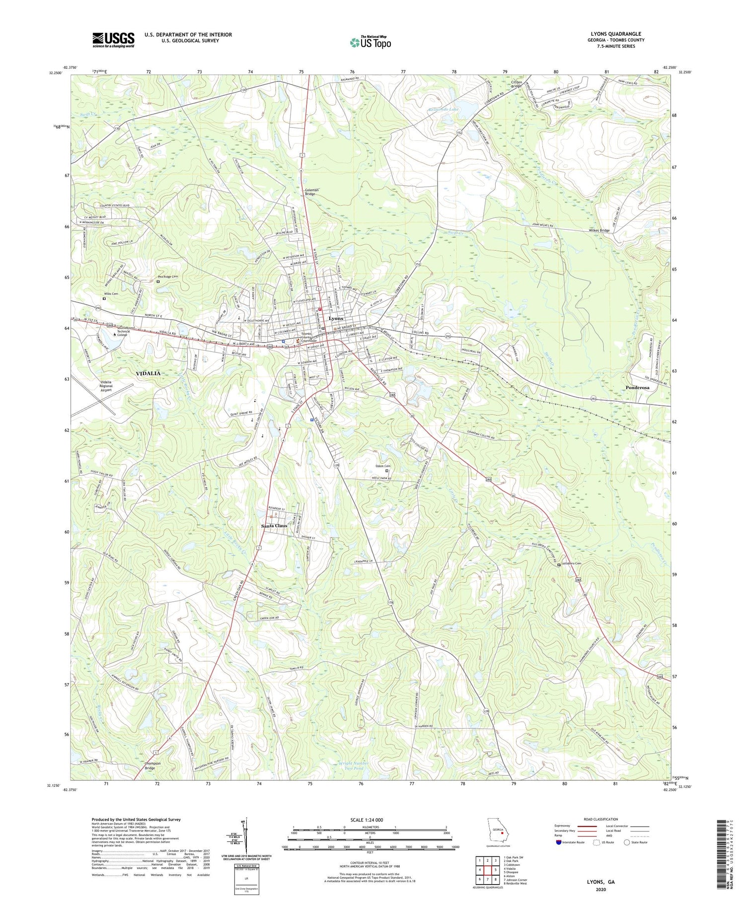
2024 topographic map quadrangle Lyons in the state of Georgia. Scale: 1:24000. Based on the newly updated USGS 7.5' US Topo map series, this map is in the following counties: Toombs. The map contains contour data, water features, and other items you are used to seeing on USGS maps, but also has updated roads and other features. This is the next generation of topographic maps. Printed on high-quality waterproof paper with UV fade-resistant inks.
Quads adjacent to this one:
West: Vidalia
Northwest: Oak Park SW
North: Oak Park
Northeast: Cobbtown
East: Ohoopee
Southeast: Reidsville West
South: Johnson Corner
Southwest: Alston
This map covers the same area as the classic USGS quad with code o32082b3.
Contains the following named places: Booster Stadium, Charles Durst Detention Center, Citizen Bridge, City of Lyons, City of Santa Claus, Coleman Bridge, Collins Church, Faith Church, First Baptist Church, First Methodist Church, Gordon Bridge, Hallmark Park, Hammond Church, Hickson Bridge, Hillsboro Cemetery, Jordon Stream Church, Little Creek, Lyons, Lyons City Hall, Lyons Elementary School, Lyons Fire Department, Lyons Junior High School, Lyons Police Department, Lyons Post Office, Lyons Public Library, Lyons Senior High School, Odom Cemetery, Partin Park, Pea Ridge Cemetery, Ponderosa, Resmondo Lake, Resmondo Lake Dam, Robert Toombs Christian Academy, Santa Claus, Sharpes Chapel, Swift Creek, Thompson Bridge, Toombs County Area Technical Institute, Toombs County Courthouse, Toombs County Lookout Tower, Toombs County Sheriff's Office, Vidalia Army Air Field, Vidalia Regional Airport, Vidalia-Lyons Division, WBBT-AM (Lyons), Wilkes Bridge, Wilks Cemetery, Wright Number Two Pond, ZIP Codes: 30436, 30475


