MyTopo
Cobbtown Georgia US Topo Map
Couldn't load pickup availability
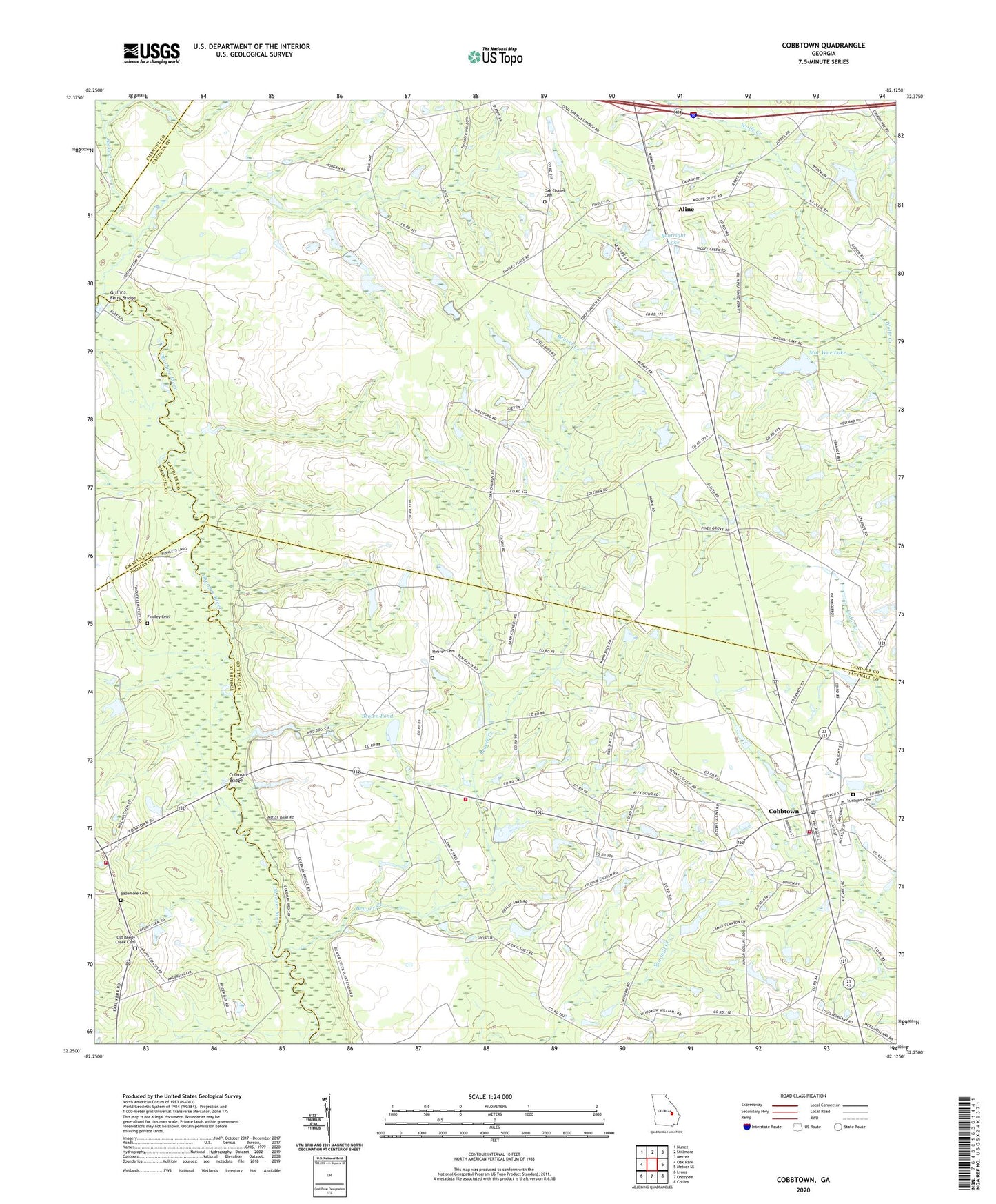
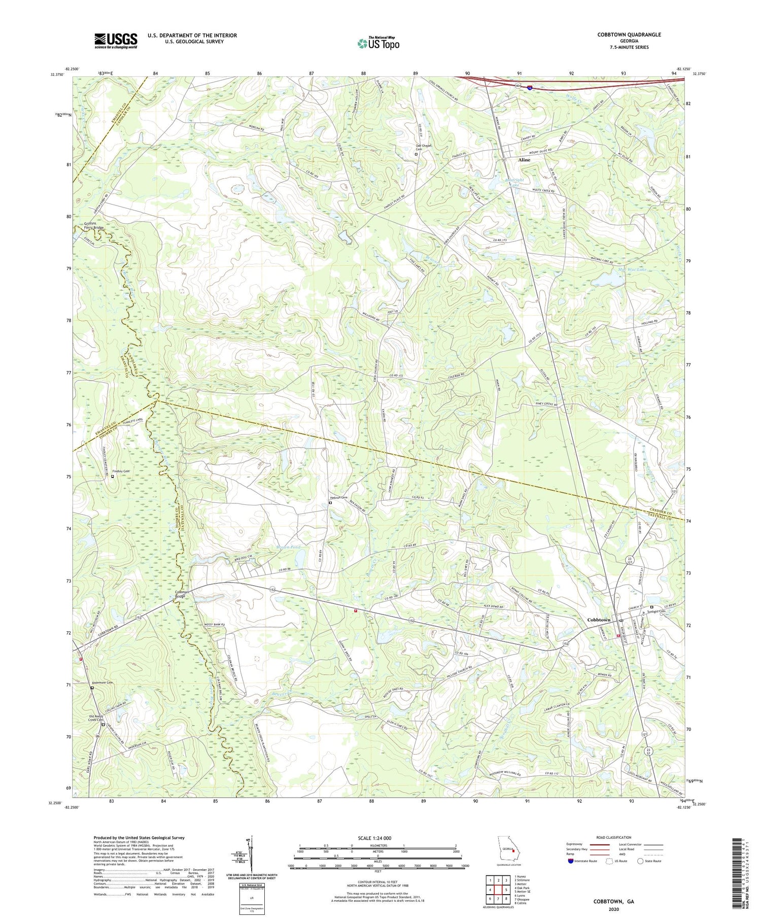
2024 topographic map quadrangle Cobbtown in the state of Georgia. Scale: 1:24000. Based on the newly updated USGS 7.5' US Topo map series, this map is in the following counties: Candler, Tattnall, Toombs, Emanuel. The map contains contour data, water features, and other items you are used to seeing on USGS maps, but also has updated roads and other features. This is the next generation of topographic maps. Printed on high-quality waterproof paper with UV fade-resistant inks.
Quads adjacent to this one:
West: Oak Park
Northwest: Nunez
North: Stillmore
Northeast: Metter
East: Metter SE
Southeast: Collins
South: Ohoopee
Southwest: Lyons
This map covers the same area as the classic USGS quad with code o32082c2.
Contains the following named places: Aline, Aline Church, Aline Division, Anderson Dam Two, Anderson Lake, Anderson Lake Dam, Bazemore Cemetery, Beaver Creek, Boatright Lake, Boatright Lake Dam, Brown Pond, City of Cobbtown, Cobbtown, Cobbtown Fire Department, Cobbtown Post Office, Coleman Bridge, Connors Church, Cool Springs Church, East Toombs Volunteer Fire Department Station 2, Eden Church, Elton, Findley Cemetery, Griffins Ferry Bridge, Hebron Cemetery, Hillside Church, Jacks Creek, Mac Wac Lake, Mount Olive Church, New Eden Church, New Life Church, Oak Chapel Cemetery, Old Reedy Creek Cemetery, Piney Grove Church, Roxy Church, Stones Pond, Stones Pond Dam, Sunlight Cemetery, Sunlight Primitive Baptist Church, ZIP Code: 30420